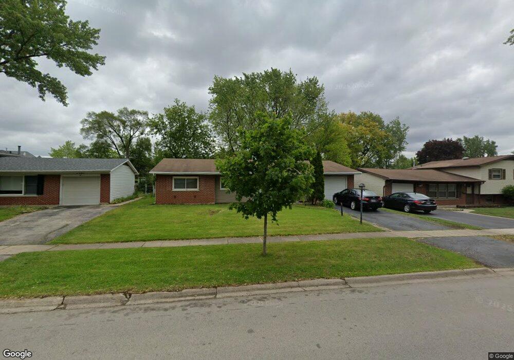
7155 Orchard Ln Hanover Park, IL 60133
Estimated Value: $282,000 - $378,933
4
Beds
2
Baths
1,577
Sq Ft
$222/Sq Ft
Est. Value
About This Home
This home is located at 7155 Orchard Ln, Hanover Park, IL 60133 and is currently estimated at $349,983, approximately $221 per square foot. 7155 Orchard Ln is a home located in Cook County with nearby schools including Hanover Highlands Elementary School, Robert Frost Junior High School, and Schaumburg High School.
Ownership History
Date
Name
Owned For
Owner Type
Purchase Details
Closed on
Jun 11, 2001
Sold by
Veto Robert A and Veto Corina M
Bought by
Talla John T and Talla Colyna K
Current Estimated Value
Home Financials for this Owner
Home Financials are based on the most recent Mortgage that was taken out on this home.
Original Mortgage
$149,205
Interest Rate
7.14%
Mortgage Type
FHA
Create a Home Valuation Report for This Property
The Home Valuation Report is an in-depth analysis detailing your home's value as well as a comparison with similar homes in the area
Home Values in the Area
Average Home Value in this Area
Purchase History
| Date | Buyer | Sale Price | Title Company |
|---|---|---|---|
| Talla John T | $166,000 | -- |
Source: Public Records
Mortgage History
| Date | Status | Borrower | Loan Amount |
|---|---|---|---|
| Previous Owner | Talla John T | $149,205 |
Source: Public Records
Tax History Compared to Growth
Tax History
| Year | Tax Paid | Tax Assessment Tax Assessment Total Assessment is a certain percentage of the fair market value that is determined by local assessors to be the total taxable value of land and additions on the property. | Land | Improvement |
|---|---|---|---|---|
| 2024 | $7,475 | $27,000 | $6,474 | $20,526 |
| 2023 | $7,199 | $27,000 | $6,474 | $20,526 |
| 2022 | $7,199 | $27,000 | $6,474 | $20,526 |
| 2021 | $6,127 | $20,657 | $4,233 | $16,424 |
| 2020 | $6,132 | $20,657 | $4,233 | $16,424 |
| 2019 | $6,208 | $23,211 | $4,233 | $18,978 |
| 2018 | $5,437 | $18,774 | $3,735 | $15,039 |
| 2017 | $5,370 | $18,774 | $3,735 | $15,039 |
| 2016 | $5,338 | $18,774 | $3,735 | $15,039 |
| 2015 | $5,092 | $16,969 | $3,237 | $13,732 |
| 2014 | $5,013 | $16,969 | $3,237 | $13,732 |
| 2013 | $4,844 | $16,969 | $3,237 | $13,732 |
Source: Public Records
Map
Nearby Homes
- 1882 Keystone Place Unit 1882
- 1410 Brownstone Place Unit 38
- 7031 Glenwood Ln
- 7018 Orchard Ln
- 763 Verandah Dr
- 7468 Filmore Ave
- 1463 Mercury Dr Unit 304
- 1463 Mercury Dr Unit 115
- 1463 Mercury Dr Unit 408
- 6908 Orchard Ln
- 1460 Fairlane Dr Unit 513
- 1460 Fairlane Dr Unit 228
- 1460 Fairlane Dr Unit 106
- 6915 Hawthorne Ln
- 7418 Nantucket Cove
- 1309 Fairlane Dr
- 1105 Stratford Ln
- 1515 Mercury Dr Unit 4
- 6857 Hawthorne Ln
- 1020 Webster Ln
- 7139 Orchard Ln
- 7167 Orchard Ln
- 7123 Orchard Ln
- 7185 Orchard Ln
- 1878 Keystone Place Unit 65
- 1876 Keystone Place Unit 64
- 1874 Keystone Place Unit 63
- 1880 Keystone Place Unit 66
- 1882 Keystone Place Unit 67
- 7101 Orchard Ln
- 7164 Orchard Ln
- 1884 Keystone Place Unit 68
- 991 Countryside Dr
- 7148 Orchard Ln
- 1872 Keystone Place Unit 62
- 7182 Orchard Ln
- 1886 Keystone Place Unit 69
- 1870 Keystone Place Unit 61
- 7132 Orchard Ln
- 7099 Orchard Ln