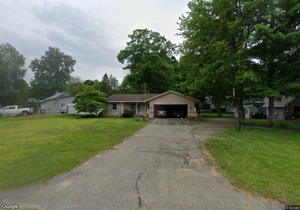
7157 Georgetown Ave Hudsonville, MI 49426
Estimated Value: $353,739 - $391,000
3
Beds
2
Baths
1
Sq Ft
$374,685/Sq Ft
Est. Value
About This Home
This home is located at 7157 Georgetown Ave, Hudsonville, MI 49426 and is currently estimated at $374,685, approximately $374,685 per square foot. 7157 Georgetown Ave is a home located in Ottawa County with nearby schools including Bauer Elementary School, Baldwin Street Middle School, and Hudsonville Freshman Campus.
Ownership History
Date
Name
Owned For
Owner Type
Purchase Details
Closed on
May 29, 2008
Sold by
Goff Michael J
Bought by
Goff Michael J and Goff Jodi
Current Estimated Value
Home Financials for this Owner
Home Financials are based on the most recent Mortgage that was taken out on this home.
Original Mortgage
$135,375
Outstanding Balance
$87,047
Interest Rate
6.09%
Mortgage Type
FHA
Estimated Equity
$287,638
Create a Home Valuation Report for This Property
The Home Valuation Report is an in-depth analysis detailing your home's value as well as a comparison with similar homes in the area
Home Values in the Area
Average Home Value in this Area
Purchase History
| Date | Buyer | Sale Price | Title Company |
|---|---|---|---|
| Goff Michael J | -- | None Available | |
| Goff Michael J | -- | None Available | |
| Goff Cora Lee | -- | None Available |
Source: Public Records
Mortgage History
| Date | Status | Borrower | Loan Amount |
|---|---|---|---|
| Open | Goff Cora Lee | $135,375 |
Source: Public Records
Tax History Compared to Growth
Tax History
| Year | Tax Paid | Tax Assessment Tax Assessment Total Assessment is a certain percentage of the fair market value that is determined by local assessors to be the total taxable value of land and additions on the property. | Land | Improvement |
|---|---|---|---|---|
| 2025 | $2,697 | $176,700 | $0 | $0 |
| 2024 | $2,334 | $163,800 | $0 | $0 |
| 2023 | $2,229 | $146,400 | $0 | $0 |
| 2022 | $2,449 | $133,000 | $0 | $0 |
| 2021 | $2,380 | $117,100 | $0 | $0 |
| 2020 | $2,355 | $110,300 | $0 | $0 |
| 2019 | $2,358 | $98,900 | $0 | $0 |
| 2018 | $2,199 | $98,100 | $0 | $0 |
| 2017 | $2,159 | $98,000 | $0 | $0 |
| 2016 | $2,146 | $92,700 | $0 | $0 |
| 2015 | $2,048 | $87,500 | $0 | $0 |
| 2014 | $2,048 | $81,400 | $0 | $0 |
Source: Public Records
Map
Nearby Homes
- 6950 Meadowcreek Dr
- 4101 Blair St
- 6863 Bridgeport Dr
- 4106 Blair St
- 6821 Bridgeport Dr
- 7068 Jasper Dr
- 4087 Baldwin St
- 0 Baldwin St
- 3617 Teton Dr
- 3528 Tearose Dr
- 7918 Westside Dr
- 4663 Hidden Ridge Dr Unit lot 38
- 3808 Port Sheldon St
- 7318 Alycia Dr
- 6584 Moss Lake Dr
- 6530 Van Dam Ave Unit 3
- 6561 Van Dam Ave
- 6500 Van Dam Ave Unit 1
- 4672 Lexem Dr
- 6533 Moss Lake Dr
- 7163 Georgetown Ave
- 7143 Georgetown Ave
- 7175 Georgetown Ave
- 7057 Williamstown Dr
- 7164 Georgetown Ave
- 7131 Georgetown Ave
- 7154 Georgetown Ave
- 7172 Georgetown Ave
- 7084 Gettysburg Dr
- 7142 Georgetown Ave
- 7178 Georgetown Ave
- 7096 Gettysburg Dr
- 7130 Georgetown Ave
- 7072 Gettysburg Dr
- 7045 Williamstown Dr
- 7122 Gettysburg Dr
- 4278 Yorkshire Dr
- 4266 Yorkshire Dr
- 7194 Gettysburg Dr
- 7131 Williamstown Dr