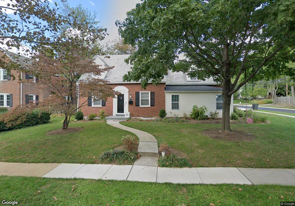
716 Kingston Rd Baltimore, MD 21212
Estimated Value: $148,416 - $207,000
Studio
1
Bath
1,020
Sq Ft
$164/Sq Ft
Est. Value
About This Home
This home is located at 716 Kingston Rd, Baltimore, MD 21212 and is currently estimated at $167,604, approximately $164 per square foot. 716 Kingston Rd is a home located in Baltimore County with nearby schools including Hawthorne Elementary School, Stemmers Run Middle School, and Kenwood High.
Ownership History
Date
Name
Owned For
Owner Type
Purchase Details
Closed on
Mar 22, 2023
Sold by
Patton Jeffrey S
Bought by
Norton Paul Timothy and Norton Lori Lynn
Current Estimated Value
Home Financials for this Owner
Home Financials are based on the most recent Mortgage that was taken out on this home.
Original Mortgage
$101,800
Outstanding Balance
$89,656
Interest Rate
5%
Mortgage Type
New Conventional
Estimated Equity
$77,948
Purchase Details
Closed on
Dec 29, 1995
Sold by
Red Fox Farms Development Group
Bought by
White Mildred L and White James D
Create a Home Valuation Report for This Property
The Home Valuation Report is an in-depth analysis detailing your home's value as well as a comparison with similar homes in the area
Home Values in the Area
Average Home Value in this Area
Purchase History
| Date | Buyer | Sale Price | Title Company |
|---|---|---|---|
| Norton Paul Timothy | $105,000 | None Listed On Document | |
| White Mildred L | $85,450 | -- |
Source: Public Records
Mortgage History
| Date | Status | Borrower | Loan Amount |
|---|---|---|---|
| Open | Norton Paul Timothy | $101,800 |
Source: Public Records
Tax History
| Year | Tax Paid | Tax Assessment Tax Assessment Total Assessment is a certain percentage of the fair market value that is determined by local assessors to be the total taxable value of land and additions on the property. | Land | Improvement |
|---|---|---|---|---|
| 2025 | $2,973 | $145,667 | -- | -- |
| 2024 | $2,973 | $138,533 | $0 | $0 |
| 2023 | $1,425 | $131,400 | $50,000 | $81,400 |
| 2022 | $2,593 | $122,933 | $0 | $0 |
| 2021 | $1,310 | $114,467 | $0 | $0 |
| 2020 | $1,285 | $106,000 | $50,000 | $56,000 |
| 2019 | $1,285 | $106,000 | $50,000 | $56,000 |
| 2018 | $2,250 | $106,000 | $50,000 | $56,000 |
| 2017 | $2,310 | $107,200 | $0 | $0 |
| 2016 | $2,142 | $105,400 | $0 | $0 |
| 2015 | $2,142 | $103,600 | $0 | $0 |
| 2014 | $2,142 | $101,800 | $0 | $0 |
Source: Public Records
Map
Nearby Homes
- 725 Kingston Rd
- 84 Kingston Park Ln
- 78 W Kingston Park Ln
- 116 Kingston Park Ln
- 2218 Southorn Rd
- 522 Grovethorn Rd
- 60 Dogwood Dr
- 2222 Graythorn Rd
- 2247 Graythorn Rd
- 2162 Vailthorn Rd
- 40 Dogwood Dr
- 34 Dogwood Dr
- 21 Dogwood Dr
- 572 Hopkins Landing Dr
- 1306 Third Rd
- 532 Hopkins Landing Dr
- 215 Nanticoke Rd
- 2151 Coralthorn Rd
- 2203 Coralthorn Rd
- 203 Antietam Rd
- 718 Kingston Rd
- 714 Kingston Rd
- 720 Kingston Rd
- 712 Kingston Rd
- 722 Kingston Rd
- 710 Kingston Rd
- 724 Kingston Rd
- 708 Kingston Rd
- 726 Kingston Rd
- 728 Kingston Rd
- 710 Kingston Rd
- 728 Kingston Rd
- 717 W Kingsway Rd
- 719 W Kingsway Rd
- 715 W Kingsway Rd
- 730 Kingston Rd
- 713 W Kingsway Rd
- 721 W Kingsway Rd
- 721 Kingston Rd
- 723 W Kingsway Rd
Your Personal Tour Guide
Ask me questions while you tour the home.