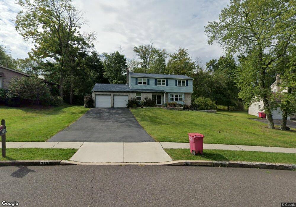
716 Mourning Dove Rd Norristown, PA 19403
Estimated Value: $577,000 - $640,000
4
Beds
3
Baths
2,470
Sq Ft
$242/Sq Ft
Est. Value
About This Home
This home is located at 716 Mourning Dove Rd, Norristown, PA 19403 and is currently estimated at $597,756, approximately $242 per square foot. 716 Mourning Dove Rd is a home located in Montgomery County with nearby schools including Woodland Elementary School, Skyview Upper Elementary School, and Arcola Intermediate School.
Ownership History
Date
Name
Owned For
Owner Type
Purchase Details
Closed on
May 19, 2025
Sold by
Crompton Linda J and Crompton Thomas A
Bought by
Linda Jeanne Crompton And Thomas Albert Cromp and Crompton
Current Estimated Value
Purchase Details
Closed on
Jul 8, 1991
Bought by
Crompton Thomas A and Crompton Linda J
Create a Home Valuation Report for This Property
The Home Valuation Report is an in-depth analysis detailing your home's value as well as a comparison with similar homes in the area
Home Values in the Area
Average Home Value in this Area
Purchase History
| Date | Buyer | Sale Price | Title Company |
|---|---|---|---|
| Linda Jeanne Crompton And Thomas Albert Cromp | -- | None Listed On Document | |
| Linda Jeanne Crompton And Thomas Albert Cromp | -- | None Listed On Document | |
| Crompton Thomas A | $182,000 | -- |
Source: Public Records
Tax History Compared to Growth
Tax History
| Year | Tax Paid | Tax Assessment Tax Assessment Total Assessment is a certain percentage of the fair market value that is determined by local assessors to be the total taxable value of land and additions on the property. | Land | Improvement |
|---|---|---|---|---|
| 2025 | $6,993 | $171,460 | $52,170 | $119,290 |
| 2024 | $6,993 | $171,460 | $52,170 | $119,290 |
| 2023 | $6,727 | $171,460 | $52,170 | $119,290 |
| 2022 | $6,544 | $171,460 | $52,170 | $119,290 |
| 2021 | $6,375 | $171,460 | $52,170 | $119,290 |
| 2020 | $6,226 | $171,460 | $52,170 | $119,290 |
| 2019 | $6,169 | $171,460 | $52,170 | $119,290 |
| 2018 | $6,169 | $171,460 | $52,170 | $119,290 |
| 2017 | $5,891 | $171,460 | $52,170 | $119,290 |
| 2016 | $5,824 | $171,460 | $52,170 | $119,290 |
| 2015 | $5,597 | $171,460 | $52,170 | $119,290 |
| 2014 | $5,597 | $171,460 | $52,170 | $119,290 |
Source: Public Records
Map
Nearby Homes
- 617 Meadowlark Rd
- 3026 Highley Rd
- 1102 Redtail Rd
- 35 Buckwalter Rd
- LOT 24 Egypt Rd
- 2825 Egypt Rd
- 123 Glenwood Ave
- 106 Glenwood Ave
- 18 Pheasant Rd
- 636 Hillside Ave
- 2016 Bayless Place Unit CONDO Q-4
- 308 Hillside Ave
- Laney Craftsman
- 0 Roosevelt Blvd
- 2044 Mill Rd
- 11 Pershing Ave
- 1503 Reagan Ct
- 12 Wilson Blvd
- 38 S Grange Ave
- 109 N Park Ave
- 720 Mourning Dove Rd
- 717 Mockingbird Ln
- 708 Mourning Dove Rd
- 713 Mockingbird Ln
- 724 Mourning Dove Rd
- 721 Mockingbird Ln
- 717 Mourning Dove Rd
- 709 Mockingbird Ln
- 713 Mourning Dove Rd
- 704 Mourning Dove Rd
- 725 Mockingbird Ln
- 728 Mourning Dove Rd
- 709 Mourning Dove Rd Unit 35
- 705 Mockingbird Ln
- 729 Mockingbird Ln
- 721 Mourning Dove Rd
- 700 Mourning Dove Rd
- 705 Mourning Dove Rd
- 732 Mourning Dove Rd
- 701 Mockingbird Ln