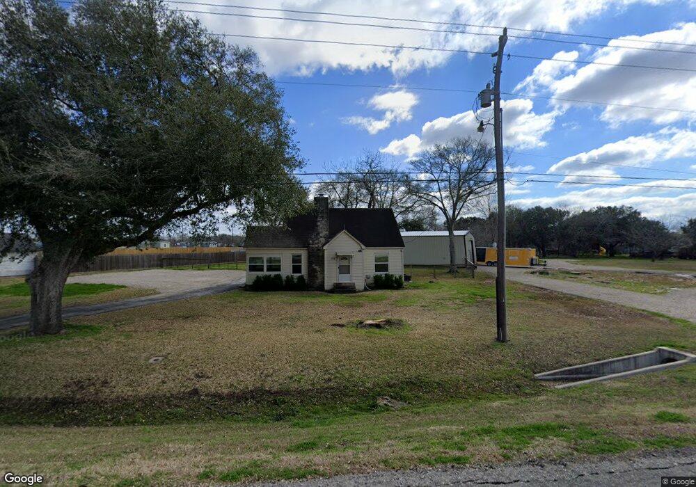
716 State Highway 529 Spur Rosenberg, TX 77471
Estimated Value: $246,000 - $285,000
3
Beds
2
Baths
1,352
Sq Ft
$193/Sq Ft
Est. Value
About This Home
This home is located at 716 State Highway 529 Spur, Rosenberg, TX 77471 and is currently estimated at $261,554, approximately $193 per square foot. 716 State Highway 529 Spur is a home with nearby schools including Bowie Elementary School, Navarro Middle School, and George Junior High School.
Ownership History
Date
Name
Owned For
Owner Type
Purchase Details
Closed on
Mar 12, 2024
Sold by
Arredondo Amelia D
Bought by
Lopez Elizabeth A
Current Estimated Value
Purchase Details
Closed on
Jun 3, 2023
Sold by
Cortez Carlota
Bought by
Davile Luis Elisoo
Purchase Details
Closed on
Dec 12, 2014
Sold by
Reue Margery Ann
Bought by
Kennedy Brian and Kennedy Ashley
Home Financials for this Owner
Home Financials are based on the most recent Mortgage that was taken out on this home.
Original Mortgage
$95,965
Interest Rate
3.99%
Mortgage Type
Purchase Money Mortgage
Purchase Details
Closed on
Dec 6, 2012
Sold by
Reue Margery Ann and Bonnie Jo Bahr
Bought by
Kennedy Brian and Kennedy Ashley
Purchase Details
Closed on
Jun 28, 2010
Sold by
Reue Martha P
Bought by
Kennedy Brian and Kennedy Ashley
Create a Home Valuation Report for This Property
The Home Valuation Report is an in-depth analysis detailing your home's value as well as a comparison with similar homes in the area
Home Values in the Area
Average Home Value in this Area
Purchase History
| Date | Buyer | Sale Price | Title Company |
|---|---|---|---|
| Lopez Elizabeth A | -- | None Listed On Document | |
| Davile Luis Elisoo | -- | None Listed On Document | |
| Kennedy Brian | -- | Charter Title Co Fort Bend | |
| Kennedy Brian | -- | -- | |
| Kennedy Brian | -- | -- |
Source: Public Records
Mortgage History
| Date | Status | Borrower | Loan Amount |
|---|---|---|---|
| Previous Owner | Kennedy Brian | $95,965 |
Source: Public Records
Tax History Compared to Growth
Tax History
| Year | Tax Paid | Tax Assessment Tax Assessment Total Assessment is a certain percentage of the fair market value that is determined by local assessors to be the total taxable value of land and additions on the property. | Land | Improvement |
|---|---|---|---|---|
| 2025 | $4,551 | $210,215 | $40,347 | $169,868 |
| 2024 | $4,551 | $240,942 | $40,347 | $200,595 |
| 2023 | $4,392 | $227,529 | $24,973 | $202,556 |
| 2022 | $3,891 | $189,970 | $24,970 | $165,000 |
| 2021 | $3,238 | $156,050 | $24,970 | $131,080 |
| 2020 | $2,468 | $116,280 | $24,970 | $91,310 |
| 2019 | $2,832 | $124,010 | $24,970 | $99,040 |
| 2018 | $2,161 | $93,120 | $24,970 | $68,150 |
| 2017 | $2,117 | $90,680 | $24,970 | $65,710 |
| 2016 | $1,817 | $77,850 | $24,970 | $52,880 |
| 2015 | $1,731 | $73,800 | $24,970 | $48,830 |
| 2014 | $1,815 | $76,440 | $24,970 | $51,470 |
Source: Public Records
Map
Nearby Homes
- 206 Timothy Trail
- 217 Timothy Trail
- 802 Matamoros Dr
- 1015 Santa fe Ct
- 805 Avenue J
- 3326 Tilley Dr
- 1112 James St
- 2511 Spur 529
- 1108 Easy St
- 903 Brooks Ave
- 1208 Klare Ave
- 1400 Dyer Ave
- 915 Avenue E
- 1220 Mulcahy St
- 000 Bamore Rd
- 1301 Southgate Dr
- 614 Mulcahy St
- 735 Willow St
- 1613 Mulcahy St
- 1210 Avenue E