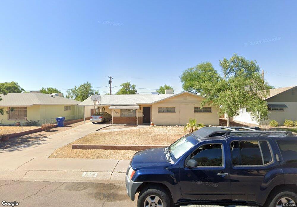
716 W 10th St Tempe, AZ 85281
Mitchell Park West NeighborhoodEstimated Value: $364,446 - $453,000
Studio
2
Baths
1,139
Sq Ft
$372/Sq Ft
Est. Value
About This Home
This home is located at 716 W 10th St, Tempe, AZ 85281 and is currently estimated at $423,862, approximately $372 per square foot. 716 W 10th St is a home located in Maricopa County with nearby schools including Geneva Epps Mosley Middle School, Tempe High School, and New School for the Arts & Academics.
Ownership History
Date
Name
Owned For
Owner Type
Purchase Details
Closed on
Jan 13, 2018
Sold by
Mcginn Mark J and The Mcginn Family Living Trust
Bought by
Mcginn Mark J and Mcginn Chad J
Current Estimated Value
Purchase Details
Closed on
Mar 25, 2006
Sold by
Mcginn Gerald C and Mcginn Margaret J
Bought by
Mcginn Gerald C and Mcginn Margaret J
Create a Home Valuation Report for This Property
The Home Valuation Report is an in-depth analysis detailing your home's value as well as a comparison with similar homes in the area
Home Values in the Area
Average Home Value in this Area
Purchase History
| Date | Buyer | Sale Price | Title Company |
|---|---|---|---|
| Mcginn Mark J | -- | None Available | |
| Mcginn Gerald C | -- | None Available |
Source: Public Records
Tax History
| Year | Tax Paid | Tax Assessment Tax Assessment Total Assessment is a certain percentage of the fair market value that is determined by local assessors to be the total taxable value of land and additions on the property. | Land | Improvement |
|---|---|---|---|---|
| 2025 | $1,687 | $16,180 | -- | -- |
| 2024 | $1,548 | $15,409 | -- | -- |
| 2023 | $1,548 | $34,080 | $6,810 | $27,270 |
| 2022 | $1,478 | $25,350 | $5,070 | $20,280 |
| 2021 | $1,507 | $23,520 | $4,700 | $18,820 |
| 2020 | $1,457 | $20,950 | $4,190 | $16,760 |
| 2019 | $1,859 | $19,250 | $3,850 | $15,400 |
| 2018 | $1,391 | $16,980 | $3,390 | $13,590 |
| 2017 | $1,347 | $15,550 | $3,110 | $12,440 |
| 2016 | $1,341 | $14,030 | $2,800 | $11,230 |
| 2015 | $1,297 | $12,070 | $2,410 | $9,660 |
Source: Public Records
Map
Nearby Homes
- 522 W Howe St
- 919 S Wilson St Unit 5
- 700 W University Dr Unit 241
- 826 W 12th St
- 915 S Wilson St Unit 4
- 1215 S Judd St
- 914 S Farmer Ave
- 820 S Farmer Ave
- 1052 W Elna Rae St
- 617 W 13th St
- 611 W 13th St
- 1101 S Farmer Ave
- 1321 S Mckemy St
- 510 W University Dr Unit 118
- 942 S Ash Ave Unit 103
- 626 S Wilson St
- 604 S Roosevelt St
- 1218 S Farmer Ave
- 637 S Roosevelt St
- 1201 S Farmer Ave Unit 1
Your Personal Tour Guide
Ask me questions while you tour the home.