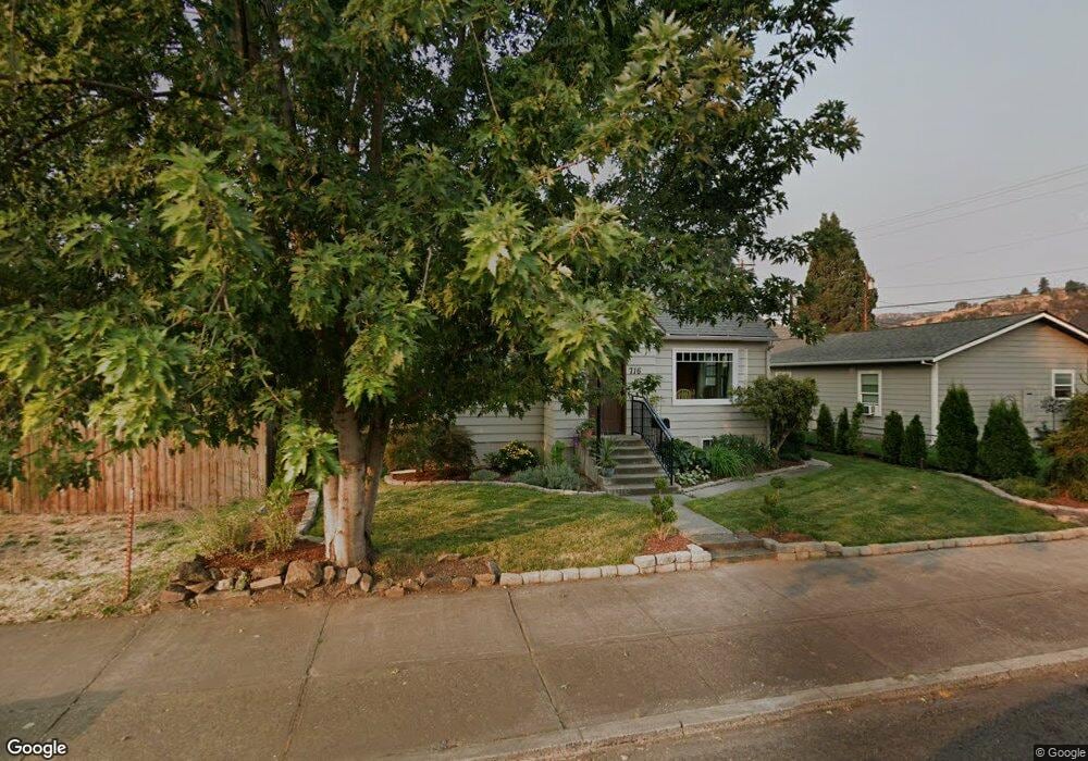
716 W 10th St the Dalles, OR 97058
Estimated Value: $375,652 - $440,000
3
Beds
1
Bath
1,418
Sq Ft
$285/Sq Ft
Est. Value
About This Home
This home is located at 716 W 10th St, the Dalles, OR 97058 and is currently estimated at $404,163, approximately $285 per square foot. 716 W 10th St is a home located in Wasco County with nearby schools including Colonel Wright Elementary School, The Dalles Middle School, and The Dalles High School.
Ownership History
Date
Name
Owned For
Owner Type
Purchase Details
Closed on
Nov 2, 2018
Sold by
Brigham Michael E
Bought by
Brigham Michael E and Brigham Velda
Current Estimated Value
Purchase Details
Closed on
Jul 1, 2005
Sold by
Green Michael M and Green Angela R
Bought by
Brigham Michael E
Home Financials for this Owner
Home Financials are based on the most recent Mortgage that was taken out on this home.
Original Mortgage
$104,000
Outstanding Balance
$62,369
Interest Rate
8.05%
Mortgage Type
Adjustable Rate Mortgage/ARM
Estimated Equity
$341,794
Purchase Details
Closed on
Jun 30, 2005
Sold by
Jelderks Ann Marie
Bought by
Green Michael M and Green Angela R
Home Financials for this Owner
Home Financials are based on the most recent Mortgage that was taken out on this home.
Original Mortgage
$104,000
Outstanding Balance
$62,369
Interest Rate
8.05%
Mortgage Type
Adjustable Rate Mortgage/ARM
Estimated Equity
$341,794
Create a Home Valuation Report for This Property
The Home Valuation Report is an in-depth analysis detailing your home's value as well as a comparison with similar homes in the area
Home Values in the Area
Average Home Value in this Area
Purchase History
| Date | Buyer | Sale Price | Title Company |
|---|---|---|---|
| Brigham Michael E | -- | None Available | |
| Brigham Michael E | $83,500 | -- | |
| Green Michael M | $81,000 | -- |
Source: Public Records
Mortgage History
| Date | Status | Borrower | Loan Amount |
|---|---|---|---|
| Open | Brigham Michael E | $104,000 |
Source: Public Records
Tax History Compared to Growth
Tax History
| Year | Tax Paid | Tax Assessment Tax Assessment Total Assessment is a certain percentage of the fair market value that is determined by local assessors to be the total taxable value of land and additions on the property. | Land | Improvement |
|---|---|---|---|---|
| 2024 | $2,583 | $143,514 | -- | -- |
| 2023 | $2,508 | $139,334 | $0 | $0 |
| 2022 | $2,452 | $127,955 | $0 | $0 |
| 2021 | $2,377 | $124,228 | $0 | $0 |
| 2020 | $2,318 | $120,610 | $0 | $0 |
| 2019 | $2,448 | $117,097 | $0 | $0 |
| 2018 | $2,380 | $120,191 | $0 | $0 |
| 2017 | $2,305 | $116,690 | $0 | $0 |
| 2016 | $2,255 | $113,291 | $0 | $0 |
Source: Public Records
Map
Nearby Homes
- 811 W 9th St
- 719 W 11th St
- 608 W 6th St
- 990 W 8th Place
- 906 Garrison St
- 602 W 13th St
- 529 W 3rd Place
- 1832 Cherry Heights Rd
- 309 W 7th St
- 0 W 16th St
- 209 1/2 W 5th Place
- 216 E 5th St
- 115 W Scenic Dr
- 1606 W 10th St
- 522 W 22nd St
- 319 E 7th St
- 0 Sandstone Way
- 1622 W 12th St
- 417 Park Place
- 1014 Laughlin St
- 1100 Mount Hood St
- 712 W 10th St
- 708 W 10th St
- 1108 Mount Hood St
- 711 W 11th St
- 1010 Mount Hood St
- 717 W 10th St
- 804 W 10th St
- 806 W 10th St
- 800 W 10th St
- 800 E 10th St
- 702 W 10th St
- 709 W 10th St
- 705 W 11th St
- 802 W 10th St
- 1111 Mount Hood St
- 1111 Mt Hood
- 705 W 10th St
- 701 W 11th St
- 1015 Mount Hood St