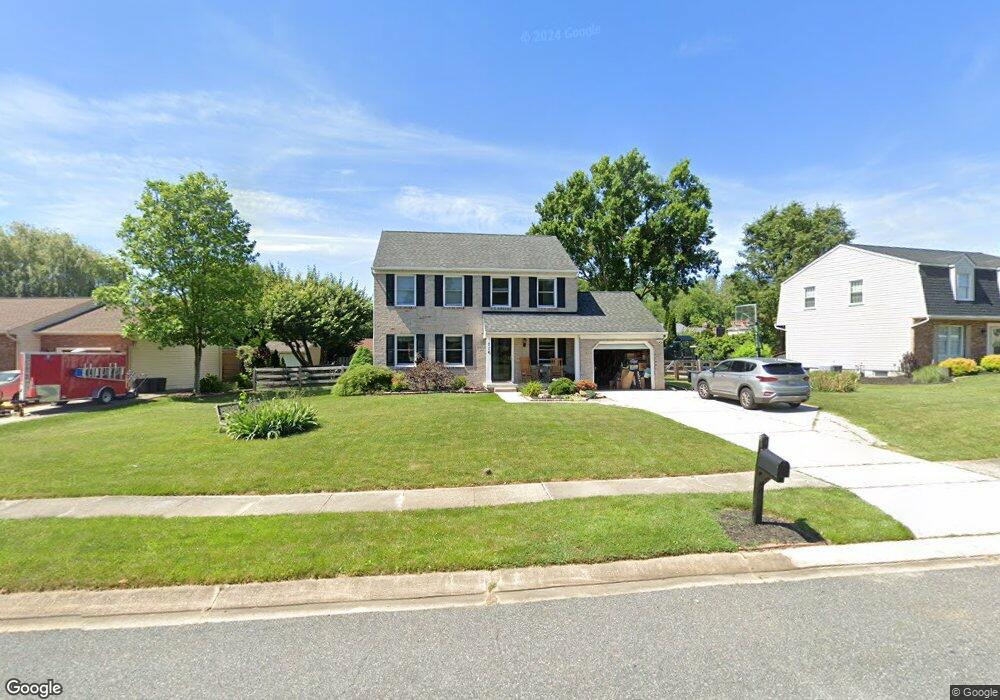
716 W Macphail Rd Bel Air, MD 21014
Estimated Value: $509,587 - $564,000
--
Bed
3
Baths
1,828
Sq Ft
$292/Sq Ft
Est. Value
About This Home
This home is located at 716 W Macphail Rd, Bel Air, MD 21014 and is currently estimated at $533,397, approximately $291 per square foot. 716 W Macphail Rd is a home located in Harford County with nearby schools including Homestead-Wakefield Elementary School, Bel Air Middle School, and Bel Air High School.
Ownership History
Date
Name
Owned For
Owner Type
Purchase Details
Closed on
Nov 27, 2001
Sold by
Colosimo Mark F
Bought by
Newton John R and Newton Melissa L
Current Estimated Value
Purchase Details
Closed on
Sep 12, 1990
Sold by
Hutchins Edward J
Bought by
Colosimo Mark F
Home Financials for this Owner
Home Financials are based on the most recent Mortgage that was taken out on this home.
Original Mortgage
$141,000
Interest Rate
10.19%
Purchase Details
Closed on
May 9, 1985
Sold by
Turner Clark Inc
Bought by
Hutchins Edward J
Home Financials for this Owner
Home Financials are based on the most recent Mortgage that was taken out on this home.
Original Mortgage
$91,000
Interest Rate
13.07%
Create a Home Valuation Report for This Property
The Home Valuation Report is an in-depth analysis detailing your home's value as well as a comparison with similar homes in the area
Home Values in the Area
Average Home Value in this Area
Purchase History
| Date | Buyer | Sale Price | Title Company |
|---|---|---|---|
| Newton John R | $194,900 | -- | |
| Colosimo Mark F | $148,500 | -- | |
| Hutchins Edward J | $99,900 | -- |
Source: Public Records
Mortgage History
| Date | Status | Borrower | Loan Amount |
|---|---|---|---|
| Previous Owner | Colosimo Mark F | $141,000 | |
| Previous Owner | Hutchins Edward J | $91,000 | |
| Closed | Newton John R | -- |
Source: Public Records
Tax History Compared to Growth
Tax History
| Year | Tax Paid | Tax Assessment Tax Assessment Total Assessment is a certain percentage of the fair market value that is determined by local assessors to be the total taxable value of land and additions on the property. | Land | Improvement |
|---|---|---|---|---|
| 2025 | $4,197 | $405,100 | $100,400 | $304,700 |
| 2024 | $4,197 | $386,433 | $0 | $0 |
| 2023 | $3,996 | $367,767 | $0 | $0 |
| 2022 | $3,805 | $349,100 | $100,400 | $248,700 |
| 2021 | $1,804 | $338,667 | $0 | $0 |
| 2020 | $1,804 | $328,233 | $0 | $0 |
| 2019 | $3,667 | $317,800 | $115,200 | $202,600 |
| 2018 | $3,561 | $311,367 | $0 | $0 |
| 2017 | $3,487 | $317,800 | $0 | $0 |
| 2016 | -- | $298,500 | $0 | $0 |
| 2015 | $3,247 | $293,633 | $0 | $0 |
| 2014 | $3,247 | $288,767 | $0 | $0 |
Source: Public Records
Map
Nearby Homes
- 719 Paige Cir
- 600 Harvest Ct
- 1055 Sansa Ct
- 608 Squire Ln Unit B
- 804 Grady Ct
- 606 Squire Ln Unit 606-A
- 601 Thames Way Unit E
- 203 Yorkshire Way Unit K
- 600 Squire Ln Unit 2J
- 134 W Heather Rd
- 298 Canterbury Rd Unit 298-D
- 204 Chaucer Ln Unit O
- 204 Chaucer Ln Unit D
- 292 Canterbury Rd Unit N
- 304 Canterbury Rd Unit K
- 726 Iron Gate Rd
- 699 Iron Gate Rd
- 103 S Reed St
- 296 Canterbury Rd
- 0 Winter Park Rd
- 714 W Macphail Rd
- 718 W Macphail Rd
- 719 Macphail Ct N
- 717 Macphail Ct N
- 700 Paige Cir
- 712 W Macphail Rd
- 715 Macphail Ct N
- 717 W Macphail Rd
- 726 Macphail Ct N
- 702 Paige Cir
- 713 Macphail Ct N
- 724 Macphail Ct N
- 725 Macphail Ct S
- 710 W Macphail Rd
- 701 Paige Cir
- 722 Macphail Ct N
- 720 Macphail Ct N
- 703 Paige Cir
- 704 Paige Cir
- 718 Macphail Ct N