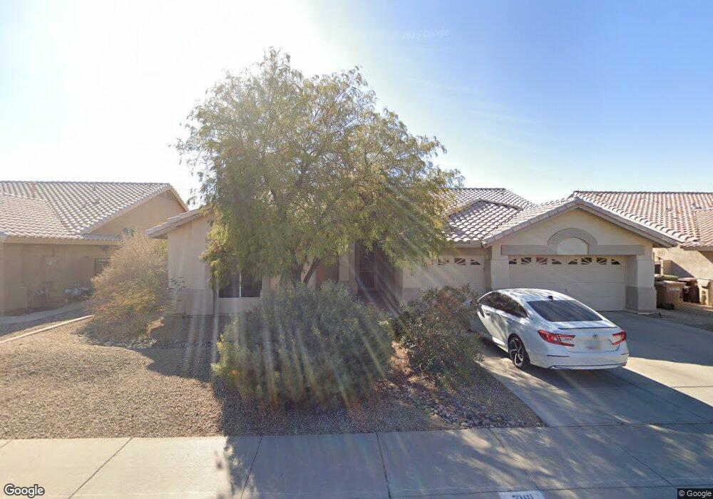
7161 W Pershing Ave Peoria, AZ 85381
Estimated Value: $533,476 - $664,000
--
Bed
3
Baths
2,476
Sq Ft
$244/Sq Ft
Est. Value
About This Home
This home is located at 7161 W Pershing Ave, Peoria, AZ 85381 and is currently estimated at $603,619, approximately $243 per square foot. 7161 W Pershing Ave is a home located in Maricopa County with nearby schools including Oakwood Elementary School, Cactus High School, and Legacy Traditional School - Glendale.
Ownership History
Date
Name
Owned For
Owner Type
Purchase Details
Closed on
Jul 8, 2003
Sold by
Mouw Philip J and Mouw Pamela L
Bought by
Mouw Philip J and Mouw Pamela L
Current Estimated Value
Home Financials for this Owner
Home Financials are based on the most recent Mortgage that was taken out on this home.
Original Mortgage
$160,000
Interest Rate
5.22%
Mortgage Type
Purchase Money Mortgage
Purchase Details
Closed on
May 14, 1999
Sold by
Mouw Philip J and Mouw Pamela L
Bought by
Mouw Philip J and Mouw Pamela L
Purchase Details
Closed on
Jan 31, 1997
Sold by
T W Lewis Company
Bought by
Mouw Philip J and Mouw Pamela L
Home Financials for this Owner
Home Financials are based on the most recent Mortgage that was taken out on this home.
Original Mortgage
$183,150
Interest Rate
7.86%
Mortgage Type
New Conventional
Create a Home Valuation Report for This Property
The Home Valuation Report is an in-depth analysis detailing your home's value as well as a comparison with similar homes in the area
Home Values in the Area
Average Home Value in this Area
Purchase History
| Date | Buyer | Sale Price | Title Company |
|---|---|---|---|
| Mouw Philip J | -- | First American Title Ins Co | |
| Mouw Philip J | -- | First American Title Ins Co | |
| Mouw Philip J | -- | -- | |
| Mouw Philip J | $192,891 | Chicago Title Insurance Co |
Source: Public Records
Mortgage History
| Date | Status | Borrower | Loan Amount |
|---|---|---|---|
| Closed | Mouw Philip J | $160,000 | |
| Closed | Mouw Philip J | $30,000 | |
| Closed | Mouw Philip J | $183,150 |
Source: Public Records
Tax History Compared to Growth
Tax History
| Year | Tax Paid | Tax Assessment Tax Assessment Total Assessment is a certain percentage of the fair market value that is determined by local assessors to be the total taxable value of land and additions on the property. | Land | Improvement |
|---|---|---|---|---|
| 2025 | $2,323 | $30,222 | -- | -- |
| 2024 | $2,351 | $28,783 | -- | -- |
| 2023 | $2,351 | $41,880 | $8,370 | $33,510 |
| 2022 | $2,303 | $32,960 | $6,590 | $26,370 |
| 2021 | $2,456 | $30,660 | $6,130 | $24,530 |
| 2020 | $2,482 | $29,670 | $5,930 | $23,740 |
| 2019 | $2,401 | $27,310 | $5,460 | $21,850 |
| 2018 | $2,312 | $26,080 | $5,210 | $20,870 |
| 2017 | $2,313 | $23,550 | $4,710 | $18,840 |
| 2016 | $2,289 | $23,220 | $4,640 | $18,580 |
| 2015 | $2,136 | $22,980 | $4,590 | $18,390 |
Source: Public Records
Map
Nearby Homes
- 7191 W Surrey Ave
- 7326 W Pershing Ave
- 13629 N 71st Dr
- 7301 W Sweetwater Ave
- 7138 W Rue de Lamour
- 12709 N 72nd Ave
- 7236 W Voltaire Ave
- 7233 W Corrine Dr
- 13676 N 73rd Dr Unit 3
- 7220 W Larkspur Dr
- 7126 W Columbine Dr
- 13051 N 75th Dr
- 7214 W Columbine Dr
- 7418 W Corrine Dr
- 7025 W Redfield Rd
- 7114 W Ludlow Dr
- 7537 W Dreyfus Dr
- 7544 W Dreyfus Dr
- 13851 N 74th Ave
- 7122 W Redfield Rd
- 7155 W Pershing Ave
- 7167 W Pershing Ave
- 7162 W Surrey Ave
- 7149 W Pershing Ave
- 7173 W Pershing Ave
- 7156 W Surrey Ave
- 7168 W Surrey Ave
- 7162 W Pershing Ave
- 7150 W Surrey Ave
- 7168 W Pershing Ave
- 7174 W Surrey Ave
- 7156 W Pershing Ave
- 7143 W Pershing Ave
- 7179 W Pershing Ave
- 7174 W Pershing Ave
- 7150 W Pershing Ave
- 7144 W Surrey Ave
- 7180 W Surrey Ave
- 7180 W Pershing Ave
- 7185 W Pershing Ave