Estimated Value: $377,000 - $470,000
4
Beds
3
Baths
2,882
Sq Ft
$147/Sq Ft
Est. Value
About This Home
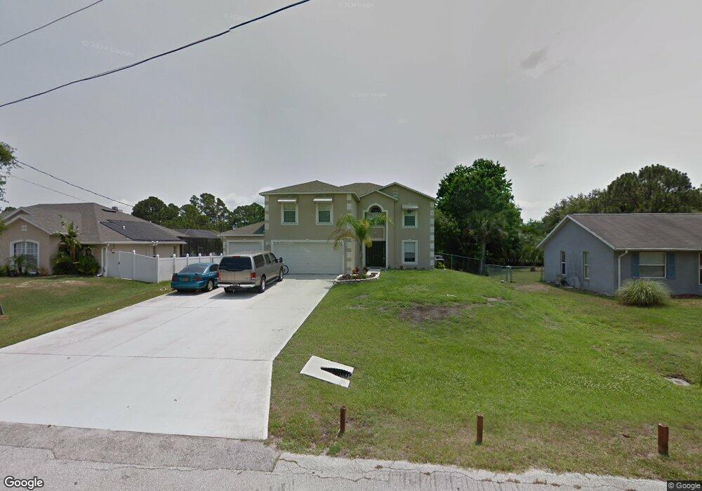
This home is located at 7165 Kimball Ave, Cocoa, FL 32927 and is currently estimated at $424,724, approximately $147 per square foot. 7165 Kimball Ave is a home located in Brevard County with nearby schools including Enterprise Elementary School, Space Coast Junior/Senior High School, and East Atlantic Prep of Brevard County.
Ownership History
Date
Name
Owned For
Owner Type
Purchase Details
Closed on
Aug 16, 2024
Sold by
Swanson Denise and Swanson Gene
Bought by
Gene K And Denise G Swanson Trust and Swanson
Current Estimated Value
Purchase Details
Closed on
Dec 8, 2006
Sold by
Maronda Homes Inc Of Florida
Bought by
Swanson Gene and Swanson Denise
Home Financials for this Owner
Home Financials are based on the most recent Mortgage that was taken out on this home.
Original Mortgage
$179,200
Interest Rate
6.29%
Purchase Details
Closed on
Feb 20, 2004
Sold by
Ferrer Thomas M
Bought by
Lleva E V
Purchase Details
Closed on
Aug 7, 1995
Sold by
Nationsbank Fl N A
Bought by
Ferrer Thomas M
Create a Home Valuation Report for This Property
The Home Valuation Report is an in-depth analysis detailing your home's value as well as a comparison with similar homes in the area
Home Values in the Area
Average Home Value in this Area
Purchase History
We collect this data history from publicly available records. To have your information removed, we recommend requesting removal directly through your county’s website.
| Date | Buyer | Sale Price | Title Company |
|---|---|---|---|
| Gene K And Denise G Swanson Trust | $100 | None Listed On Document | |
| Swanson Gene | $224,400 | Adams Title Inc | |
| Lleva E V | $10,000 | Security First Title Partner | |
| Ferrer Thomas M | $11,100 | -- |
Source: Public Records
Mortgage History
We collect this data history from publicly available records. To have your information removed, we recommend requesting removal directly through your county’s website.
| Date | Status | Borrower | Loan Amount |
|---|---|---|---|
| Previous Owner | Swanson Gene | $179,200 |
Source: Public Records
Tax History
| Year | Tax Paid | Tax Assessment Tax Assessment Total Assessment is a certain percentage of the fair market value that is determined by local assessors to be the total taxable value of land and additions on the property. | Land | Improvement |
|---|---|---|---|---|
| 2025 | $2,283 | $157,290 | -- | -- |
| 2024 | $2,237 | $152,860 | -- | -- |
| 2023 | $2,237 | $148,410 | $0 | $0 |
| 2022 | $2,099 | $144,090 | $0 | $0 |
| 2021 | $2,117 | $139,900 | $0 | $0 |
| 2020 | $2,019 | $137,970 | $0 | $0 |
| 2019 | $1,958 | $134,870 | $0 | $0 |
| 2018 | $1,955 | $132,360 | $0 | $0 |
| 2017 | $1,955 | $129,640 | $0 | $0 |
| 2016 | $1,971 | $126,980 | $18,000 | $108,980 |
| 2015 | $2,008 | $126,100 | $15,000 | $111,100 |
| 2014 | $2,015 | $125,100 | $11,000 | $114,100 |
Source: Public Records
Map
Nearby Homes
- 7200 Oakwood Ave
- 7368 Crepe Myrtle Ct
- 5551 Cinnamon Fern Blvd
- 7735 Fringe Place
- 5555 Brandon St
- 6965 Hundred Acre Dr
- 5350 Cinnamon Fern Blvd
- 7606 Fringe Place
- 5303 Yaupon Holly Dr
- 6643 Emil Ave
- 6815 Bryant Rd
- 5165 Patricia St
- 5155 Mayflower St
- 5170 Andover St
- 6581 Bancroft Ave
- 5145 Carter St
- 6760 Cairo Rd
- 6615 Dock Ave
- 6813 Cecil Rd
- 5145 Everett St
- 7175 Kimball Ave
- 7155 Kimball Ave
- 7185 Kimball Ave
- 5690 Falcon Blvd
- 7160 Freeport Rd
- 7161 Freeport Rd
- 7140 Milton Ave
- 5740 Falcon Blvd
- 5645 Falcon Blvd
- 7190 Kimball Ave
- 7205 Kimball Ave
- 5760 Falcon Blvd
- 7185 Freeport Rd
- 7200 E Kimball
- 7200 Kimball Ave
- 7164 Freeport Rd
- 7155 Milton Ave
- 7150 Milton Ave
- 5695 Falcon Blvd
- 7195 Freeport Rd
Your Personal Tour Guide
Ask me questions while you tour the home.