2
Beds
2
Baths
800
Sq Ft
0.69
Acres
About This Home
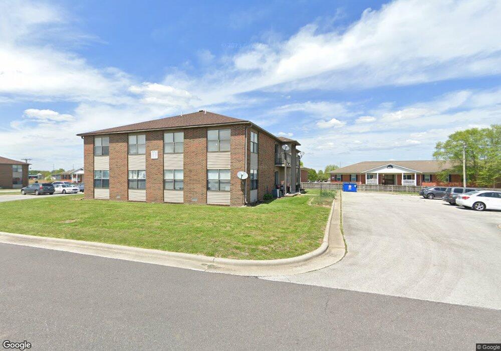
This home is located at 717-731 Brett Cir, Nixa, MO 65714. 717-731 Brett Cir is a home located in Christian County with nearby schools including P.S. 376, Espy Elementary School, and Queens Gateway to Health Sciences Secondary School.
Ownership History
Date
Name
Owned For
Owner Type
Purchase Details
Closed on
Oct 2, 2024
Sold by
Annie Properties Llc
Bought by
Brett Circle Apartments Llc
Purchase Details
Closed on
Jan 20, 2023
Sold by
Yugo Properties Llc
Bought by
Kadpm Llc
Home Financials for this Owner
Home Financials are based on the most recent Mortgage that was taken out on this home.
Original Mortgage
$2,749,600
Interest Rate
6.33%
Mortgage Type
Credit Line Revolving
Purchase Details
Closed on
Nov 18, 2020
Sold by
Skipworth Betty L
Bought by
Skipworth Betty L and Hayter Sonya May
Purchase Details
Closed on
Apr 24, 2014
Sold by
Skipworth Percy L and Percy L Skipworth Revocable Tr
Bought by
Skipworth Percy L and Skipworth Betty L
Create a Home Valuation Report for This Property
The Home Valuation Report is an in-depth analysis detailing your home's value as well as a comparison with similar homes in the area
Home Values in the Area
Average Home Value in this Area
Purchase History
| Date | Buyer | Sale Price | Title Company |
|---|---|---|---|
| Brett Circle Apartments Llc | -- | None Listed On Document | |
| Annie Properties Llc | -- | None Listed On Document | |
| Kadpm Llc | -- | Titan Title | |
| Yugo Properties Llc | -- | Titan Title | |
| Skipworth Betty L | -- | None Available | |
| Skipworth Percy L | -- | None Available |
Source: Public Records
Mortgage History
| Date | Status | Borrower | Loan Amount |
|---|---|---|---|
| Previous Owner | Kadpm Llc | $2,749,600 |
Source: Public Records
Tax History Compared to Growth
Tax History
| Year | Tax Paid | Tax Assessment Tax Assessment Total Assessment is a certain percentage of the fair market value that is determined by local assessors to be the total taxable value of land and additions on the property. | Land | Improvement |
|---|---|---|---|---|
| 2024 | $3,401 | $54,570 | -- | -- |
| 2023 | $3,401 | $54,570 | $0 | $0 |
| 2022 | $3,405 | $54,570 | $0 | $0 |
| 2021 | $3,407 | $54,570 | $0 | $0 |
| 2020 | $3,572 | $54,610 | $0 | $0 |
| 2019 | $3,572 | $54,610 | $0 | $0 |
| 2018 | $3,327 | $54,610 | $0 | $0 |
| 2017 | $3,327 | $54,610 | $0 | $0 |
| 2016 | $3,277 | $54,610 | $0 | $0 |
| 2015 | $3,281 | $54,610 | $54,610 | $0 |
| 2014 | $3,205 | $54,680 | $0 | $0 |
| 2013 | $32 | $54,680 | $0 | $0 |
| 2011 | $32 | $109,360 | $0 | $0 |
Source: Public Records
Map
Nearby Homes
- 403 S Bryant St
- 848 S Somerset Dr
- 412 S Bryant St
- 000 West St
- Sw Corner Highway 160 & St S
- 502 Osage Dr
- 1334 W Mount Vernon St
- 404 S Patricia Ave
- 000 (Tbd) Highway 160 (14 8 Acres) St
- 601 S Gregg Rd
- 106 S Delaware St
- 305 Meadow St
- 806 Honeysuckle Ln
- 204 Gate Ln
- 1001 W Bryce Ln
- 613 N Baywood Dr
- 304 N Bonda Way
- 609 N Elderberry Ln
- 703 N Baywood Dr
- 705 N Baywood Dr
- 736 Brett Cir
- 248 Covered Bridge Rd
- 741 Brett Cir
- 703 Mclean Ct
- 713 Mclean Ct
- 209 S Ellen Ave
- 717 719 Mclean Ct
- 207 S Ellen St
- 702-704 Mclean Ct
- 305 S Coventry Cir
- 205 S Ellen Ave
- 307 S Coventry Cir
- 706 Mclean Ct
- 203 S Ellen St
- 613 Coventry St
- 613 W Coventry Rd
- 208 S Ellen Ave
- 304 S Coventry Cir
- 704 W Mount Vernon St