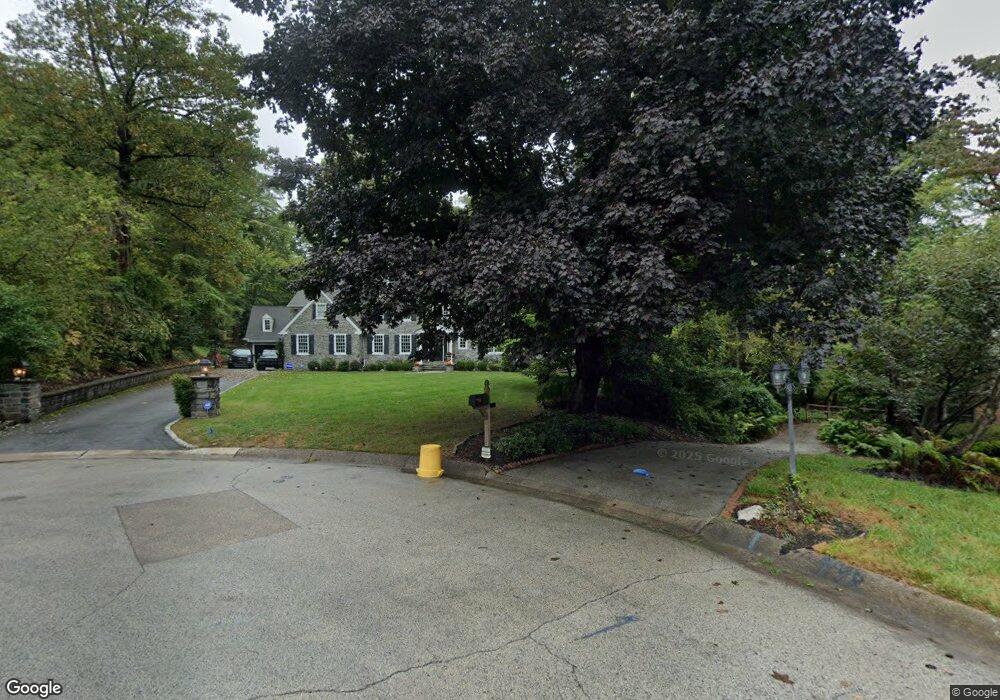
717 Amherst Cir Newtown Square, PA 19073
Estimated Value: $1,347,000 - $1,885,000
4
Beds
4
Baths
6,123
Sq Ft
$264/Sq Ft
Est. Value
About This Home
This home is located at 717 Amherst Cir, Newtown Square, PA 19073 and is currently estimated at $1,618,051, approximately $264 per square foot. 717 Amherst Cir is a home located in Delaware County with nearby schools including Ithan Elementary School, Radnor Middle School, and Radnor Senior High School.
Ownership History
Date
Name
Owned For
Owner Type
Purchase Details
Closed on
Jun 3, 2005
Sold by
Hoenig Eugene M and Hoenig Judith B
Bought by
Webb Simon R and Webb Lauren L
Current Estimated Value
Home Financials for this Owner
Home Financials are based on the most recent Mortgage that was taken out on this home.
Original Mortgage
$508,000
Outstanding Balance
$266,400
Interest Rate
5.83%
Mortgage Type
Fannie Mae Freddie Mac
Estimated Equity
$1,351,651
Create a Home Valuation Report for This Property
The Home Valuation Report is an in-depth analysis detailing your home's value as well as a comparison with similar homes in the area
Home Values in the Area
Average Home Value in this Area
Purchase History
| Date | Buyer | Sale Price | Title Company |
|---|---|---|---|
| Webb Simon R | $635,000 | Trident Land Transfer Co |
Source: Public Records
Mortgage History
| Date | Status | Borrower | Loan Amount |
|---|---|---|---|
| Open | Webb Simon R | $508,000 |
Source: Public Records
Tax History Compared to Growth
Tax History
| Year | Tax Paid | Tax Assessment Tax Assessment Total Assessment is a certain percentage of the fair market value that is determined by local assessors to be the total taxable value of land and additions on the property. | Land | Improvement |
|---|---|---|---|---|
| 2025 | $21,251 | $1,051,090 | $230,160 | $820,930 |
| 2024 | $21,251 | $1,051,090 | $230,160 | $820,930 |
| 2023 | $20,409 | $1,051,090 | $230,160 | $820,930 |
| 2022 | $20,186 | $1,051,090 | $230,160 | $820,930 |
| 2021 | $32,425 | $1,051,090 | $230,160 | $820,930 |
| 2020 | $18,240 | $524,340 | $132,140 | $392,200 |
| 2019 | $17,726 | $524,340 | $132,140 | $392,200 |
| 2018 | $17,378 | $524,340 | $0 | $0 |
| 2017 | $17,014 | $524,340 | $0 | $0 |
| 2016 | $2,878 | $524,340 | $0 | $0 |
| 2015 | $2,936 | $524,340 | $0 | $0 |
| 2014 | $2,878 | $524,340 | $0 | $0 |
Source: Public Records
Map
Nearby Homes
- 726 Darby Paoli Rd
- 204 Wedgewood Cir
- 238 E Chelsea Cir Unit 238
- 211 E Chelsea Cir
- 217 Jeffrey Ln
- 820 Darby Paoli Rd
- 739 S Roberts Rd
- 212 Aronimink Dr
- 3111 Sawmill Rd
- 310 Jeffrey Ln
- 202 Barren Rd
- 12 Lincoln Ln
- 119 Bella Dr Unit 2MD
- 135 Bryn Mawr Ave
- 117 Bella Dr Unit 3AD
- 3500 Goshen Rd
- 126 Bryn Mawr Ave
- 133 Brookside Rd
- 66 Northwood Rd
- 115 Newby Dr
- 718 Amherst Cir
- 721 Amherst Cir
- 852 Briarwood Rd
- 848 Briarwood Rd
- 722 Amherst Cir
- 860 Briarwood Rd
- 729 Amherst Cir
- 726 Amherst Cir
- 853 Briarwood Rd
- 864 Briarwood Rd
- 855 Briarwood Rd
- 730 Amherst Cir
- 845 Briarwood Rd
- 836 Briarwood Rd
- 872 Briarwood Rd
- 849 Briarwood Rd
- 841 Briarwood Rd
- 865 Briarwood Rd
- 896 Briarwood Rd
- 813 Lawrence Ln