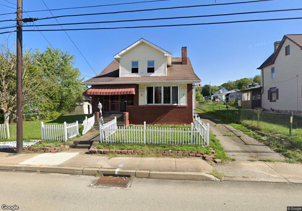
717 Brown St Everson, PA 15631
Estimated Value: $126,277 - $249,000
3
Beds
3
Baths
2,020
Sq Ft
$91/Sq Ft
Est. Value
About This Home
This home is located at 717 Brown St, Everson, PA 15631 and is currently estimated at $184,819, approximately $91 per square foot. 717 Brown St is a home located in Fayette County with nearby schools including Southmoreland Elementary School, Southmoreland Primary Center, and Southmoreland Senior High School.
Ownership History
Date
Name
Owned For
Owner Type
Purchase Details
Closed on
Jun 7, 2024
Sold by
Sheriff Of Fayette County In The Commonw
Bought by
Peterson Sheila
Current Estimated Value
Purchase Details
Closed on
Feb 7, 2013
Sold by
Frye Timothy E and Mcalister Brianne
Bought by
Smith Matthew V
Home Financials for this Owner
Home Financials are based on the most recent Mortgage that was taken out on this home.
Original Mortgage
$117,472
Interest Rate
3.38%
Mortgage Type
VA
Purchase Details
Closed on
May 27, 2011
Sold by
Shoemaker Timothy P and Shoemaker Cheryl A
Bought by
Frye Timothy E and Mcalister Brianne
Home Financials for this Owner
Home Financials are based on the most recent Mortgage that was taken out on this home.
Original Mortgage
$102,338
Interest Rate
4.87%
Mortgage Type
FHA
Create a Home Valuation Report for This Property
The Home Valuation Report is an in-depth analysis detailing your home's value as well as a comparison with similar homes in the area
Home Values in the Area
Average Home Value in this Area
Purchase History
| Date | Buyer | Sale Price | Title Company |
|---|---|---|---|
| Peterson Sheila | $38,000 | None Listed On Document | |
| Smith Matthew V | $115,000 | None Available | |
| Frye Timothy E | $105,000 | None Available |
Source: Public Records
Mortgage History
| Date | Status | Borrower | Loan Amount |
|---|---|---|---|
| Previous Owner | Smith Matthew V | $117,472 | |
| Previous Owner | Frye Timothy E | $102,338 |
Source: Public Records
Tax History
| Year | Tax Paid | Tax Assessment Tax Assessment Total Assessment is a certain percentage of the fair market value that is determined by local assessors to be the total taxable value of land and additions on the property. | Land | Improvement |
|---|---|---|---|---|
| 2025 | $1,081 | $35,895 | $7,080 | $28,815 |
| 2024 | $1,088 | $35,895 | $7,080 | $28,815 |
| 2023 | $2,125 | $35,895 | $7,080 | $28,815 |
| 2022 | $2,189 | $35,895 | $7,080 | $28,815 |
| 2021 | $2,102 | $35,895 | $7,080 | $28,815 |
| 2020 | $2,035 | $35,895 | $7,080 | $28,815 |
| 2019 | $1,814 | $35,895 | $7,080 | $28,815 |
| 2018 | $1,852 | $35,895 | $7,080 | $28,815 |
| 2017 | $1,852 | $35,895 | $7,080 | $28,815 |
| 2016 | -- | $35,895 | $7,080 | $28,815 |
| 2015 | -- | $35,895 | $7,080 | $28,815 |
| 2014 | -- | $71,790 | $14,160 | $57,630 |
Source: Public Records
Map
Nearby Homes
- 500 Painter St
- 230 Maple St
- 420 Brown St
- 324 Brown St Unit 316
- 324 Brown St
- 244 Brown St
- 376 Penn Ave
- 322 S Broadway St
- 320 S Broadway St
- 514 Eleanor Ave
- 501 S Chestnut St
- 510 S Chestnut St
- 518 Walnut Ave
- 401 N Broadway St
- 804 George St Unit OV
- 201 Arthur Ave
- 435 N Broadway St
- 511 Arthur Ave
- 504 Arthur Ave Unit 506
- 2149 Kingview Rd
Your Personal Tour Guide
Ask me questions while you tour the home.