Estimated Value: $716,000 - $927,000
4
Beds
5
Baths
4,218
Sq Ft
$190/Sq Ft
Est. Value
About This Home
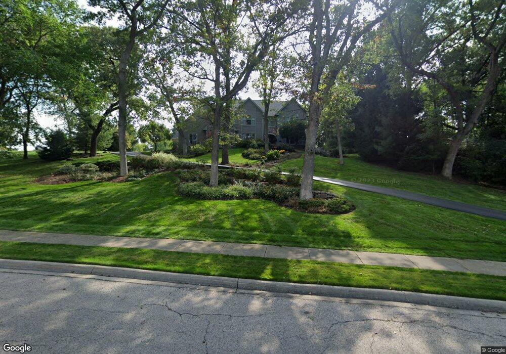
This home is located at 717 Cove Dr, Cary, IL 60013 and is currently estimated at $803,406, approximately $190 per square foot. 717 Cove Dr is a home located in McHenry County with nearby schools including Deer Path Elementary School, Cary Jr High School, and Cary Grove High School.
Ownership History
Date
Name
Owned For
Owner Type
Purchase Details
Closed on
Dec 12, 2007
Sold by
Sytsma William J and Sytsma Colleen A
Bought by
Sytsma Colleen A
Current Estimated Value
Purchase Details
Closed on
Dec 15, 1998
Sold by
American National Bk & Tr Co Of Chicago
Bought by
Sytsma William J and Sytsma Colleen A
Home Financials for this Owner
Home Financials are based on the most recent Mortgage that was taken out on this home.
Original Mortgage
$77,000
Outstanding Balance
$19,347
Interest Rate
8%
Estimated Equity
$784,059
Create a Home Valuation Report for This Property
The Home Valuation Report is an in-depth analysis detailing your home's value as well as a comparison with similar homes in the area
Home Values in the Area
Average Home Value in this Area
Purchase History
| Date | Buyer | Sale Price | Title Company |
|---|---|---|---|
| Sytsma Colleen A | -- | None Available | |
| Sytsma William J | $110,000 | Intercounty Title |
Source: Public Records
Mortgage History
| Date | Status | Borrower | Loan Amount |
|---|---|---|---|
| Open | Sytsma William J | $77,000 |
Source: Public Records
Tax History Compared to Growth
Tax History
| Year | Tax Paid | Tax Assessment Tax Assessment Total Assessment is a certain percentage of the fair market value that is determined by local assessors to be the total taxable value of land and additions on the property. | Land | Improvement |
|---|---|---|---|---|
| 2024 | $18,882 | $244,205 | $38,621 | $205,584 |
| 2023 | $18,512 | $218,411 | $34,542 | $183,869 |
| 2022 | $17,757 | $205,330 | $75,734 | $129,596 |
| 2021 | $16,964 | $191,289 | $70,555 | $120,734 |
| 2020 | $16,480 | $184,517 | $68,057 | $116,460 |
| 2019 | $16,171 | $176,605 | $65,139 | $111,466 |
| 2018 | $15,575 | $166,285 | $60,175 | $106,110 |
| 2017 | $15,303 | $156,651 | $56,689 | $99,962 |
| 2016 | $17,955 | $172,174 | $53,169 | $119,005 |
| 2013 | -- | $163,743 | $49,600 | $114,143 |
Source: Public Records
Map
Nearby Homes
- 1055 White Pine Dr
- 406 Catkins Way
- 380 Merion Dr
- Lot 7 Hickory Nut Grove Rd
- 945 White Pine Dr
- 6414 Kingsbridge Dr
- 28413 W Harvest Glen Cir
- 0000 Newbold Rd
- 24744 N Golden Oat Cir
- 6407 Kingsbridge Dr
- 365 Oakmont Dr
- Lot 11 Park Dr
- 111 Park Dr
- 1712 Squirrel Trail
- 331 Parkstone Dr
- 0 Three Oaks Dr Unit MRD12417647
- 322 Parkstone Dr
- 296 Foxford Dr Unit 1
- 138 Eastwood Ave
- 651 S Circle Ave
- 709 Cove Dr
- 7117 Saddle Oaks Dr
- 7201 Saddle Oaks Dr
- 7110 Saddle Oaks Dr
- 7118 Saddle Oaks Dr
- 616 Cove Dr
- 7205 Saddle Oaks Dr
- 7206 Saddle Oaks Dr
- 609 Cove Dr
- 7206 Horseshoe Ct
- 608 Cove Dr
- 7208 Horseshoe Ct
- 7209 Saddle Oaks Dr
- 7207 Horseshoe Ct
- 7210 Saddle Oaks Dr
- 602 Cove Dr
- 601 Cove Dr
- 7215 Saddle Oaks Dr
- 7214 Horseshoe Ct
- 7215 Horseshoe Ct