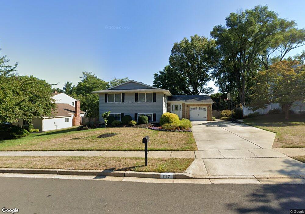
717 Decatur Dr Mount Laurel, NJ 08054
Estimated Value: $598,000 - $646,000
--
Bed
--
Bath
2,492
Sq Ft
$248/Sq Ft
Est. Value
About This Home
This home is located at 717 Decatur Dr, Mount Laurel, NJ 08054 and is currently estimated at $617,535, approximately $247 per square foot. 717 Decatur Dr is a home located in Burlington County with nearby schools including Hillside Elementary School, T.E. Harrington Middle School, and Mount Laurel Hartford School.
Ownership History
Date
Name
Owned For
Owner Type
Purchase Details
Closed on
Jul 21, 2000
Sold by
Clarke Lonnie and Clarke Mary Jane
Bought by
Gambetta John P and Gambetta Eileen
Current Estimated Value
Home Financials for this Owner
Home Financials are based on the most recent Mortgage that was taken out on this home.
Original Mortgage
$116,000
Outstanding Balance
$41,126
Interest Rate
8.1%
Mortgage Type
Purchase Money Mortgage
Estimated Equity
$576,409
Create a Home Valuation Report for This Property
The Home Valuation Report is an in-depth analysis detailing your home's value as well as a comparison with similar homes in the area
Home Values in the Area
Average Home Value in this Area
Purchase History
| Date | Buyer | Sale Price | Title Company |
|---|---|---|---|
| Gambetta John P | $181,000 | Integrity Title Agency |
Source: Public Records
Mortgage History
| Date | Status | Borrower | Loan Amount |
|---|---|---|---|
| Open | Gambetta John P | $116,000 |
Source: Public Records
Tax History Compared to Growth
Tax History
| Year | Tax Paid | Tax Assessment Tax Assessment Total Assessment is a certain percentage of the fair market value that is determined by local assessors to be the total taxable value of land and additions on the property. | Land | Improvement |
|---|---|---|---|---|
| 2025 | $8,634 | $273,500 | $89,000 | $184,500 |
| 2024 | $8,309 | $273,500 | $89,000 | $184,500 |
| 2023 | $8,309 | $273,500 | $89,000 | $184,500 |
| 2022 | $8,282 | $273,500 | $89,000 | $184,500 |
| 2021 | $8,126 | $273,500 | $89,000 | $184,500 |
| 2020 | $7,967 | $273,500 | $89,000 | $184,500 |
| 2019 | $7,885 | $273,500 | $89,000 | $184,500 |
| 2018 | $7,825 | $273,500 | $89,000 | $184,500 |
| 2017 | $7,622 | $273,500 | $89,000 | $184,500 |
| 2016 | $7,508 | $273,500 | $89,000 | $184,500 |
| 2015 | $7,420 | $273,500 | $89,000 | $184,500 |
| 2014 | $7,346 | $273,500 | $89,000 | $184,500 |
Source: Public Records
Map
Nearby Homes
- 23 Emory Ln
- 12 Taconia Ct
- 8 Raven Ct
- 13 Marcy Ct
- 1 Adner Dr
- 10 Gretna Ct
- 266 Saint David Dr
- 102 Union Mill Terrace
- 317 Saint David Dr
- 23 E Oleander Dr
- 223 Saint David Dr
- 32 Hearthstone Ln
- 11 E Berwin Way
- 3 Abington Rd
- 3 Village Ct
- 31 Quince Ct
- 70B Sumac Ct Unit 70B
- 6 Keatley Dr
- 1201A Ginger Ct
- 13 Keatley Dr
- 715 Decatur Dr
- 719 Decatur Dr
- 716 Lincoln Dr
- 714 Lincoln Dr
- 721 Decatur Dr
- 718 Lincoln Dr
- 713 Decatur Dr
- 716 Decatur Dr
- 714 Decatur Dr
- 718 Decatur Dr
- 712 Decatur Dr
- 712 Lincoln Dr
- 723 Decatur Dr
- 720 Lincoln Dr
- 720 Decatur Dr
- 711 Decatur Dr
- 710 Decatur Dr
- 699 Lincoln Dr
- 701 Stuyvesant Place
- 708 Decatur Dr