717 Double O Nine Rd Branson West, MO 65737
Estimated Value: $276,000 - $422,000
4
Beds
3
Baths
2,028
Sq Ft
$174/Sq Ft
Est. Value
About This Home
This home is located at 717 Double O Nine Rd, Branson West, MO 65737 and is currently estimated at $351,942, approximately $173 per square foot. 717 Double O Nine Rd is a home located in Stone County with nearby schools including Reeds Spring Primary School, Reeds Spring Elementary School, and Reeds Spring Middle School.
Ownership History
Date
Name
Owned For
Owner Type
Purchase Details
Closed on
May 15, 2015
Sold by
Hall Harold W and Hall Kathryn
Bought by
Hall David W
Current Estimated Value
Home Financials for this Owner
Home Financials are based on the most recent Mortgage that was taken out on this home.
Original Mortgage
$168,547
Outstanding Balance
$130,078
Interest Rate
3.73%
Mortgage Type
VA
Estimated Equity
$221,864
Purchase Details
Closed on
Jul 29, 2008
Sold by
Watkins Dorothy A and Watkins Family Trust
Bought by
Hall Harold W and Hall Kathryn A
Home Financials for this Owner
Home Financials are based on the most recent Mortgage that was taken out on this home.
Original Mortgage
$26,000
Interest Rate
6.4%
Mortgage Type
Credit Line Revolving
Purchase Details
Closed on
Mar 22, 2007
Sold by
Hall Harold W and Hall Akthryn
Bought by
Hall Harold W and Hall Kkathryn
Home Financials for this Owner
Home Financials are based on the most recent Mortgage that was taken out on this home.
Original Mortgage
$133,500
Interest Rate
6.3%
Mortgage Type
New Conventional
Create a Home Valuation Report for This Property
The Home Valuation Report is an in-depth analysis detailing your home's value as well as a comparison with similar homes in the area
Home Values in the Area
Average Home Value in this Area
Purchase History
| Date | Buyer | Sale Price | Title Company |
|---|---|---|---|
| Hall David W | -- | None Available | |
| Hall Harold W | -- | None Available | |
| Hall Harold W | -- | None Available |
Source: Public Records
Mortgage History
| Date | Status | Borrower | Loan Amount |
|---|---|---|---|
| Open | Hall David W | $168,547 | |
| Previous Owner | Hall Harold W | $26,000 | |
| Previous Owner | Hall Harold W | $133,500 |
Source: Public Records
Tax History Compared to Growth
Tax History
| Year | Tax Paid | Tax Assessment Tax Assessment Total Assessment is a certain percentage of the fair market value that is determined by local assessors to be the total taxable value of land and additions on the property. | Land | Improvement |
|---|---|---|---|---|
| 2024 | $878 | $17,940 | -- | -- |
| 2023 | $878 | $17,940 | $0 | $0 |
| 2022 | $873 | $17,940 | $0 | $0 |
| 2021 | $883 | $17,940 | $0 | $0 |
| 2020 | $778 | $17,940 | $0 | $0 |
| 2019 | $774 | $17,940 | $0 | $0 |
| 2018 | $772 | $17,940 | $0 | $0 |
| 2017 | $774 | $17,940 | $0 | $0 |
| 2016 | $749 | $17,940 | $0 | $0 |
| 2015 | $750 | $17,860 | $0 | $0 |
| 2014 | $739 | $17,860 | $0 | $0 |
| 2012 | -- | $17,860 | $0 | $0 |
Source: Public Records
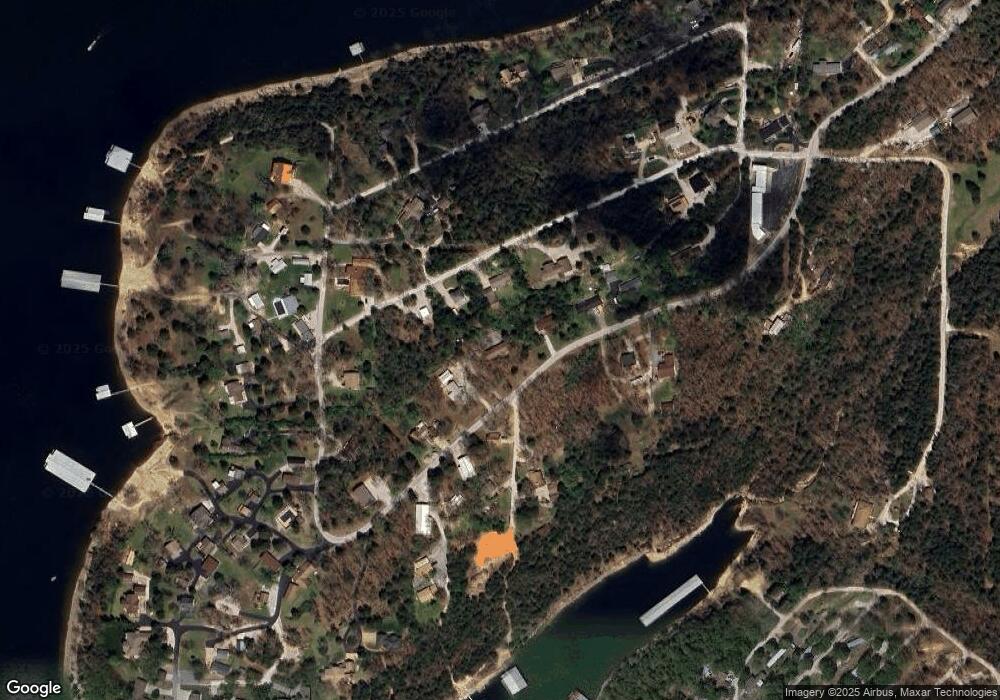
Map
Nearby Homes
- 241 Nine Center Ct
- 610 Double O 9 Rd
- 47 Misty Den Dr
- 474 Double O 9 Rd
- 455 Eagle Dr
- 303 Deep Water Cir
- 353 Deep Water Cir
- 273 Deep Water Cir
- 423 & 425 Eagle Dr
- 425 Eagle Dr
- 423 Eagle Dr
- 88 Deep Water Cir
- 108 Deep Water Cir
- 154 Deep Water Cir
- 152 Deep Water Cir
- 152 & 154 Deep Water Cir
- 134 Deep Water Cir
- 21 Tall Cedar Ln
- 11 Tall Cedar Ln
- 122 Peaceful Valley Ln
- 673 Double O 9 Rd
- 198 9 Center Ct
- 27 Notaroad Ln
- 208 9 Center Ct
- 631 Double O Nine Rd
- 246 Nine Center
- 761 Double O Nine Rd
- 136 9 Center Ct
- 0 9 Center Ct
- 246 9 Center Ct
- 60 Notaroad Ln
- 53 Notaroad Ln
- 644 Double O 9 Rd
- 627 Double O 9 Rd
- 949 Double O 9 Rd
- Tbd Notaroad Ln
- 0 Notaroad Ln
- 241 9 Center Ct
- 1035 Double O Nine Rd
- Lot 5 Double-O-nine and Nine-Center