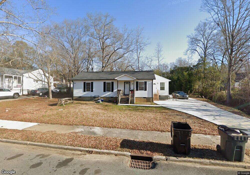
717 Flint St Rock Hill, SC 29730
Estimated Value: $203,000 - $250,000
3
Beds
2
Baths
1,050
Sq Ft
$213/Sq Ft
Est. Value
About This Home
This home is located at 717 Flint St, Rock Hill, SC 29730 and is currently estimated at $224,051, approximately $213 per square foot. 717 Flint St is a home located in York County with nearby schools including Rawlinson Road Middle School, Northwestern High School, and Providence Classical School.
Ownership History
Date
Name
Owned For
Owner Type
Purchase Details
Closed on
May 20, 2022
Sold by
Kennedy Lakeshia T
Bought by
Kennedy Lakeshia T and Gordon Frances D
Current Estimated Value
Home Financials for this Owner
Home Financials are based on the most recent Mortgage that was taken out on this home.
Original Mortgage
$177,000
Outstanding Balance
$168,146
Interest Rate
5.25%
Mortgage Type
Balloon
Estimated Equity
$55,905
Purchase Details
Closed on
Oct 6, 2000
Sold by
Nolin John E
Bought by
Parris Bobbie J
Create a Home Valuation Report for This Property
The Home Valuation Report is an in-depth analysis detailing your home's value as well as a comparison with similar homes in the area
Home Values in the Area
Average Home Value in this Area
Purchase History
| Date | Buyer | Sale Price | Title Company |
|---|---|---|---|
| Kennedy Lakeshia T | -- | None Listed On Document | |
| Parris Bobbie J | $8,500 | -- |
Source: Public Records
Mortgage History
| Date | Status | Borrower | Loan Amount |
|---|---|---|---|
| Open | Kennedy Lakeshia T | $177,000 |
Source: Public Records
Tax History Compared to Growth
Tax History
| Year | Tax Paid | Tax Assessment Tax Assessment Total Assessment is a certain percentage of the fair market value that is determined by local assessors to be the total taxable value of land and additions on the property. | Land | Improvement |
|---|---|---|---|---|
| 2024 | $694 | $3,163 | $560 | $2,603 |
| 2023 | $2,103 | $3,163 | $560 | $2,603 |
| 2022 | $701 | $3,163 | $560 | $2,603 |
| 2021 | -- | $3,163 | $560 | $2,603 |
| 2020 | $702 | $3,163 | $0 | $0 |
| 2019 | $650 | $2,840 | $0 | $0 |
| 2018 | $650 | $2,840 | $0 | $0 |
| 2017 | $626 | $2,840 | $0 | $0 |
| 2016 | $620 | $2,840 | $0 | $0 |
| 2014 | $628 | $2,840 | $560 | $2,280 |
| 2013 | $628 | $3,020 | $480 | $2,540 |
Source: Public Records
Map
Nearby Homes
- 215 Keels Ave
- 210 Marshall St
- 234 Marshall St
- 402 Keels Ave
- 724 Chestnut St
- 621 Flint St
- 606 E Black St
- 368 Chestnut St
- 560 Walnut St
- 517 E Main St
- 304 N Jones Ave
- 301 S Spruce St
- 315 High St
- 720 Arch Dr
- 348 Catherine St
- 369 S Workman St
- 350 Catherine St
- 434 Stoneycreek Ln
- 366 Catherine St
- 462 Kimbrell St Unit 5