Estimated Value: $185,000 - $253,000
3
Beds
2
Baths
1,452
Sq Ft
$144/Sq Ft
Est. Value
About This Home
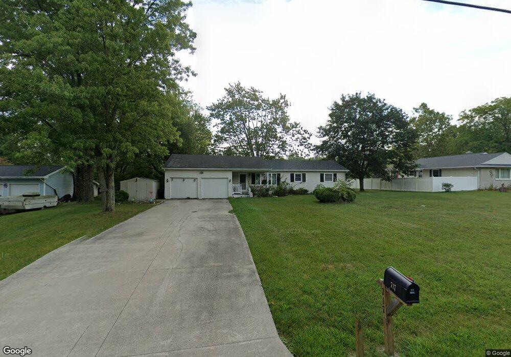
This home is located at 717 Lois Clarke Ln, Bryan, OH 43506 and is currently estimated at $208,626, approximately $143 per square foot. 717 Lois Clarke Ln is a home located in Williams County with nearby schools including Bryan Elementary PK-5, Washington Elementary School, and Bryan Middle School/High School.
Ownership History
Date
Name
Owned For
Owner Type
Purchase Details
Closed on
Oct 28, 2022
Sold by
Crocker Morris and Crocker Kelly A
Bought by
Henshaw Jody
Current Estimated Value
Purchase Details
Closed on
Jul 22, 2022
Sold by
Dorcas Lamneck
Bought by
Lamneck Dorcas and Henshaw Jody
Purchase Details
Closed on
Aug 16, 2019
Sold by
Estate Of Janice Crocker
Bought by
Lamneck Dorcas and Testamentary Trust Of Janice C
Purchase Details
Closed on
Jan 1, 1990
Bought by
Crocker Webb and Crocker Janice
Create a Home Valuation Report for This Property
The Home Valuation Report is an in-depth analysis detailing your home's value as well as a comparison with similar homes in the area
Home Values in the Area
Average Home Value in this Area
Purchase History
| Date | Buyer | Sale Price | Title Company |
|---|---|---|---|
| Henshaw Jody | -- | -- | |
| Lamneck Dorcas | -- | Breininger Spangler | |
| Lamneck Dorcas | -- | Breininger Spangler | |
| Lamneck Dorcas | -- | None Available | |
| Crocker Webb | -- | -- |
Source: Public Records
Tax History
| Year | Tax Paid | Tax Assessment Tax Assessment Total Assessment is a certain percentage of the fair market value that is determined by local assessors to be the total taxable value of land and additions on the property. | Land | Improvement |
|---|---|---|---|---|
| 2025 | $2,205 | $50,090 | $7,980 | $42,110 |
| 2024 | $2,205 | $50,090 | $7,980 | $42,110 |
| 2023 | $2,227 | $42,840 | $8,190 | $34,650 |
| 2022 | $2,111 | $42,840 | $8,190 | $34,650 |
| 2021 | $2,111 | $42,840 | $8,190 | $34,650 |
| 2020 | $1,351 | $35,320 | $6,830 | $28,490 |
| 2019 | $1,339 | $35,320 | $6,830 | $28,490 |
| 2018 | $906 | $35,320 | $6,830 | $28,490 |
| 2017 | $1,236 | $33,150 | $7,180 | $25,970 |
| 2016 | $1,812 | $33,150 | $7,180 | $25,970 |
| 2015 | $1,820 | $33,150 | $7,180 | $25,970 |
| 2014 | $1,820 | $31,580 | $6,830 | $24,750 |
| 2013 | $1,853 | $31,580 | $6,830 | $24,750 |
Source: Public Records
Map
Nearby Homes
- 144 Deerfield Cir
- 1001 Greystone Dr
- 12341 County Road C
- 0 Whetstone Unit 7
- 630 Center Ridge Rd
- 723 W High St
- 000 C R C (West 828)
- 000 C R C (East 787)
- 412 Center St
- 425 Oakwood Ave
- 414 Rosemont Ave
- 206 Brown Dr
- 205 Indiana Dr
- 311 W South St
- 542 S Beech St
- 000 Spring Meadow Ln
- 1006 S Beech St
- 000 N Main St
- 422 S Main St
- 128 N Beech St
- 727 Lois Clarke Ln
- 707 Lois Clarke Ln
- 107 Dorothy Dr
- 0 Dorthy Dr Unit 6015098
- 807 Lois Clarke Ln
- 625 Lois Clarke Ln
- 819 Lois Clarke Ln
- 108 Dorothy Dr
- 829 Lois Clarke Ln
- 103 Deerfield Cir
- 103 Deerfield Cir
- 103 Deerfield Cir
- 103 Deerfield Cir Unit D
- 0 Hidden Oaks (Lot 2) Unit 4632164
- 0 Hidden Oaks (Lot 2) Unit 4648787
- 101 Deerfield Cir
- 101 Deerfield Cir
- 101 Deerfield Cir
- 101 Deerfield Cir Unit A
- 101 Deerfield Cir Unit B
Your Personal Tour Guide
Ask me questions while you tour the home.