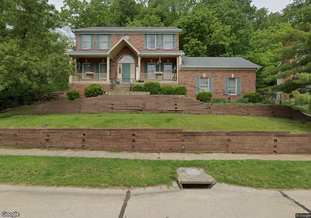
717 McBride Pointe Dr Wildwood, MO 63011
Estimated Value: $481,000 - $605,000
About This Home
This home is located at 717 McBride Pointe Dr, Wildwood, MO 63011 and is currently estimated at $545,457, approximately $221 per square foot. 717 McBride Pointe Dr is a home located in St. Louis County with nearby schools including Babler Elementary School, Rockwood Valley Middle School, and Lafayette High School.
Ownership History
We collect this data history from publicly available records. To have your information removed, we recommend requesting removal directly through your county’s website.
Purchase Details
Home Financials for this Owner
Home Financials are based on the most recent Mortgage that was taken out on this home.Purchase Details
Home Financials for this Owner
Home Financials are based on the most recent Mortgage that was taken out on this home.Home Values in the Area
Average Home Value in this Area
Purchase History
We collect this data history from publicly available records. To have your information removed, we recommend requesting removal directly through your county’s website.
| Date | Buyer | Sale Price | Title Company |
|---|---|---|---|
| $270,000 | None Available | ||
| -- | -- |
Mortgage History
We collect this data history from publicly available records. To have your information removed, we recommend requesting removal directly through your county’s website.
| Date | Status | Borrower | Loan Amount |
|---|---|---|---|
| Open | $256,500 | ||
| Previous Owner | $141,950 |
Tax History
We collect this data history from publicly available records. To have your information removed, we recommend requesting removal directly through your county’s website.
| Year | Tax Paid | Tax Assessment Tax Assessment Total Assessment is a certain percentage of the fair market value that is determined by local assessors to be the total taxable value of land and additions on the property. | Land | Improvement |
|---|---|---|---|---|
| 2025 | $5,769 | $93,860 | $38,910 | $54,950 |
| 2024 | $5,769 | $82,970 | $32,640 | $50,330 |
| 2023 | $5,765 | $82,970 | $32,640 | $50,330 |
| 2022 | $5,587 | $74,690 | $21,760 | $52,930 |
| 2021 | $5,546 | $74,690 | $21,760 | $52,930 |
| 2020 | $5,370 | $68,950 | $19,130 | $49,820 |
| 2019 | $5,391 | $68,950 | $19,130 | $49,820 |
| 2018 | $5,539 | $66,800 | $19,130 | $47,670 |
| 2017 | $5,407 | $66,800 | $19,130 | $47,670 |
| 2016 | $5,184 | $61,600 | $19,130 | $42,470 |
| 2015 | $5,079 | $61,600 | $19,130 | $42,470 |
| 2014 | $4,655 | $55,060 | $24,620 | $30,440 |
Map
- 18024 Cider Mill Dr
- 619 Martin Pointe Ct
- 16365 Peppermill Dr
- 18032 Turkey Bend Dr
- 1910 Berthoud Pass Ct
- 16231 Pepper View Ct
- 1432 Shepard Rd
- 2175 Quaethem Dr
- 18110 Linden Grove Ln
- 16404 Clayton Rd
- 18005 Indian Tree Run
- 16608 Clayton Rd
- 16200 Wynncrest Ridge Ct
- 16354 Clayton Rd
- 16627 Clayton Rd
- 16342 Clayton Rd
- 1105 Shepard Oaks Dr
- 2437 Powders Mill Dr
- 556 Red Rock Dr
- 2416 Powders Mill Dr
- 723 McBride Pointe Dr
- 1823 Oconnell Pointe Ct
- 711 McBride Pointe Dr
- 729 McBride Pointe Dr
- 1824 Oconnell Pointe Ct
- 1819 Oconnell Pointe Ct
- 705 McBride Pointe Dr
- 1820 O'Connell Pointe Ct
- 1820 Oconnell Pointe Ct
- 702 McBride Pointe Dr
- 1815 Oconnell Pointe Ct
- 659 McBride Pointe Dr
- 1816 Oconnell Pointe Ct
- 735 McBride Pointe Dr
- 1806 Sullivan Pointe Dr
- 1811 Oconnell Pointe Ct
- 1812 Oconnell Pointe Ct
- 1840 Sparks Ct
- 614 Boggan Pointe Ct
- 651 McBride Pointe Dr
Ask me questions while you tour the home.