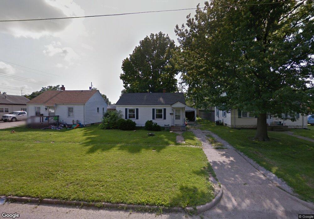
717 N 12th St Mattoon, IL 61938
Estimated Value: $59,250 - $76,000
2
Beds
1
Bath
720
Sq Ft
$92/Sq Ft
Est. Value
About This Home
This home is located at 717 N 12th St, Mattoon, IL 61938 and is currently estimated at $66,313, approximately $92 per square foot. 717 N 12th St is a home located in Coles County with nearby schools including Mattoon High School, St Mary School, and St. John's Lutheran School.
Ownership History
Date
Name
Owned For
Owner Type
Purchase Details
Closed on
Jul 8, 2021
Sold by
Land Trust 122
Bought by
Swearingen Enterprises Llc
Current Estimated Value
Purchase Details
Closed on
May 8, 2014
Sold by
Niemeyer Curtis W and Niemeyer Linze R
Bought by
First Natioanl Bank Mattoon
Purchase Details
Closed on
Jun 13, 2007
Sold by
Ramsey Robert C and Ramsey Merrie D
Bought by
Niemeyer Curtis W and Niemeyer Linze R
Create a Home Valuation Report for This Property
The Home Valuation Report is an in-depth analysis detailing your home's value as well as a comparison with similar homes in the area
Home Values in the Area
Average Home Value in this Area
Purchase History
| Date | Buyer | Sale Price | Title Company |
|---|---|---|---|
| Swearingen Enterprises Llc | -- | Attorney | |
| First Natioanl Bank Mattoon | $30,000 | -- | |
| Niemeyer Curtis W | $67,000 | None Available |
Source: Public Records
Tax History Compared to Growth
Tax History
| Year | Tax Paid | Tax Assessment Tax Assessment Total Assessment is a certain percentage of the fair market value that is determined by local assessors to be the total taxable value of land and additions on the property. | Land | Improvement |
|---|---|---|---|---|
| 2024 | $693 | $14,159 | $3,689 | $10,470 |
| 2023 | $587 | $12,642 | $3,294 | $9,348 |
| 2022 | $562 | $12,434 | $3,240 | $9,194 |
| 2021 | $323 | $8,458 | $2,976 | $5,482 |
| 2020 | $323 | $8,763 | $3,083 | $5,680 |
| 2019 | $329 | $8,458 | $2,976 | $5,482 |
| 2018 | $323 | $8,458 | $2,976 | $5,482 |
| 2017 | $322 | $8,458 | $2,976 | $5,482 |
| 2016 | $315 | $8,458 | $2,976 | $5,482 |
| 2015 | $744 | $8,458 | $2,976 | $5,482 |
| 2014 | $744 | $8,458 | $2,976 | $5,482 |
| 2013 | $744 | $8,458 | $2,976 | $5,482 |
Source: Public Records
Map
Nearby Homes
- 817 N 11th St
- 1021 Piatt Ave
- 916 Piatt Ave
- 1120 N 11th St
- 1412 Champaign Ave
- 1205 Champaign Ave
- 1705 Dewitt Ave
- 1816 Grant Ave
- 1612 Richmond Ave
- 1904 Dewitt Ave
- 1905 Dewitt Ave
- 1908 Dewitt Ave
- 1120 Broadway Ave
- 801 Richmond Ave
- 512 Dewitt Ave
- 1900 Champaign Ave
- 421 Dewitt Ave
- 2016 Douglas Ave
- 801 N 21st St
- 2104 Moultrie Ave