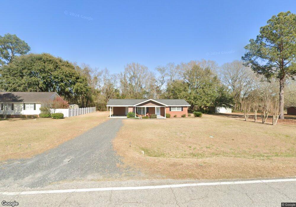
717 Perkins Mill Rd Unit Lot number 4 Claxton, GA 30417
Estimated Value: $148,131 - $185,000
3
Beds
1
Bath
1,116
Sq Ft
$147/Sq Ft
Est. Value
About This Home
This home is located at 717 Perkins Mill Rd Unit Lot number 4, Claxton, GA 30417 and is currently estimated at $163,783, approximately $146 per square foot. 717 Perkins Mill Rd Unit Lot number 4 is a home located in Evans County with nearby schools including Claxton Elementary School, Second Chance, and Claxton Middle School.
Ownership History
Date
Name
Owned For
Owner Type
Purchase Details
Closed on
Dec 16, 2021
Sold by
Boyd Donald
Bought by
Boyd Donald D
Current Estimated Value
Purchase Details
Closed on
May 30, 2019
Sold by
Pierce Eric M
Bought by
Boyd Donald
Purchase Details
Closed on
Mar 4, 2014
Sold by
Cope Faye S
Bought by
Sun West Mtg Co Inc
Purchase Details
Closed on
Oct 24, 1979
Sold by
Deloach Theron
Bought by
Cope Faye S
Create a Home Valuation Report for This Property
The Home Valuation Report is an in-depth analysis detailing your home's value as well as a comparison with similar homes in the area
Home Values in the Area
Average Home Value in this Area
Purchase History
| Date | Buyer | Sale Price | Title Company |
|---|---|---|---|
| Boyd Donald D | -- | -- | |
| Boyd Donald | $100,000 | -- | |
| Sun West Mtg Co Inc | $37,000 | -- | |
| Cope Faye S | -- | -- |
Source: Public Records
Tax History Compared to Growth
Tax History
| Year | Tax Paid | Tax Assessment Tax Assessment Total Assessment is a certain percentage of the fair market value that is determined by local assessors to be the total taxable value of land and additions on the property. | Land | Improvement |
|---|---|---|---|---|
| 2024 | $1,048 | $46,680 | $1,920 | $44,760 |
| 2023 | $474 | $18,720 | $3,360 | $15,360 |
| 2022 | $572 | $18,720 | $3,360 | $15,360 |
| 2021 | $681 | $18,720 | $3,360 | $15,360 |
| 2020 | $683 | $18,720 | $3,360 | $15,360 |
| 2019 | $594 | $17,200 | $3,360 | $13,840 |
| 2018 | $588 | $16,960 | $3,360 | $13,600 |
| 2017 | $542 | $17,200 | $3,360 | $13,840 |
| 2016 | $539 | $17,000 | $3,360 | $13,640 |
| 2015 | -- | $19,320 | $3,360 | $15,960 |
| 2014 | -- | $22,160 | $3,360 | $18,800 |
| 2013 | -- | $22,440 | $3,360 | $19,080 |
Source: Public Records
Map
Nearby Homes
- 19 Wysteria Ln
- 29 Grove Ln
- 12 Wisteria Ln
- 12 Wysteria Ln
- 606 Park Ave
- 19 Collins St
- 0 Turnpike Rd Unit SA339603
- 10 Honeysuckle Dr
- 7 Honeysuckle Way
- 9 Honeysuckle Dr
- 7 Honeysuckle Dr
- 712 Rosedale Ave
- 3 Honeysuckle Dr
- 610 W Liberty St
- 511 W Smith St
- 308 Old Metter Rd
- 0 Dublin Rd
- 107 Marguerite St
- 3 S Spring St
- 201 New Dr
- 717 Perkins Mill Rd
- 637 Perkins Mill Rd
- 719 Perkins Mill Rd
- 627 Perkins Mill Rd
- 704 Perkins Mill Rd
- 704 Perkins Mill Rd
- 708 Perkins Mill Rd
- 618 Perkins Mill Rd
- 723 Perkins Mill Rd
- 610 Perkins Mill Rd
- 426 Burkhalter Cir
- 710 Perkins Mill Rd
- 727 Perkins Mill Rd
- 600 Perkins Mill Rd
- 314 Burkhalter Cir
- 613 Perkins Mill Rd
- 860 Perkins Mill Rd
- 349 Issac Rd
- 437 Burkhalter Cir
- 437 Burkhalter Cir