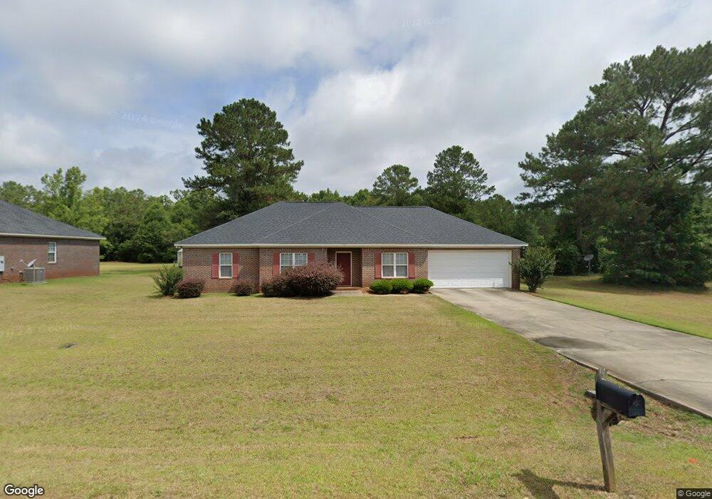
717 Shamrock Dr Albany, GA 31721
Estimated Value: $170,000 - $205,706
3
Beds
2
Baths
1,920
Sq Ft
$100/Sq Ft
Est. Value
About This Home
This home is located at 717 Shamrock Dr, Albany, GA 31721 and is currently estimated at $192,927, approximately $100 per square foot. 717 Shamrock Dr is a home located in Dougherty County with nearby schools including Live Oak Elementary School, Merry Acres Middle School, and Westover High School.
Ownership History
Date
Name
Owned For
Owner Type
Purchase Details
Closed on
Nov 1, 2019
Sold by
Musgrove S Cecil
Bought by
Lively Anna M and Lively Mark E
Current Estimated Value
Purchase Details
Closed on
Oct 12, 2006
Sold by
Five Points Agency Inc
Bought by
Musgrove S Cecil
Purchase Details
Closed on
Feb 20, 2006
Sold by
Orrell Brice and Orrell Anna M
Bought by
Five Points Agency Inc
Purchase Details
Closed on
Jan 12, 2004
Sold by
Malcolm Musgrove S and Malcolm Burnsed
Bought by
Orrell Brice and Orrell Anna M
Create a Home Valuation Report for This Property
The Home Valuation Report is an in-depth analysis detailing your home's value as well as a comparison with similar homes in the area
Home Values in the Area
Average Home Value in this Area
Purchase History
| Date | Buyer | Sale Price | Title Company |
|---|---|---|---|
| Lively Anna M | -- | -- | |
| Musgrove S Cecil | -- | -- | |
| Five Points Agency Inc | -- | -- | |
| Orrell Brice | $42,000 | -- |
Source: Public Records
Tax History Compared to Growth
Tax History
| Year | Tax Paid | Tax Assessment Tax Assessment Total Assessment is a certain percentage of the fair market value that is determined by local assessors to be the total taxable value of land and additions on the property. | Land | Improvement |
|---|---|---|---|---|
| 2024 | $2,290 | $48,000 | $7,200 | $40,800 |
| 2023 | $2,236 | $48,000 | $7,200 | $40,800 |
| 2022 | $2,245 | $48,000 | $7,200 | $40,800 |
| 2021 | $2,081 | $48,000 | $7,200 | $40,800 |
| 2020 | $2,086 | $48,000 | $7,200 | $40,800 |
| 2019 | $2,094 | $48,000 | $7,200 | $40,800 |
| 2018 | $2,103 | $48,000 | $7,200 | $40,800 |
| 2017 | $1,959 | $48,000 | $7,200 | $40,800 |
| 2016 | $1,931 | $48,000 | $7,200 | $40,800 |
| 2015 | $2,278 | $55,640 | $7,200 | $48,440 |
| 2014 | $2,249 | $55,640 | $7,200 | $48,440 |
Source: Public Records
Map
Nearby Homes
- 604 Shamrock Dr
- 2915 Autumn Ave
- 3006 Harvest Ln
- 3019 Winterwood Ave
- 219 Lockett Station Rd
- 502 Navajo Ct
- 512 Longbow Dr
- 834 Lockett Station Rd
- 627 Longbow Dr
- 838 Lockett Station Rd
- 902 Lockett Station Rd
- 906 Lockett Station Rd
- 3524 Moss Island Ct
- 611 Bison Ln
- 3108 Wax Myrtle Ln
- 4428 Gillionville Rd
- 3104 Fernridge Dr
- 2303 Joel Dr
- 1900 Covey Rd
- 120 Mossydale Ln
- 719 Shamrock Dr
- 715 Shamrock Dr
- 721 Shamrock Dr
- 722 Shamrock Dr
- 720 Shamrock Dr
- 716 Shamrock Dr
- 713 Shamrock Dr
- 724 Shamrock Dr
- 723 Shamrock Dr
- 718 Shamrock Dr
- 726 Shamrock Dr
- 714 Shamrock Dr
- 728 Shamrock Dr
- 708 Center Ridge Ct
- 706 Center Ridge Ct
- 704 Center Ridge Ct
- 730 Shamrock Dr
- 702 Center Ridge Ct
- 732 Shamrock Dr
- 706 Shamrock Dr