Estimated Value: $265,654
8
Beds
4
Baths
3,200
Sq Ft
$83/Sq Ft
Est. Value
About This Home
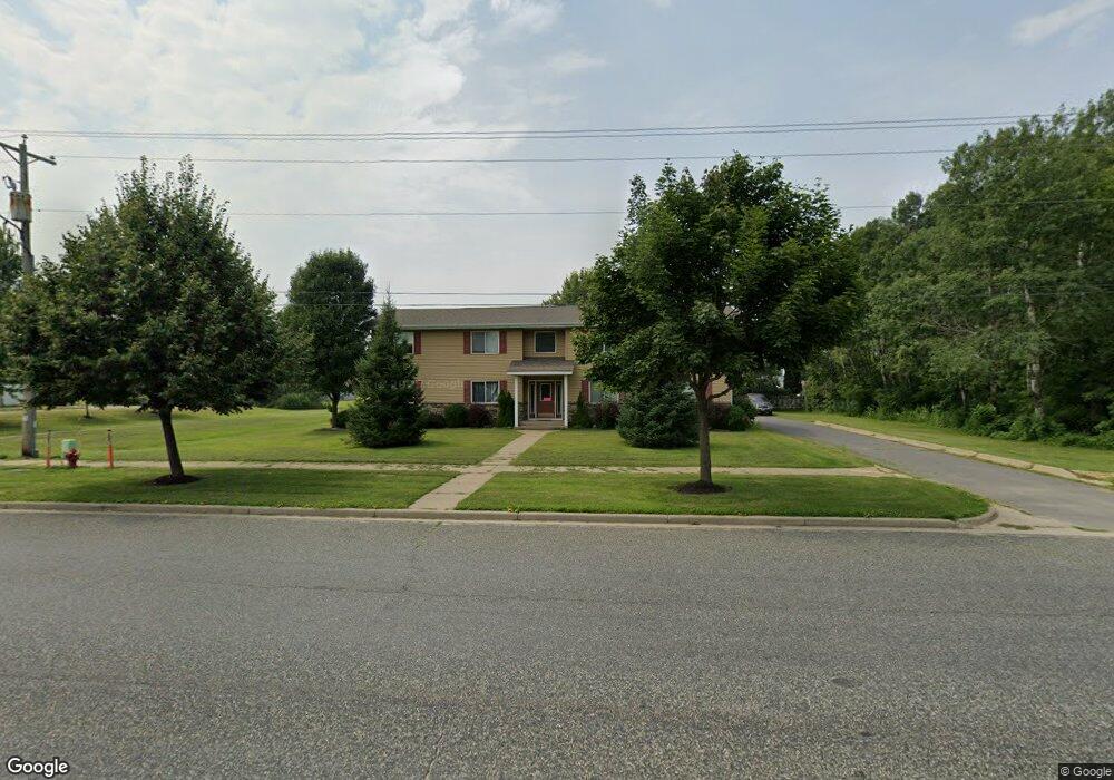
This home is located at 717 Sime Ave, Tomah, WI 54660 and is currently priced at $265,654, approximately $83 per square foot. 717 Sime Ave is a home located in Monroe County with nearby schools including Tomah High School, St. Paul Lutheran School, and Queen of the Apostles Grade School.
Ownership History
Date
Name
Owned For
Owner Type
Purchase Details
Closed on
Nov 1, 2011
Sold by
Rice Brian J
Bought by
B & G Rental Properties Llc
Current Estimated Value
Purchase Details
Closed on
May 3, 2010
Sold by
The Bank Of New York Mellon
Bought by
Rice Brian J
Purchase Details
Closed on
Apr 28, 2006
Sold by
Benton Gary and Benton Vicki
Bought by
Benton Gary and Benton Vicki
Create a Home Valuation Report for This Property
The Home Valuation Report is an in-depth analysis detailing your home's value as well as a comparison with similar homes in the area
Home Values in the Area
Average Home Value in this Area
Purchase History
| Date | Buyer | Sale Price | Title Company |
|---|---|---|---|
| B & G Rental Properties Llc | -- | Shudlick Law Office | |
| Rice Brian J | -- | -- | |
| Benton Gary | $175,000 | -- | |
| Benton Gary | $175,000 | -- |
Source: Public Records
Mortgage History
| Date | Status | Borrower | Loan Amount |
|---|---|---|---|
| Closed | Benton Gary | $0 |
Source: Public Records
Tax History Compared to Growth
Tax History
| Year | Tax Paid | Tax Assessment Tax Assessment Total Assessment is a certain percentage of the fair market value that is determined by local assessors to be the total taxable value of land and additions on the property. | Land | Improvement |
|---|---|---|---|---|
| 2024 | $6,629 | $382,000 | $33,000 | $349,000 |
| 2023 | $5,001 | $230,000 | $32,800 | $197,200 |
| 2022 | $4,626 | $230,000 | $32,800 | $197,200 |
| 2021 | $4,359 | $230,000 | $32,800 | $197,200 |
| 2020 | $5,194 | $227,000 | $32,800 | $194,200 |
| 2019 | $5,068 | $227,000 | $32,800 | $194,200 |
| 2018 | $4,982 | $227,000 | $32,800 | $194,200 |
| 2017 | $4,971 | $227,000 | $32,800 | $194,200 |
| 2016 | $4,593 | $197,500 | $30,700 | $166,800 |
| 2015 | $5,038 | $197,500 | $30,700 | $166,800 |
| 2014 | $4,657 | $197,500 | $30,700 | $166,800 |
| 2011 | $4,486 | $197,500 | $30,700 | $166,800 |
Source: Public Records
Map
Nearby Homes
- 705 E Brownell St
- 702 King Ave
- 39.35 acre King & Sime Ave
- 309 E Monowau St
- 129 N Glendale Ave
- 00 State Highway 16 -
- 205 Green Acres Ave
- 403 Green Acres Ave
- 320 Superior Ave
- 1103 Superior Ave
- 210 Superior Ave
- 1109 Superior Ave
- The Sycamore Plan at Wrenwood - Wrenwood North
- The Lavender Plan at Wrenwood - Wrenwood North
- The Wicklow Plan at Wrenwood - Wrenwood North
- The Kendall Plan at Wrenwood - Wrenwood North
- The Savannah Plan at Wrenwood - Wrenwood North
- The Acacia Plan at Wrenwood - Wrenwood North
- The Mulberry Plan at Wrenwood - Wrenwood North
- The Monterey Plan at Wrenwood - Wrenwood North
- 804 Mary Kay Ave Unit a
- 721 Mary Kay Ave
- 721 Mary Kay Ave Unit 1/2
- 715 Mary Kay Ave
- 709 Mary Kay Ave
- 709 Mary Kay Ave
- 709 Mary Kay Ave
- 709 & 709-1/2 Mary Kay Ave
- 801 Mary Kay Ave
- 703 Mary Kay Ave
- 807 Mary Kay Ave
- 805 Mary Kay Ave
- 627 Mary Kay Ave
- 809 Mary Kay Ave
- 714 Donna Ave
- 621 Mary Kay Ave
- 708 Donna Ave
- 608 Mary Kay Ave
- 608 Mary Kay Ave
- 608 Mary Kay Ave Unit a