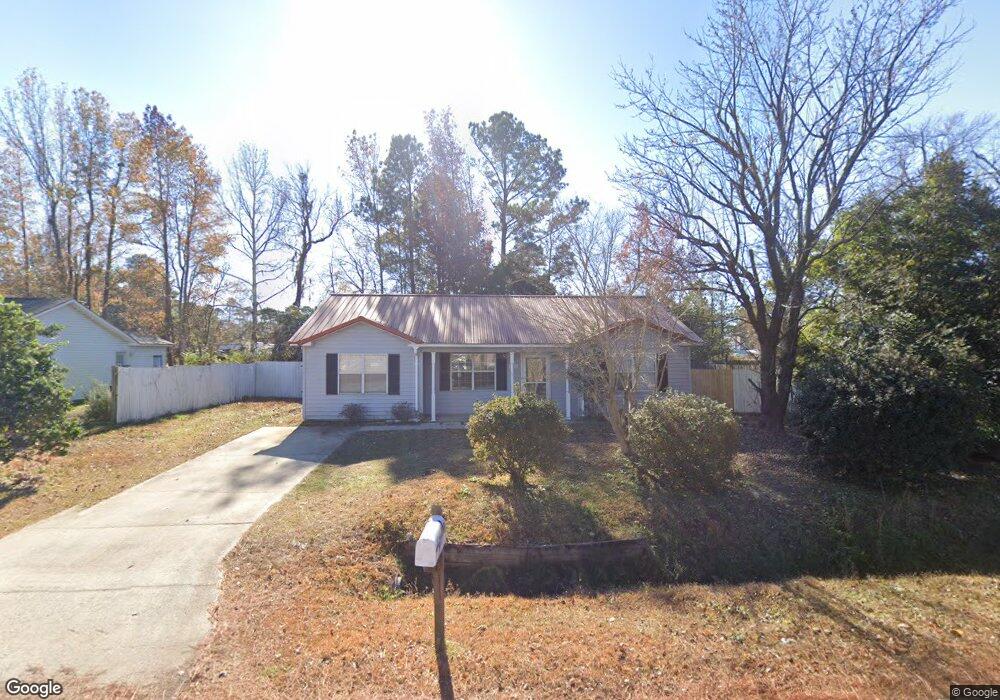
717 University Forest Cir Conway, SC 29526
Estimated Value: $197,000 - $228,000
2
Beds
2
Baths
1,192
Sq Ft
$180/Sq Ft
Est. Value
About This Home
This home is located at 717 University Forest Cir, Conway, SC 29526 and is currently estimated at $214,855, approximately $180 per square foot. 717 University Forest Cir is a home located in Horry County with nearby schools including Waccamaw Elementary School, Black Water Middle School, and Carolina Forest High School.
Ownership History
Date
Name
Owned For
Owner Type
Purchase Details
Closed on
Apr 8, 2020
Sold by
All Star Financial Llc
Bought by
Clary Dennis B
Current Estimated Value
Home Financials for this Owner
Home Financials are based on the most recent Mortgage that was taken out on this home.
Original Mortgage
$107,200
Outstanding Balance
$94,966
Interest Rate
3.4%
Mortgage Type
New Conventional
Estimated Equity
$119,889
Purchase Details
Closed on
Jan 24, 2020
Sold by
Clark Cynthia A
Bought by
All Star Financial Llc
Create a Home Valuation Report for This Property
The Home Valuation Report is an in-depth analysis detailing your home's value as well as a comparison with similar homes in the area
Home Values in the Area
Average Home Value in this Area
Purchase History
| Date | Buyer | Sale Price | Title Company |
|---|---|---|---|
| Clary Dennis B | $134,000 | -- | |
| All Star Financial Llc | -- | -- |
Source: Public Records
Mortgage History
| Date | Status | Borrower | Loan Amount |
|---|---|---|---|
| Open | Clary Dennis B | $107,200 |
Source: Public Records
Tax History Compared to Growth
Tax History
| Year | Tax Paid | Tax Assessment Tax Assessment Total Assessment is a certain percentage of the fair market value that is determined by local assessors to be the total taxable value of land and additions on the property. | Land | Improvement |
|---|---|---|---|---|
| 2024 | $1,941 | $12,482 | $3,900 | $8,582 |
| 2023 | $1,941 | $8,012 | $1,502 | $6,510 |
| 2021 | $1,793 | $8,012 | $1,502 | $6,510 |
| 2020 | $175 | $7,202 | $1,502 | $5,700 |
| 2019 | $175 | $4,801 | $1,001 | $3,800 |
| 2018 | $0 | $3,042 | $718 | $2,324 |
| 2017 | $123 | $3,042 | $718 | $2,324 |
| 2016 | -- | $3,042 | $718 | $2,324 |
| 2015 | $123 | $3,042 | $718 | $2,324 |
| 2014 | $115 | $3,042 | $718 | $2,324 |
Source: Public Records
Map
Nearby Homes
- 706 Jamie Ln
- 187 Palm Terrace Loop
- 876 Old Magnolia Dr
- 223 Palm Terrace Loop
- 957 Jamestown Rd
- 224 Fishburn Dr
- 990 Jamestown Rd
- 1056 Hunter Way
- 1065 Palm Dr
- 4009 Sweetspire Ct
- 4005 Sweetspire Ct
- 1049 Colonial Ln
- 1031 Leebury Ln
- 1248 Wehler Ct
- 947 Jamestown Rd
- 992 Cobblestone Ln
- 1050 Colonial Ln
- 1418 Hyman Ln
- 911 Old Magnolia Dr
- 496 Royal Arch Dr
- 641 University Forest Cir
- 643 University Forest Cir
- 639 University Forest Cir
- 721 Brook Ln
- 701 Jamie Ln
- 719 University Forest Cir Unit University Forest
- 719 University Forest Cir
- 713 University Forest Cir
- 702 Jamie Ln
- 721 University Forest Cir
- 635 University Forest Cir
- 635 University Forest Cir
- 703 Jamie Ln
- 634 University Forest Cir
- 704 Jamie Ln
- 722 Brook Ln
- 725 Brook Ln
- 701 Birch Ln
- 723 University Forest Cir
- 709 University Forest Cir