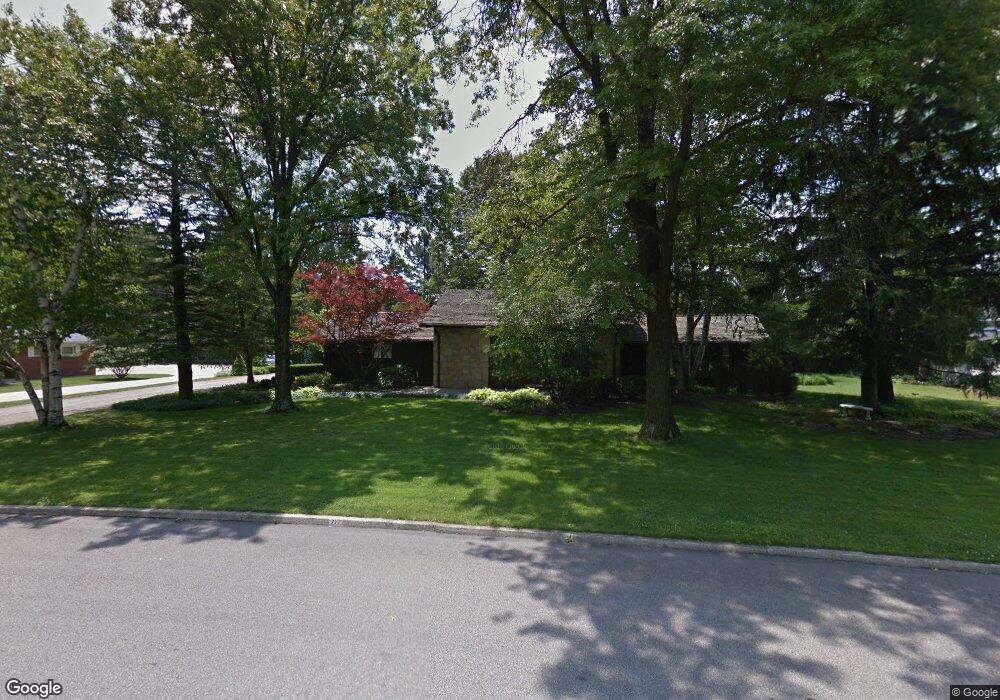
717 Westview Blvd Mansfield, OH 44907
Estimated Value: $286,000 - $366,000
3
Beds
3
Baths
3,948
Sq Ft
$86/Sq Ft
Est. Value
About This Home
This home is located at 717 Westview Blvd, Mansfield, OH 44907 and is currently estimated at $338,313, approximately $85 per square foot. 717 Westview Blvd is a home located in Richland County with nearby schools including Mansfield Christian School and Mansfield Seventh-day Adventist School.
Ownership History
Date
Name
Owned For
Owner Type
Purchase Details
Closed on
May 10, 2001
Sold by
Basting Marianna
Bought by
Waleri Carla A
Current Estimated Value
Home Financials for this Owner
Home Financials are based on the most recent Mortgage that was taken out on this home.
Original Mortgage
$70,000
Interest Rate
6.99%
Mortgage Type
New Conventional
Purchase Details
Closed on
Jun 17, 1996
Sold by
Dutton Joseph C
Bought by
Henderson Howard N and Henderson Marlanna
Create a Home Valuation Report for This Property
The Home Valuation Report is an in-depth analysis detailing your home's value as well as a comparison with similar homes in the area
Home Values in the Area
Average Home Value in this Area
Purchase History
| Date | Buyer | Sale Price | Title Company |
|---|---|---|---|
| Waleri Carla A | $210,000 | -- | |
| Henderson Howard N | $197,500 | -- |
Source: Public Records
Mortgage History
| Date | Status | Borrower | Loan Amount |
|---|---|---|---|
| Closed | Waleri Carla A | $70,000 |
Source: Public Records
Tax History Compared to Growth
Tax History
| Year | Tax Paid | Tax Assessment Tax Assessment Total Assessment is a certain percentage of the fair market value that is determined by local assessors to be the total taxable value of land and additions on the property. | Land | Improvement |
|---|---|---|---|---|
| 2024 | $4,469 | $95,450 | $14,860 | $80,590 |
| 2023 | $4,469 | $95,450 | $14,860 | $80,590 |
| 2022 | $3,937 | $70,470 | $12,390 | $58,080 |
| 2021 | $3,965 | $70,470 | $12,390 | $58,080 |
| 2020 | $4,054 | $70,470 | $12,390 | $58,080 |
| 2019 | $4,493 | $70,470 | $12,390 | $58,080 |
| 2018 | $4,432 | $70,470 | $12,390 | $58,080 |
| 2017 | $4,458 | $70,470 | $12,390 | $58,080 |
| 2016 | $4,604 | $72,960 | $12,020 | $60,940 |
| 2015 | $4,398 | $72,960 | $12,020 | $60,940 |
| 2014 | $4,341 | $72,960 | $12,020 | $60,940 |
| 2012 | $1,705 | $75,220 | $12,390 | $62,830 |
Source: Public Records
Map
Nearby Homes
- 654 Courtwright Blvd
- 1009 Woodhill Rd
- 1163 Woodland Rd
- 0 U S Highway 42
- 589 Andover Rd
- 501 Clifton Blvd
- 240 Whippoorwill Ln Unit 240
- 476 Glendale Blvd
- 1156 Briarwood Rd
- 0 George Ave
- 655 Woodhill Rd
- 421 Edgewood Rd
- 0 Bally Row Unit Lot 22940 223011208
- 0 Bally Row Unit Lot 22930 223011207
- 0 Bally Row Unit Lot 22929 223011206
- 0 S Trimble Rd
- 1201 W Cook Rd
- 646 Kennedy Dr
- 431 Overlook Rd
- 0 Lexington Ave Unit 224009661
- 703 Westview Blvd
- 733 Westview Blvd
- 724 Clifton Blvd
- 716 Clifton Blvd
- 730 Westview Blvd
- 700 Clifton Blvd
- 704 Westview Blvd
- 746 Clifton Blvd
- 1010 Woodland Rd
- 1022 Woodland Rd
- 717 W Cook Rd
- 1028 Woodland Rd
- 1034 Woodland Rd
- 994 Woodland Rd
- 725 Clifton Blvd
- 755 Clifton Blvd
- 789 Clifton Blvd
- 715 Clifton Blvd
- 986 Woodland Rd
- 781 Clifton Blvd