Estimated Value: $159,000 - $327,000
Studio
1
Bath
2,772
Sq Ft
$88/Sq Ft
Est. Value
About This Home
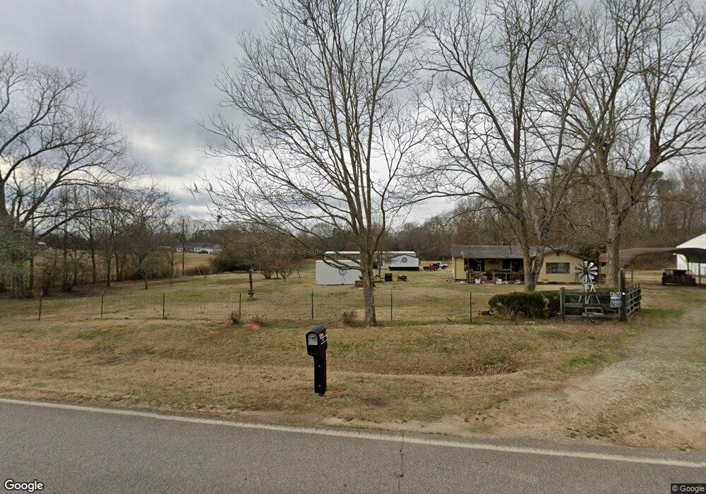
This home is located at 7171 Nowhere Rd, Hull, GA 30646 and is currently estimated at $243,437, approximately $87 per square foot. 7171 Nowhere Rd is a home located in Madison County with nearby schools including Madison County High School.
Ownership History
Date
Name
Owned For
Owner Type
Purchase Details
Closed on
Aug 27, 2024
Sold by
Seagraves Douglas Lamar
Bought by
Seagraves Douglas Lamar and Seagraves Penny R
Current Estimated Value
Purchase Details
Closed on
Apr 1, 2022
Sold by
Thompson Lynn
Bought by
Seagraves Douglas Lamar
Purchase Details
Closed on
Jan 30, 2007
Sold by
Singleton Susan Saxon
Bought by
Saxon Emiley Loraine
Purchase Details
Closed on
Feb 28, 2002
Sold by
Saxon Emily Loraine
Bought by
Saxon Emily L and Saxon
Purchase Details
Closed on
Jun 10, 1996
Bought by
Saxon Emily Loraine
Create a Home Valuation Report for This Property
The Home Valuation Report is an in-depth analysis detailing your home's value as well as a comparison with similar homes in the area
Purchase History
| Date | Buyer | Sale Price | Title Company |
|---|---|---|---|
| Seagraves Douglas Lamar | -- | -- | |
| Seagraves Douglas Lamar | -- | -- | |
| Douglas Seagraves | -- | -- | |
| Saxon Emiley Loraine | -- | -- | |
| Saxon Emily L | -- | -- | |
| Saxon Emily Loraine | -- | -- |
Source: Public Records
Tax History
| Year | Tax Paid | Tax Assessment Tax Assessment Total Assessment is a certain percentage of the fair market value that is determined by local assessors to be the total taxable value of land and additions on the property. | Land | Improvement |
|---|---|---|---|---|
| 2025 | $4,899 | $192,818 | $41,646 | $151,172 |
| 2024 | $1,706 | $65,543 | $41,646 | $23,897 |
| 2023 | $2,117 | $69,340 | $47,116 | $22,224 |
| 2022 | $1,432 | $51,927 | $32,393 | $19,534 |
| 2021 | $1,435 | $47,015 | $32,393 | $14,622 |
| 2020 | $1,300 | $42,304 | $27,682 | $14,622 |
| 2019 | $1,305 | $41,968 | $27,682 | $14,286 |
| 2018 | $1,215 | $38,961 | $25,326 | $13,635 |
| 2017 | $1,060 | $36,800 | $23,558 | $13,242 |
| 2016 | $709 | $34,702 | $23,558 | $11,143 |
| 2015 | $708 | $34,702 | $23,558 | $11,143 |
| 2014 | $691 | $34,002 | $23,281 | $10,721 |
| 2013 | -- | $34,002 | $23,281 | $10,721 |
Source: Public Records
Map
Nearby Homes
- 310 Sawdust Rd
- 0 Crabapple Hollow Rd Unit TRACT 2
- 357 Carither Rd
- 284 Snow Farm Rd
- 1246 Stone Stewart Rd
- 832 Stone Stewart Rd
- 0 Stone Stewart Rd Unit 7519457
- 0 Stone Stewart Rd Unit 10452697
- 0 Stone Stewart Rd Unit 1023553
- 1067 Garnett Ward Rd Unit 2
- 25 Rose Hill Ln
- 9980 Nowhere Rd
- 450 Candlestick Dr
- 0 Erastus Church Rd Unit 10647280
- 0 Erastus Church Rd Unit 10647276
- 0 Erastus Church Rd Unit 26346190
- 0 Erastus Church Rd Unit 10647273
- 975 Diamond Hill Neese Rd
- 3655 Neese Commerce Rd
- 103 Three Rivers Ct
- 7191 Nowhere Rd
- 7225 Nowhere Rd
- 7252 Nowhere Rd
- 7078 Nowhere Rd
- 7269 Nowhere Rd
- 7077 Nowhere Rd
- 123 Dillard Rd
- 7041 Nowhere Rd
- 7015 Nowhere Rd
- 7016 Nowhere Rd
- 7306 Nowhere Rd
- 161 Dillard Rd
- 6930 Nowhere Rd
- 6902 Nowhere Rd
- 3553 Seagraves Mill Rd
- 3433 Seagraves Mill Rd
- 3301 Seagraves Mill Rd
- 3245 Seagraves Mill Rd
- 7480 Nowhere Rd
- 7435 Nowhere Rd
Your Personal Tour Guide
Ask me questions while you tour the home.