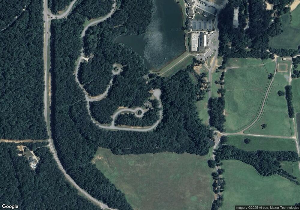
7172 Spinnerbait Ct Douglasville, GA 30135
Fouts Mill NeighborhoodEstimated Value: $714,000 - $912,402
6
Beds
8
Baths
4,938
Sq Ft
$164/Sq Ft
Est. Value
About This Home
This home is located at 7172 Spinnerbait Ct, Douglasville, GA 30135 and is currently estimated at $810,351, approximately $164 per square foot. 7172 Spinnerbait Ct is a home located in Douglas County with nearby schools including South Douglas Elementary School, Fairplay Middle School, and Alexander High School.
Ownership History
Date
Name
Owned For
Owner Type
Purchase Details
Closed on
Jul 1, 2021
Sold by
Foxhall Hospitality Core Llc
Bought by
Asian Infrastructure Llc
Current Estimated Value
Purchase Details
Closed on
May 20, 2021
Sold by
Foxhall Hospitality Core Llc
Bought by
Merrill W Harrison
Purchase Details
Closed on
May 16, 2013
Sold by
Foxhall Investors Llc
Bought by
Foxhall Hospitality Llc
Create a Home Valuation Report for This Property
The Home Valuation Report is an in-depth analysis detailing your home's value as well as a comparison with similar homes in the area
Home Values in the Area
Average Home Value in this Area
Purchase History
| Date | Buyer | Sale Price | Title Company |
|---|---|---|---|
| Asian Infrastructure Llc | $975,000 | None Listed On Document | |
| Merrill W Harrison | -- | -- | |
| Foxhall Hospitality Llc | -- | -- |
Source: Public Records
Tax History Compared to Growth
Tax History
| Year | Tax Paid | Tax Assessment Tax Assessment Total Assessment is a certain percentage of the fair market value that is determined by local assessors to be the total taxable value of land and additions on the property. | Land | Improvement |
|---|---|---|---|---|
| 2024 | $9,754 | $310,000 | $101,200 | $208,800 |
| 2023 | $9,754 | $310,000 | $101,200 | $208,800 |
| 2022 | $12,743 | $460,400 | $101,200 | $359,200 |
| 2021 | $7,827 | $240,000 | $57,484 | $182,516 |
| 2020 | $7,959 | $240,000 | $57,484 | $182,516 |
| 2019 | $13,084 | $413,000 | $101,200 | $311,800 |
| 2018 | $7,156 | $230,000 | $65,945 | $164,055 |
| 2017 | $7,295 | $230,000 | $65,945 | $164,055 |
| 2016 | $9,681 | $352,960 | $101,200 | $251,760 |
| 2015 | $6,018 | $182,600 | $101,200 | $81,400 |
| 2014 | $6,136 | $182,600 | $101,200 | $81,400 |
| 2013 | -- | $313,680 | $101,200 | $212,480 |
Source: Public Records
Map
Nearby Homes
- 6000 Stallion Ridge
- 0 Capps Ferry Rd Unit 21281192
- 6051 Stallion Ridge
- 7810 Capps Ferry Rd
- 7731 Windswept Way
- 7801 Windswept Way
- 7429 Waterview Cove
- 7791 Capps Ridge Ln
- 7794 Gusty Trail
- 7782 Capps Ridge Ln
- 7641 Capps Ridge Ln
- 7762 Capps Ridge Ln
- Cleveland Plan at The Estates at Hurricane Pointe - Executive Series
- Wilson Plan at The Estates at Hurricane Pointe - Executive Series
- Parker Plan at The Estates at Hurricane Pointe - Executive Series
- William Plan at The Estates at Hurricane Pointe - Executive Series
- Adams Plan at The Estates at Hurricane Pointe - Executive Series
- Taylor Plan at The Estates at Hurricane Pointe - Executive Series
- 7519 Waterview Cove
- 7590 Sunridge Ln
- 8010 Topwater Trail
- 7181 Pflueger Point Unit 40
- 7181 Pflueger Point
- 7171 Pflueger Point
- 7161 Pflueger Point
- 4132 Kingsbere Way
- 4124 Kingsbere Way
- 4128 Kingsbere Way
- 4122 Kingsbere Way
- 4120 Kingsbere Way
- 5128 Arista Dr
- 5124 Arista Dr Unit 41
- 5128 Arista Dr Unit 43
- 5128 Arista Dr Unit 91
- 5122 Arista Dr Unit 40
- 5120 Arista Dr Unit 39
- 3103 Heaton Dr Unit 99
- 3115 Heaton Dr Unit 93
- 3107 Heaton Dr Unit 97
- 3109 Heaton Dr Unit 96
