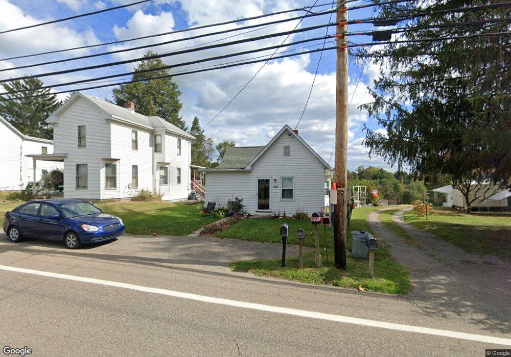
71737 Colerain Rd Bridgeport, OH 43912
Estimated Value: $75,478 - $176,000
2
Beds
1
Bath
798
Sq Ft
$147/Sq Ft
Est. Value
About This Home
This home is located at 71737 Colerain Rd, Bridgeport, OH 43912 and is currently estimated at $117,370, approximately $147 per square foot. 71737 Colerain Rd is a home located in Belmont County with nearby schools including Anna Marie Ayers Elementary School, Martins Ferry Middle School, and Martins Ferry High School.
Ownership History
Date
Name
Owned For
Owner Type
Purchase Details
Closed on
Dec 29, 2006
Sold by
Mitchell Mark Cope and Mitchell Beth Ann R
Bought by
Provenzano Lori A
Current Estimated Value
Home Financials for this Owner
Home Financials are based on the most recent Mortgage that was taken out on this home.
Original Mortgage
$38,509
Outstanding Balance
$15,930
Interest Rate
6.27%
Mortgage Type
Purchase Money Mortgage
Estimated Equity
$101,440
Purchase Details
Closed on
Dec 27, 1995
Sold by
Mitchell Mark Cope and Mitchell Beth
Bought by
Mitchell Mark Cope and Mitchell Beth
Purchase Details
Closed on
Jan 1, 1986
Sold by
Mitchell Ellis Raymond
Bought by
Mitchell Ellis Raymond
Create a Home Valuation Report for This Property
The Home Valuation Report is an in-depth analysis detailing your home's value as well as a comparison with similar homes in the area
Home Values in the Area
Average Home Value in this Area
Purchase History
| Date | Buyer | Sale Price | Title Company |
|---|---|---|---|
| Provenzano Lori A | -- | Attorney | |
| Mitchell Mark Cope | -- | -- | |
| Mitchell Ellis Raymond | -- | -- |
Source: Public Records
Mortgage History
| Date | Status | Borrower | Loan Amount |
|---|---|---|---|
| Open | Provenzano Lori A | $38,509 |
Source: Public Records
Tax History Compared to Growth
Tax History
| Year | Tax Paid | Tax Assessment Tax Assessment Total Assessment is a certain percentage of the fair market value that is determined by local assessors to be the total taxable value of land and additions on the property. | Land | Improvement |
|---|---|---|---|---|
| 2024 | $569 | $15,910 | $2,050 | $13,860 |
| 2023 | $416 | $10,870 | $2,050 | $8,820 |
| 2022 | $416 | $10,871 | $2,047 | $8,824 |
| 2021 | $413 | $10,871 | $2,047 | $8,824 |
| 2020 | $382 | $9,450 | $1,780 | $7,670 |
| 2019 | $385 | $9,450 | $1,780 | $7,670 |
| 2018 | $351 | $9,450 | $1,780 | $7,670 |
| 2017 | $310 | $7,240 | $2,430 | $4,810 |
| 2016 | $315 | $7,240 | $2,430 | $4,810 |
| 2015 | $317 | $7,240 | $2,430 | $4,810 |
| 2014 | $380 | $9,080 | $2,210 | $6,870 |
| 2013 | $357 | $9,080 | $2,210 | $6,870 |
Source: Public Records
Map
Nearby Homes
- 53979 Colerain Pike
- 71850 Colerain Rd
- 71900 Cope St
- 70798 Lollini Rd
- 53760 Farmington Rd
- 70610 Chermont Rd
- 70571 Pine Hollow Rd
- 55379 Barnes Rd
- 0 Terra Ridge Ln
- 70540 Colerain Rd
- 73881 Colerain Mount Pleasant Rd
- 69657 Chermont Rd
- 69895 Woods Rd
- 70392 Barton Rd
- 68960 Pine Terrace Rd
- 9 Township Rd
- 54980 Maple Ave
- 61 Township Road 108a
- 56745 Ferryview Rd
- 55273 Poplar Ave
- 71755 Colerain Rd
- 71725 Colerain Rd
- 71740 Colerain Rd
- 71750 Colerain Rd
- 71771 Us 250
- 71762 Colerain Rd
- 71719 Colerain Rd
- 71702 Colerain Rd
- 54011 Colerain Pike
- 71728 Colerain Rd
- 53941 Colerain Pike
- 54017 Colerain Pike
- 53996 Colerain Pike
- 71790 Colerain Rd
- 71801 Colerain Rd
- 54037 Colerain Pike
- 71590 Colerain Rd
- 54040 Colerain Pike
- 71850 Colerain Pike
- 71825 Colerain Rd