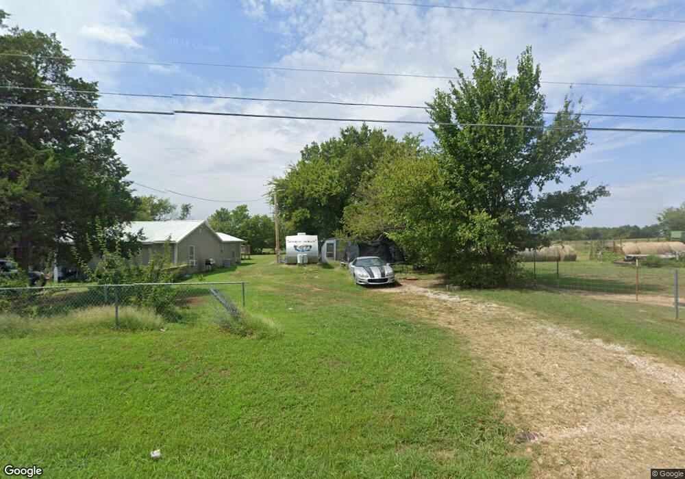
71767 S 260 Rd Wagoner, OK 74467
Estimated Value: $260,527 - $327,000
--
Bed
--
Bath
1,948
Sq Ft
$146/Sq Ft
Est. Value
About This Home
This home is located at 71767 S 260 Rd, Wagoner, OK 74467 and is currently estimated at $284,632, approximately $146 per square foot. 71767 S 260 Rd is a home with nearby schools including Ellington Elementary School, William R. Teague Elementary School, and Wagoner Middle School.
Ownership History
Date
Name
Owned For
Owner Type
Purchase Details
Closed on
Jul 17, 2015
Sold by
Swearingin Jerry L and Swearingin Wilma
Bought by
Gibson Debra Kay Swearingin and Gibson Charles Thomas
Current Estimated Value
Purchase Details
Closed on
Jun 25, 2015
Sold by
Swearingham Elaine Jean and Swearingham Jerry L
Bought by
Sherman Dillian Debra Kay Swearingham and Sherman Dilian Charles
Purchase Details
Closed on
Jun 7, 1996
Sold by
Meredith Tim D and Laura Jean
Purchase Details
Closed on
Sep 30, 1993
Sold by
Conley Barbara
Create a Home Valuation Report for This Property
The Home Valuation Report is an in-depth analysis detailing your home's value as well as a comparison with similar homes in the area
Home Values in the Area
Average Home Value in this Area
Purchase History
| Date | Buyer | Sale Price | Title Company |
|---|---|---|---|
| Gibson Debra Kay Swearingin | -- | None Available | |
| Sherman Dillian Debra Kay Swearingham | -- | None Available | |
| -- | $25,000 | -- | |
| -- | $75,000 | -- |
Source: Public Records
Tax History Compared to Growth
Tax History
| Year | Tax Paid | Tax Assessment Tax Assessment Total Assessment is a certain percentage of the fair market value that is determined by local assessors to be the total taxable value of land and additions on the property. | Land | Improvement |
|---|---|---|---|---|
| 2025 | $1,210 | $13,753 | $600 | $13,153 |
| 2024 | $1,210 | $13,098 | $572 | $12,526 |
| 2023 | $1,152 | $12,475 | $548 | $11,927 |
| 2022 | $1,095 | $11,880 | $521 | $11,359 |
| 2021 | $1,048 | $11,315 | $500 | $10,815 |
| 2020 | $1,022 | $10,776 | $494 | $10,282 |
| 2019 | $838 | $10,263 | $485 | $9,778 |
| 2018 | $720 | $8,324 | $328 | $7,996 |
| 2017 | $596 | $6,999 | $328 | $6,671 |
| 2016 | $552 | $6,666 | $328 | $6,338 |
| 2015 | -- | $2,194 | $328 | $1,866 |
| 2014 | -- | $2,936 | $1,120 | $1,816 |
Source: Public Records
Map
Nearby Homes
- 001 S 260 Rd
- 2 S 720 Rd
- 26530 E 710 Rd
- 19 E 710 Rd
- 3 N Old Town Rd
- 71279 S 270 Rd
- 0 State Hwy 51 Hwy W Unit 2529536
- 26048 E 731 Rd
- 517 Park St
- 519 Park St
- 122 Yorkshire Blvd
- 73131 S 262 Rd
- 1807 SW 2nd Place
- 405 Mockingbird Ln
- 406 Mockingbird Ln
- 308 Roosevelt Ave
- 3 Old Town Rd
- 312 Roosevelt Ave
- 311 Roosevelt Ave
- 1 Ash Ave
- 71799 S 260 Rd
- 71693 S 260 Rd
- 25907 E 720 Rd
- 71644 S 260 Rd
- 71955 S 260 Rd
- 26071 E 720 Rd
- 71505 S 260 Rd
- 26101 E 720 Rd
- 25787 E 720 Rd
- 26227 E 720 Rd
- 0 E 720 Rd Unit 2337698
- 0 E 720 Rd Unit 1535204
- 0 E 720 Rd Unit 1555314
- 0 E 720 Rd Unit 1844645
- 0 E 720 Rd Unit 1939111
- 0 E 720 Rd Unit 2015287
- 0 E 720 Rd Unit 2023536
- 0 E 720 Rd Unit 2109516
- 0 E 720 Rd Unit 2209700
- 25362 E 720 Rd