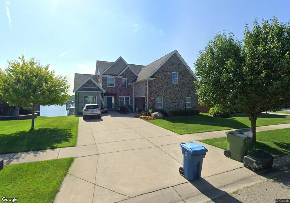
718 Bay Pointe Dr Oxford, MI 48371
Downtown Oxford NeighborhoodEstimated Value: $532,000 - $623,760
4
Beds
3
Baths
2,735
Sq Ft
$208/Sq Ft
Est. Value
About This Home
This home is located at 718 Bay Pointe Dr, Oxford, MI 48371 and is currently estimated at $568,690, approximately $207 per square foot. 718 Bay Pointe Dr is a home with nearby schools including Lakeville Elementary School, Oxford Middle School, and Oxford High School.
Ownership History
Date
Name
Owned For
Owner Type
Purchase Details
Closed on
Jan 26, 2015
Sold by
Taube Marlene and Kozloff Michael
Bought by
Buchanan Brian and Buchanan Danielle
Current Estimated Value
Home Financials for this Owner
Home Financials are based on the most recent Mortgage that was taken out on this home.
Original Mortgage
$354,600
Outstanding Balance
$271,997
Interest Rate
3.8%
Mortgage Type
Construction
Estimated Equity
$296,693
Purchase Details
Closed on
Jan 3, 2014
Sold by
Taube Marlene and Kozloff Michael
Bought by
Buchanan Brian and Buchanan Danielle
Create a Home Valuation Report for This Property
The Home Valuation Report is an in-depth analysis detailing your home's value as well as a comparison with similar homes in the area
Home Values in the Area
Average Home Value in this Area
Purchase History
| Date | Buyer | Sale Price | Title Company |
|---|---|---|---|
| Buchanan Brian | $111,800 | Seaver Title Agency | |
| Buchanan Brian | -- | Troy Abstract & Title Agency | |
| Taube Marlene | -- | None Available |
Source: Public Records
Mortgage History
| Date | Status | Borrower | Loan Amount |
|---|---|---|---|
| Open | Buchanan Brian | $354,600 |
Source: Public Records
Tax History Compared to Growth
Tax History
| Year | Tax Paid | Tax Assessment Tax Assessment Total Assessment is a certain percentage of the fair market value that is determined by local assessors to be the total taxable value of land and additions on the property. | Land | Improvement |
|---|---|---|---|---|
| 2024 | $7,693 | $258,160 | $0 | $0 |
| 2023 | $7,334 | $233,240 | $0 | $0 |
| 2022 | $9,115 | $229,450 | $0 | $0 |
| 2021 | $8,724 | $229,520 | $0 | $0 |
| 2020 | $6,743 | $219,530 | $0 | $0 |
| 2019 | $6,046 | $207,620 | $0 | $0 |
| 2018 | $7,945 | $193,710 | $0 | $0 |
| 2017 | $7,601 | $187,400 | $0 | $0 |
| 2016 | $7,502 | $181,530 | $0 | $0 |
| 2015 | -- | $36,500 | $0 | $0 |
| 2014 | -- | $36,500 | $0 | $0 |
| 2011 | -- | $40,500 | $0 | $0 |
Source: Public Records
Map
Nearby Homes
- 335 Whispering Winds
- 113 State St Unit 25
- 0 Granger Rd
- 272 Hunters Rill
- 338 Trillum Trail
- 00 S Lapeer Rd
- 511 State St
- 148 East St
- 23 Broadway St
- 271 Laurel Leah
- 241 Laurel Leah
- 19 Stanton St
- Building A of PUD E Burdick St
- 54 Division St
- 28 Lincoln St
- 445 Chinkapin Rill
- 1 Park St
- 661 State St
- 321 Basket Branch
- 8 Hovey St
- 710 Bay Pointe Dr
- 726 Bay Pointe Dr
- 667 Bay Pointe Dr
- 702 Bay Pointe Dr
- 659 Bay Pointe Dr
- 734 Bay Pointe Dr
- 683 Bay Pointe Dr Dr
- 651 Bay Pointe Dr
- 683 Bay Pointe Dr
- 694 Bay Pointe Dr
- 643 Bay Pointe Dr
- 691 Bay Pointe Dr
- 742 Bay Pointe Dr
- 699 Bay Pointe Dr
- 635 Bay Pointe Dr
- 686 Bay Pointe Dr
- 750 Bay Pointe Dr
- 627 Bay Pointe Dr
- 662 Bay Pointe Dr
- 670 Bay Pointe Dr