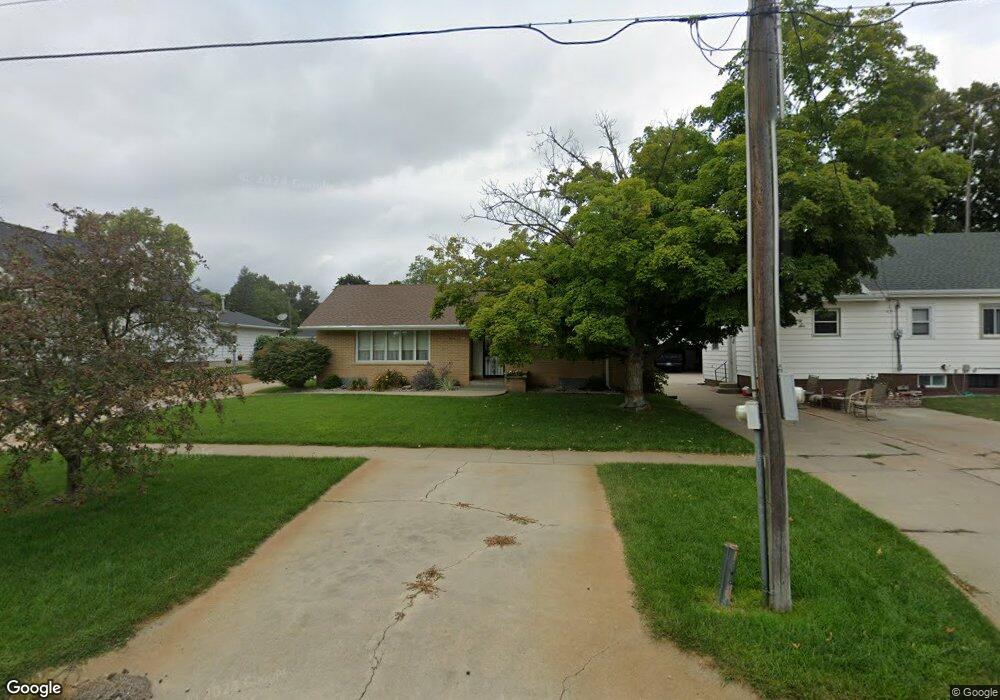
718 E Sherman St West Point, NE 68788
Estimated Value: $246,000 - $296,000
2
Beds
4
Baths
2,223
Sq Ft
$120/Sq Ft
Est. Value
About This Home
This home is located at 718 E Sherman St, West Point, NE 68788 and is currently estimated at $265,920, approximately $119 per square foot. 718 E Sherman St is a home located in Cuming County with nearby schools including West Point-Beemer Junior/Senior High School, St. Paul Lutheran School, and Guardian Angels Elementary School.
Ownership History
Date
Name
Owned For
Owner Type
Purchase Details
Closed on
Jan 6, 2006
Sold by
Dechant Mary Hugo and Estate Of Matthias E Hugo
Bought by
Kinister David C and Kinister Patricia L
Current Estimated Value
Home Financials for this Owner
Home Financials are based on the most recent Mortgage that was taken out on this home.
Original Mortgage
$50,000
Outstanding Balance
$27,663
Interest Rate
6.2%
Mortgage Type
Future Advance Clause Open End Mortgage
Estimated Equity
$238,257
Create a Home Valuation Report for This Property
The Home Valuation Report is an in-depth analysis detailing your home's value as well as a comparison with similar homes in the area
Home Values in the Area
Average Home Value in this Area
Purchase History
| Date | Buyer | Sale Price | Title Company |
|---|---|---|---|
| Kinister David C | $100,000 | -- |
Source: Public Records
Mortgage History
| Date | Status | Borrower | Loan Amount |
|---|---|---|---|
| Open | Kinister David C | $50,000 |
Source: Public Records
Tax History
| Year | Tax Paid | Tax Assessment Tax Assessment Total Assessment is a certain percentage of the fair market value that is determined by local assessors to be the total taxable value of land and additions on the property. | Land | Improvement |
|---|---|---|---|---|
| 2025 | $80 | $220,715 | $19,155 | $201,560 |
| 2024 | $21 | $204,775 | $19,155 | $185,620 |
| 2023 | $128 | $191,490 | $16,930 | $174,560 |
| 2022 | $2,197 | $173,645 | $16,930 | $156,715 |
| 2021 | $2,046 | $153,550 | $15,595 | $137,955 |
| 2020 | $1,942 | $145,435 | $15,595 | $129,840 |
| 2019 | $1,867 | $136,615 | $15,595 | $121,020 |
| 2018 | $1,711 | $124,695 | $15,595 | $109,100 |
| 2017 | $1,749 | $124,695 | $15,595 | $109,100 |
| 2016 | $1,732 | $119,900 | $13,810 | $106,090 |
| 2015 | $1,843 | $119,900 | $13,810 | $106,090 |
| 2014 | $1,832 | $105,425 | $13,810 | $91,615 |
| 2013 | $1,832 | $105,425 | $13,810 | $91,615 |
Source: Public Records
Map
Nearby Homes
- 726 E Sherman St
- 706 E Sherman St
- 740 E Sherman St
- 404 Greenview Rd
- 717 E Sherman St
- 731 E Grant St
- 727 E Sherman St
- 705 E Sherman St
- 703 E Grant St
- 644 E Sherman St
- 741 E Sherman St
- 404 S Bruner St
- 917 E Sherman St
- 801 E Sherman St
- 741 E Grant St
- 810 E Sherman St
- 753 E Grant St
- 624 E Sherman St
- 424 S Bruner St
- 643 E Grant St
Your Personal Tour Guide
Ask me questions while you tour the home.