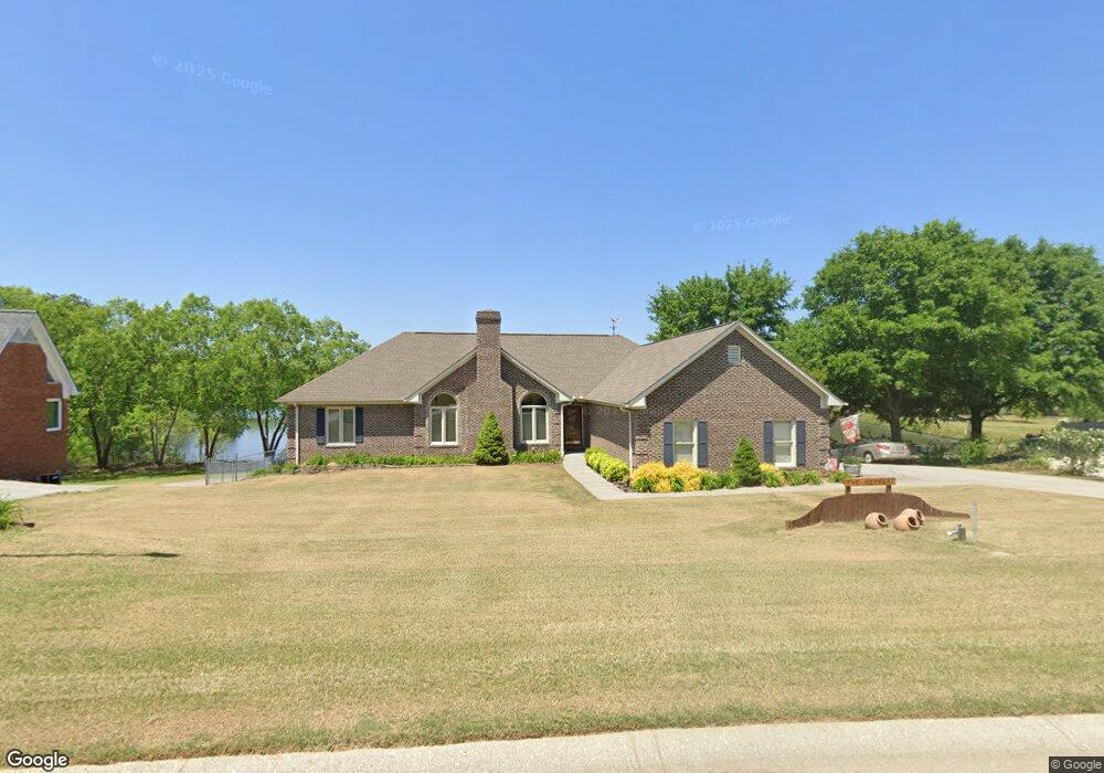
718 Mallard Dr Unit 31 Winder, GA 30680
Estimated Value: $400,000 - $415,000
3
Beds
3
Baths
2,291
Sq Ft
$177/Sq Ft
Est. Value
About This Home
This home is located at 718 Mallard Dr Unit 31, Winder, GA 30680 and is currently estimated at $406,530, approximately $177 per square foot. 718 Mallard Dr Unit 31 is a home located in Barrow County with nearby schools including County Line Elementary School, Russell Middle School, and Winder-Barrow High School.
Ownership History
Date
Name
Owned For
Owner Type
Purchase Details
Closed on
Nov 21, 2014
Sold by
Camp Anne M Suc
Bought by
Rouse Richard L and Garner Eva G
Current Estimated Value
Home Financials for this Owner
Home Financials are based on the most recent Mortgage that was taken out on this home.
Original Mortgage
$148,000
Interest Rate
3.95%
Mortgage Type
New Conventional
Purchase Details
Closed on
Nov 19, 2004
Sold by
Stanek Mark D
Bought by
Darrell E Camp Living
Purchase Details
Closed on
Apr 4, 2003
Sold by
Doster Pearlie I
Bought by
Doster George N
Create a Home Valuation Report for This Property
The Home Valuation Report is an in-depth analysis detailing your home's value as well as a comparison with similar homes in the area
Home Values in the Area
Average Home Value in this Area
Purchase History
| Date | Buyer | Sale Price | Title Company |
|---|---|---|---|
| Rouse Richard L | $185,000 | -- | |
| Darrell E Camp Living | $215,000 | -- | |
| Doster George N | -- | -- |
Source: Public Records
Mortgage History
| Date | Status | Borrower | Loan Amount |
|---|---|---|---|
| Previous Owner | Rouse Richard L | $148,000 |
Source: Public Records
Tax History Compared to Growth
Tax History
| Year | Tax Paid | Tax Assessment Tax Assessment Total Assessment is a certain percentage of the fair market value that is determined by local assessors to be the total taxable value of land and additions on the property. | Land | Improvement |
|---|---|---|---|---|
| 2024 | $3,899 | $141,637 | $28,000 | $113,637 |
| 2023 | $4,568 | $141,637 | $28,000 | $113,637 |
| 2022 | $3,004 | $91,692 | $16,400 | $75,292 |
| 2021 | $3,124 | $91,692 | $16,400 | $75,292 |
| 2020 | $2,803 | $85,451 | $16,400 | $69,051 |
| 2019 | $2,842 | $85,451 | $16,400 | $69,051 |
| 2018 | $2,586 | $78,010 | $15,200 | $62,810 |
| 2017 | $2,190 | $73,400 | $15,200 | $58,200 |
| 2016 | $2,195 | $69,530 | $15,200 | $54,330 |
| 2015 | $2,216 | $70,204 | $15,200 | $55,004 |
| 2014 | $1,947 | $62,538 | $6,860 | $55,678 |
| 2013 | -- | $59,734 | $6,860 | $52,874 |
Source: Public Records
Map
Nearby Homes
- 707 Overlook Dr Unit 1
- 553 Drake Cir
- 94 Garrison Dr
- 381 W Candler St
- 469 Plantation Dr
- 642 Teal Dr
- The Cary A Plan at Lake Shore
- The Marion A Plan at Lake Shore
- 254 Cedar Wood Trace
- 249 Cedar Wood Trace
- 240 Cedar Wood Trace
- 239 Cedar Wood Trace
- 225 Cedar Wood Trace
- 418 Jasmine Dr
- 213 Cedar Wood Trace
- 244 Bayou Ln Unit 1
- 98 Cannondale Dr
- 718 Mallard Dr Unit 1
- 720 Mallard Dr
- 716 Mallard Dr Unit 1
- 717 Mallard Dr Unit 1
- 717 Mallard Dr
- 714 Mallard Dr
- 719 Mallard Dr
- 719 Mallard Dr Unit 15
- 715 Mallard Dr Unit 13B
- 715 Mallard Dr Unit 1
- 722 Mallard Dr Unit I
- 721 Mallard Dr
- 721 Mallard Dr Unit 1
- 712 Mallard Dr
- 713 Mallard Dr
- 724 Mallard Dr Unit 1
- 704 High Point Dr
- 723 Mallard Dr Unit 24
- 723 Mallard Dr
- 706 High Point Dr