Estimated Value: $185,000 - $253,000
3
Beds
2
Baths
1,587
Sq Ft
$132/Sq Ft
Est. Value
About This Home
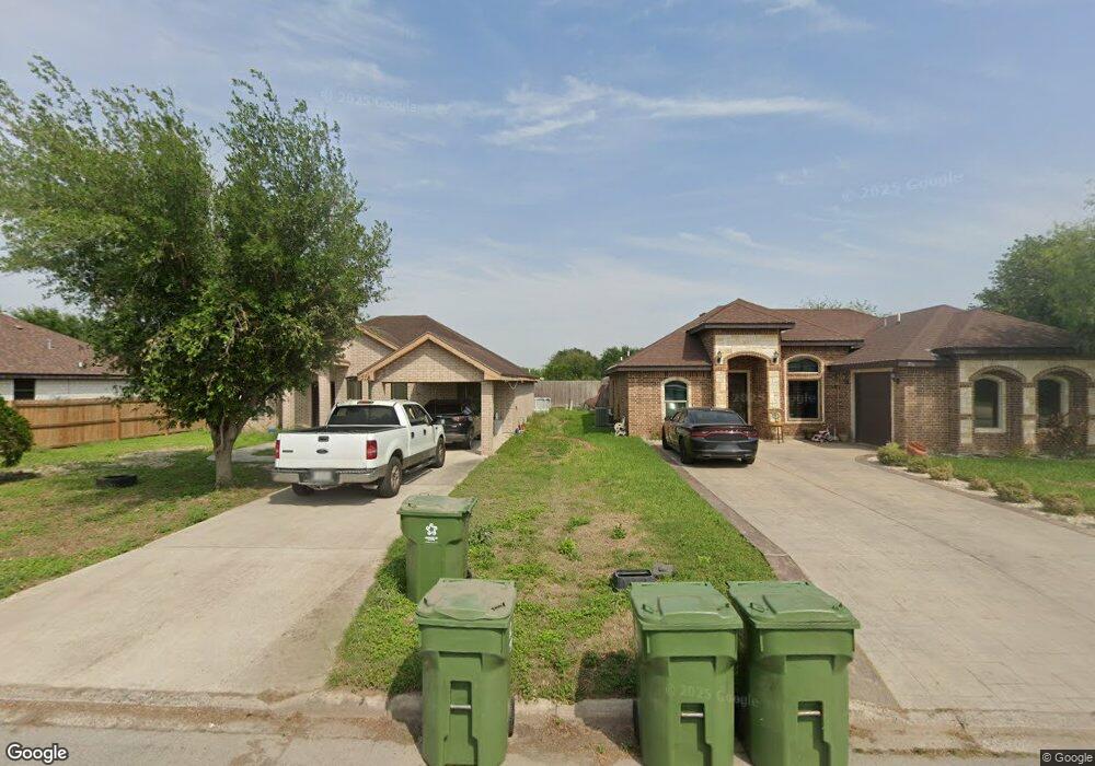
This home is located at 718 Margret St, Alamo, TX 78516 and is currently estimated at $210,266, approximately $132 per square foot. 718 Margret St is a home with nearby schools including Capt. D. Salinas Elementary School, Dora M. Sauceda Middle School, and Donna North High School.
Ownership History
Date
Name
Owned For
Owner Type
Purchase Details
Closed on
Aug 18, 2017
Sold by
Rodriguez Azael
Bought by
Rivera Amanda
Current Estimated Value
Purchase Details
Closed on
Sep 23, 2011
Sold by
Santos Oscar
Bought by
Perez Ulises Daniel
Home Financials for this Owner
Home Financials are based on the most recent Mortgage that was taken out on this home.
Original Mortgage
$18,995
Interest Rate
3.91%
Mortgage Type
Seller Take Back
Purchase Details
Closed on
May 28, 2010
Sold by
Santos Oscar
Bought by
Rodriguez Azael
Home Financials for this Owner
Home Financials are based on the most recent Mortgage that was taken out on this home.
Original Mortgage
$17,495
Interest Rate
4.42%
Mortgage Type
Seller Take Back
Create a Home Valuation Report for This Property
The Home Valuation Report is an in-depth analysis detailing your home's value as well as a comparison with similar homes in the area
Home Values in the Area
Average Home Value in this Area
Purchase History
| Date | Buyer | Sale Price | Title Company |
|---|---|---|---|
| Rivera Amanda | -- | None Available | |
| Perez Ulises Daniel | -- | None Available | |
| Rodriguez Azael | -- | None Available |
Source: Public Records
Mortgage History
| Date | Status | Borrower | Loan Amount |
|---|---|---|---|
| Previous Owner | Perez Ulises Daniel | $18,995 | |
| Previous Owner | Rodriguez Azael | $17,495 |
Source: Public Records
Tax History Compared to Growth
Tax History
| Year | Tax Paid | Tax Assessment Tax Assessment Total Assessment is a certain percentage of the fair market value that is determined by local assessors to be the total taxable value of land and additions on the property. | Land | Improvement |
|---|---|---|---|---|
| 2025 | $3,858 | $174,282 | $55,696 | $118,586 |
| 2024 | $3,858 | $148,181 | $28,892 | $119,289 |
| 2023 | $3,804 | $149,455 | $28,892 | $120,563 |
| 2022 | $3,559 | $136,601 | $29,589 | $107,012 |
| 2021 | $3,092 | $117,831 | $29,589 | $88,242 |
| 2020 | $3,001 | $110,698 | $29,589 | $81,109 |
| 2019 | $2,944 | $107,345 | $29,589 | $77,756 |
| 2018 | $2,616 | $96,043 | $18,101 | $77,942 |
| 2017 | $2,672 | $96,881 | $18,101 | $78,780 |
| 2016 | $2,415 | $87,563 | $18,797 | $68,766 |
| 2015 | $2,330 | $89,026 | $18,797 | $70,229 |
Source: Public Records
Map
Nearby Homes
- 417 Belinda Dr
- 721 N Margret St
- 810 Santa Anna Dr
- 719 N Margret St
- 421 Diana Dr
- 821 Nada Dr
- 818 Nada Dr
- 731 N Tower Rd
- 503 Shea Dr
- 510 Greystone Cir
- 912 Palm Dr
- 912 Santa Anna Dr
- 317 Karen Dr
- 843 Brady Ave
- 917 Citrus Dr
- 419 Country Club Dr
- 1016 Palm Dr
- 311 Rebecca Dr
- 517 Hunter Dr
- 1233 Country Club Dr
- 716 Margret St
- 720 Margret St
- 714 Margret St
- 722 Margret St
- 712 N Margret St
- 723 Margret St
- 723 Margret St
- 741 N Margret St
- 739 Margret St
- 743 Margret St
- 737 N Margret St
- 1001 E Nebraska Rd
- 000 E Nebraska Rd
- 0000 E Nebraska Rd
- 745 Margret St
- 730 Margret St
- 735 Margret St
- 713 Margret St
- 738 Veronika St
- 415 Belinda Dr