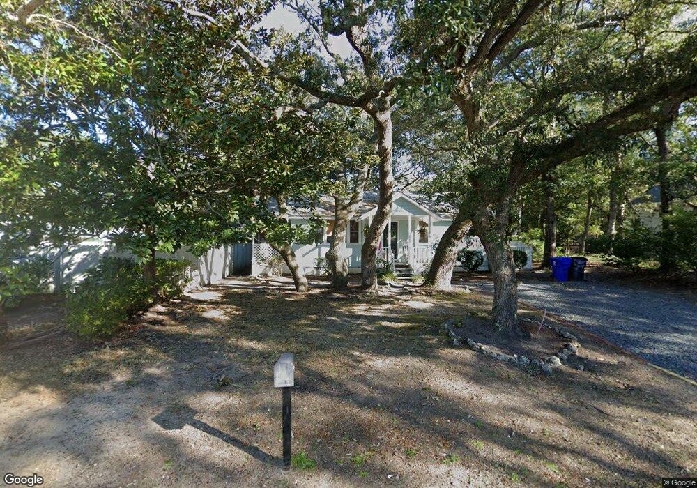
718 N Atlantic Ave Southport, NC 28461
Estimated Value: $282,000 - $442,000
2
Beds
1
Bath
1,140
Sq Ft
$296/Sq Ft
Est. Value
About This Home
This home is located at 718 N Atlantic Ave, Southport, NC 28461 and is currently estimated at $337,558, approximately $296 per square foot. 718 N Atlantic Ave is a home located in Brunswick County with nearby schools including Southport Elementary School, South Brunswick Middle School, and South Brunswick High School.
Ownership History
Date
Name
Owned For
Owner Type
Purchase Details
Closed on
Mar 25, 2024
Sold by
Wagoner Living Trust and Wagoner Ronald Dean
Bought by
Brown Carla F
Current Estimated Value
Purchase Details
Closed on
Sep 3, 2018
Sold by
Crowe Heidi Marie and Crowe Heidi Marie
Bought by
Crowe Heidi Marie and Crowe John Michael
Purchase Details
Closed on
Jun 1, 1992
Bought by
Weigeshoff Ann Marie and Weigeshoff Weigeshoff
Create a Home Valuation Report for This Property
The Home Valuation Report is an in-depth analysis detailing your home's value as well as a comparison with similar homes in the area
Home Values in the Area
Average Home Value in this Area
Purchase History
| Date | Buyer | Sale Price | Title Company |
|---|---|---|---|
| Brown Carla F | $249,000 | None Listed On Document | |
| Brown Carla F | $249,000 | None Listed On Document | |
| Crowe Heidi Marie | -- | None Available | |
| Weigeshoff Ann Marie | $40,000 | -- |
Source: Public Records
Tax History Compared to Growth
Tax History
| Year | Tax Paid | Tax Assessment Tax Assessment Total Assessment is a certain percentage of the fair market value that is determined by local assessors to be the total taxable value of land and additions on the property. | Land | Improvement |
|---|---|---|---|---|
| 2025 | $419 | $205,870 | $85,400 | $120,470 |
| 2024 | $419 | $205,870 | $85,400 | $120,470 |
| 2023 | $1,278 | $206,720 | $85,400 | $121,320 |
| 2022 | $278 | $117,060 | $52,500 | $64,560 |
| 2021 | $198 | $117,060 | $52,500 | $64,560 |
| 2020 | $498 | $117,060 | $52,500 | $64,560 |
| 2019 | $1,098 | $52,790 | $52,500 | $290 |
| 2018 | $1,196 | $60,290 | $60,000 | $290 |
| 2017 | $1,183 | $60,290 | $60,000 | $290 |
| 2016 | $1,094 | $60,290 | $60,000 | $290 |
| 2015 | $1,094 | $128,980 | $60,000 | $68,980 |
| 2014 | $1,800 | $233,478 | $163,530 | $69,948 |
Source: Public Records
Map
Nearby Homes
- 716 N Atlantic Ave
- 304 E Leonard St
- 822 N Lord St
- 120 W 9th St
- 319 Herring Dr
- 908 N Lord St
- 29 N Caswell Ave
- Lot 5a N Caswell Ave
- 826 N Caswell Ave
- 801 N Caswell Ave
- 205 W Leonard St
- 610 N Fodale Ave
- 1163 N Caswell Ave
- 27 Lots N Caswell Ave
- 403 N Howe St
- 204 Joshuas Way
- 520 Clarendon Ave
- 409 N Lord St
- Lot 8 Clarendon Ave
- 311 College St
- 202 E 8th St
- 204 E 8th St
- 705 Cape Harbor Dr
- 714 N Atlantic Ave
- 714 N Atlantic Ave
- 717 N Atlantic Ave
- 721 N Atlantic Ave
- 719 N Atlantic Ave
- 703 Cape Harbor Dr
- 715 N Atlantic Ave
- 712 N Atlantic Ave
- 208 E 8th St
- 711 N Atlantic Ave
- 708 N Atlantic Ave
- 709 N Atlantic Ave
- 706 N Atlantic Ave
- 203 E 8th St
- 205 E 8th St
- 728 N Howe St Unit 1
- 728 N Howe St Unit 1 & 2