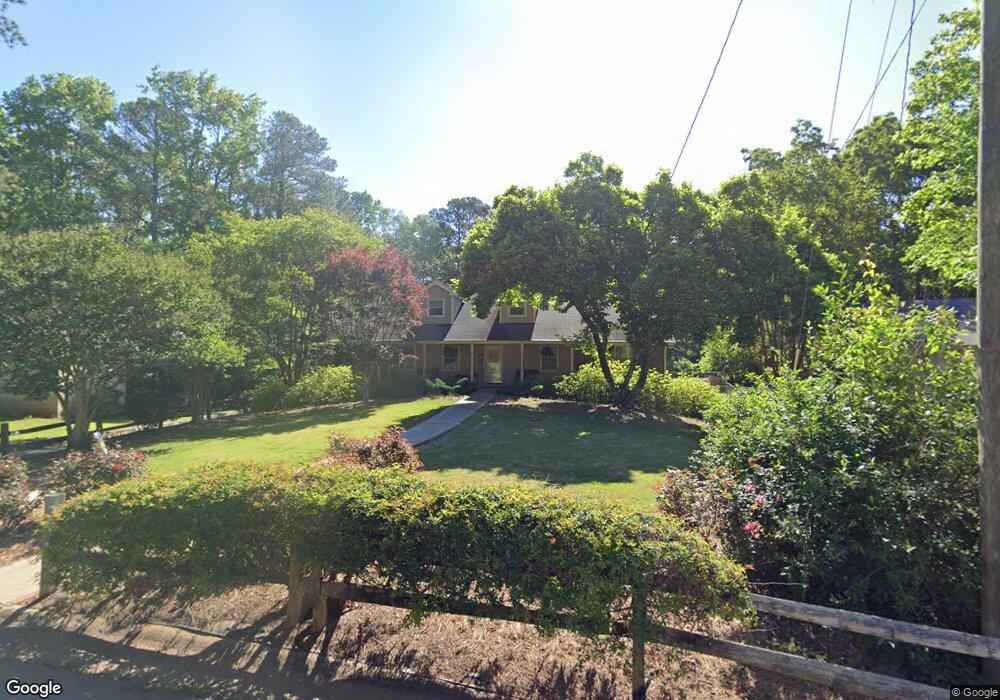
718 Rollingwood Dr Stone Mountain, GA 30087
Smoke Rise NeighborhoodEstimated Value: $349,073 - $397,000
3
Beds
3
Baths
2,015
Sq Ft
$185/Sq Ft
Est. Value
About This Home
This home is located at 718 Rollingwood Dr, Stone Mountain, GA 30087 and is currently estimated at $372,268, approximately $184 per square foot. 718 Rollingwood Dr is a home located in Gwinnett County with nearby schools including Camp Creek Elementary School, Trickum Middle School, and Parkview High School.
Ownership History
Date
Name
Owned For
Owner Type
Purchase Details
Closed on
Aug 29, 1997
Sold by
Kitchens Billy C
Bought by
Blanton William M and Blanton Catherine T
Current Estimated Value
Home Financials for this Owner
Home Financials are based on the most recent Mortgage that was taken out on this home.
Original Mortgage
$36,000
Outstanding Balance
$5,127
Interest Rate
7.43%
Mortgage Type
Seller Take Back
Estimated Equity
$367,141
Create a Home Valuation Report for This Property
The Home Valuation Report is an in-depth analysis detailing your home's value as well as a comparison with similar homes in the area
Home Values in the Area
Average Home Value in this Area
Purchase History
| Date | Buyer | Sale Price | Title Company |
|---|---|---|---|
| Blanton William M | $129,000 | -- |
Source: Public Records
Mortgage History
| Date | Status | Borrower | Loan Amount |
|---|---|---|---|
| Open | Blanton William M | $36,000 |
Source: Public Records
Tax History
| Year | Tax Paid | Tax Assessment Tax Assessment Total Assessment is a certain percentage of the fair market value that is determined by local assessors to be the total taxable value of land and additions on the property. | Land | Improvement |
|---|---|---|---|---|
| 2025 | $1,019 | $148,840 | $22,200 | $126,640 |
| 2024 | $1,010 | $149,800 | $22,200 | $127,600 |
| 2023 | $1,010 | $143,120 | $24,000 | $119,120 |
| 2022 | $969 | $123,480 | $24,000 | $99,480 |
| 2021 | $957 | $90,080 | $17,200 | $72,880 |
| 2020 | $955 | $90,080 | $17,200 | $72,880 |
| 2019 | $893 | $81,800 | $14,000 | $67,800 |
| 2018 | $874 | $76,960 | $14,000 | $62,960 |
| 2016 | $915 | $67,920 | $14,000 | $53,920 |
| 2015 | $930 | $61,320 | $14,000 | $47,320 |
| 2014 | -- | $51,840 | $14,000 | $37,840 |
Source: Public Records
Map
Nearby Homes
- 886 Oakhill Ct
- 771/761 Mountainbrooke Cir SW
- 771 Mountainbrooke Cir SW
- 4969 Dufour Dr
- 930 Old Tucker Rd
- 507 Castleaire Dr Unit 1
- 5666 Redcoat Run
- 717 Oxford Ct SW
- 450 Shay Lind Ct SW
- 2360 Ivey Oaks Place
- 2173 Spencers Way
- 5798 Musket Ln
- 1942 Musket Ct
- 5976 Bowers Rd
- 353 Old Rosser Rd
- 5498 Smoke Rise Dr
- 5523 Bahia Mar Cir
- 5013 Oakwood Dr
- 5005 Oakwood Dr
- 5011 Oakwood Dr
- 722 Rollingwood Dr
- 712 Rollingwood Dr
- 753 Lions Trail
- 5707 Lorraine Dr
- 5707 Lorraine Dr Unit A
- 743 Lions Trail
- 708 Rollingwood Dr
- 728 Rollingwood Dr
- 5717 Lorraine Dr
- 763 Lions Trail
- 719 Rollingwood Dr
- 5727 Lorraine Dr
- 698 Rollingwood Dr
- 738 Rollingwood Dr
- 729 Rollingwood Dr
- 733 Lions Trail
- 5684 Cub Ct
- 5694 Cub Ct
- 699 Rollingwood Dr
- 5737 Lorraine Dr
Your Personal Tour Guide
Ask me questions while you tour the home.