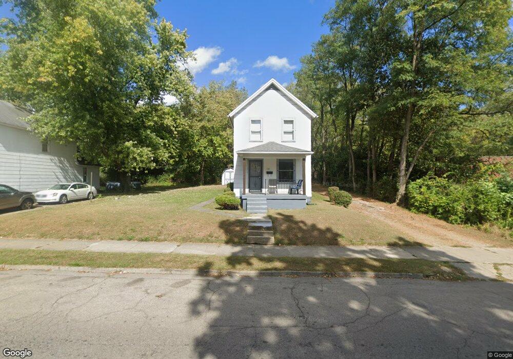
718 Sherman Ave Springfield, OH 45503
Estimated Value: $90,000 - $103,000
2
Beds
1
Bath
1,165
Sq Ft
$84/Sq Ft
Est. Value
About This Home
This home is located at 718 Sherman Ave, Springfield, OH 45503 and is currently estimated at $97,739, approximately $83 per square foot. 718 Sherman Ave is a home located in Clark County with nearby schools including Lagonda Elementary School, Roosevelt Middle School, and Springfield High School.
Ownership History
Date
Name
Owned For
Owner Type
Purchase Details
Closed on
Jun 30, 2025
Sold by
Borden Robert
Bought by
Anderson Kendrick
Current Estimated Value
Home Financials for this Owner
Home Financials are based on the most recent Mortgage that was taken out on this home.
Original Mortgage
$98,090
Outstanding Balance
$97,924
Interest Rate
6.86%
Mortgage Type
FHA
Estimated Equity
-$185
Purchase Details
Closed on
Oct 15, 2004
Sold by
Borden Carrie B
Bought by
Borden Robert
Purchase Details
Closed on
Jul 23, 2001
Sold by
Borden Carrie B
Bought by
Borden Robert
Purchase Details
Closed on
Jun 30, 2001
Sold by
Borden David
Bought by
Borden Carrie B
Purchase Details
Closed on
Jun 21, 2001
Sold by
Borden Robert
Bought by
Borden Carrie B
Purchase Details
Closed on
Jun 2, 2001
Sold by
Brown Pam
Bought by
Borden Carrie B
Create a Home Valuation Report for This Property
The Home Valuation Report is an in-depth analysis detailing your home's value as well as a comparison with similar homes in the area
Home Values in the Area
Average Home Value in this Area
Purchase History
| Date | Buyer | Sale Price | Title Company |
|---|---|---|---|
| Anderson Kendrick | $99,900 | City Title | |
| Anderson Kendrick | $99,900 | City Title | |
| Borden Robert | -- | -- | |
| Borden Robert | -- | -- | |
| Borden Carrie B | -- | -- | |
| Borden Carrie B | -- | -- | |
| Borden Carrie B | -- | -- | |
| Borden Carrie B | -- | -- | |
| Borden Carrie B | -- | -- |
Source: Public Records
Mortgage History
| Date | Status | Borrower | Loan Amount |
|---|---|---|---|
| Open | Anderson Kendrick | $98,090 | |
| Closed | Anderson Kendrick | $98,090 |
Source: Public Records
Tax History
| Year | Tax Paid | Tax Assessment Tax Assessment Total Assessment is a certain percentage of the fair market value that is determined by local assessors to be the total taxable value of land and additions on the property. | Land | Improvement |
|---|---|---|---|---|
| 2025 | $875 | $21,760 | $3,260 | $18,500 |
| 2024 | $853 | $17,690 | $3,140 | $14,550 |
| 2023 | $853 | $17,690 | $3,140 | $14,550 |
| 2022 | $873 | $17,690 | $3,140 | $14,550 |
| 2021 | $700 | $13,100 | $2,320 | $10,780 |
| 2020 | $702 | $13,100 | $2,320 | $10,780 |
| 2019 | $704 | $13,100 | $2,320 | $10,780 |
| 2018 | $607 | $10,850 | $2,320 | $8,530 |
| 2017 | $606 | $10,850 | $2,324 | $8,526 |
| 2016 | $607 | $10,850 | $2,324 | $8,526 |
| 2015 | $300 | $10,507 | $2,324 | $8,183 |
| 2014 | $597 | $10,507 | $2,324 | $8,183 |
| 2013 | $590 | $10,507 | $2,324 | $8,183 |
Source: Public Records
Map
Nearby Homes
- 726 E Madison Ave
- 836-838 Rodgers Dr
- 802 Warder St
- 412 E Madison Ave
- 368 E Madison Ave
- 825-827 Elm St
- 301 Chestnut Ave
- 242 Chestnut Ave
- 469 E Cecil St Unit 471
- 469-471 E Cecil St
- 0 Mitchell Blvd
- 1015 Rodgers Dr
- 1009 Elm St
- 114-116 E Ward St
- 825 E McCreight Ave
- 1223 Lagonda Ave
- 307 E Northern Ave
- 33-35 E Ward St
- 29 E Ward St
- 1007 N Limestone St
- 730 Sherman Ave
- 712 Sherman Ave
- 704 Sherman Ave
- 616 N Murray St
- 620 N Murray St
- 702 Sherman Ave
- 715 Stanton Ave
- 711 Stanton Ave
- 626 N Murray St
- 717 Stanton Ave
- 707 Stanton Ave
- 719 Stanton Ave
- 542 N Murray St
- 731 Stanton Ave
- 618 Sherman Ave Unit 620
- 744 Sherman Ave
- 737 Stanton Ave
- 617 N Murray St Unit 619
- 703 Stanton Ave
- 538 N Murray St