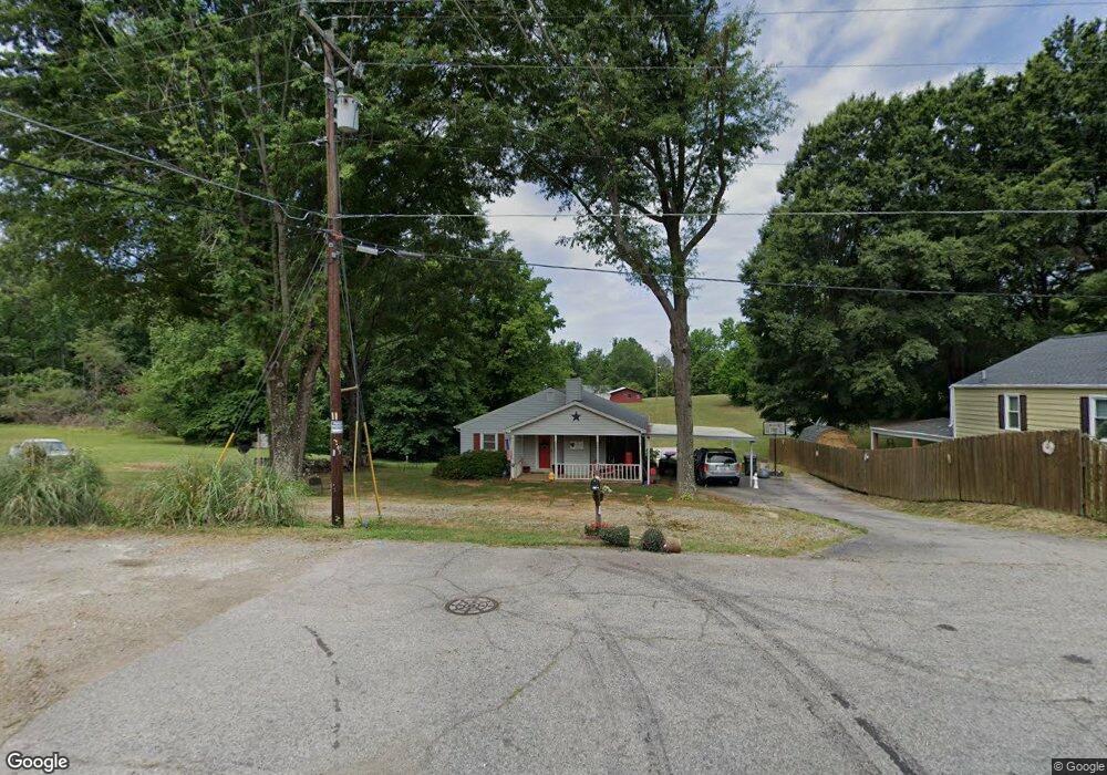
718 Southard St Reidsville, NC 27320
Estimated Value: $236,000 - $278,000
3
Beds
2
Baths
1,960
Sq Ft
$135/Sq Ft
Est. Value
About This Home
This home is located at 718 Southard St, Reidsville, NC 27320 and is currently estimated at $264,936, approximately $135 per square foot. 718 Southard St is a home located in Rockingham County with nearby schools including Reidsville High School, Moss Street Elementary, and Reidsville Middle School.
Ownership History
Date
Name
Owned For
Owner Type
Purchase Details
Closed on
Jan 13, 2022
Sold by
Goff Jennifer L
Bought by
Leach Ricky Dennis and Leach Carol Ann
Current Estimated Value
Purchase Details
Closed on
Oct 2, 2012
Sold by
Goff Darrell W
Bought by
Goff Jennifer L
Purchase Details
Closed on
Apr 23, 2010
Sold by
Perry Barbara W and Perry Randal
Bought by
Goff Jennifer L and Goff Darrell W
Home Financials for this Owner
Home Financials are based on the most recent Mortgage that was taken out on this home.
Original Mortgage
$125,190
Interest Rate
5.5%
Mortgage Type
FHA
Create a Home Valuation Report for This Property
The Home Valuation Report is an in-depth analysis detailing your home's value as well as a comparison with similar homes in the area
Home Values in the Area
Average Home Value in this Area
Purchase History
| Date | Buyer | Sale Price | Title Company |
|---|---|---|---|
| Leach Ricky Dennis | -- | Skidmore Scoot K | |
| Goff Jennifer L | -- | None Available | |
| Goff Jennifer L | $127,500 | None Available |
Source: Public Records
Mortgage History
| Date | Status | Borrower | Loan Amount |
|---|---|---|---|
| Previous Owner | Goff Jennifer L | $125,190 |
Source: Public Records
Tax History Compared to Growth
Tax History
| Year | Tax Paid | Tax Assessment Tax Assessment Total Assessment is a certain percentage of the fair market value that is determined by local assessors to be the total taxable value of land and additions on the property. | Land | Improvement |
|---|---|---|---|---|
| 2025 | $2,583 | $208,287 | $38,635 | $169,652 |
| 2024 | $2,583 | $208,287 | $38,635 | $169,652 |
| 2023 | $1,898 | $132,080 | $34,828 | $97,252 |
| 2022 | $1,894 | $132,080 | $34,828 | $97,252 |
| 2021 | $1,894 | $132,080 | $34,828 | $97,252 |
| 2020 | $1,894 | $132,080 | $34,828 | $97,252 |
| 2019 | $1,894 | $132,080 | $34,828 | $97,252 |
| 2018 | $1,776 | $123,687 | $40,222 | $83,465 |
| 2017 | $1,776 | $123,687 | $40,222 | $83,465 |
| 2015 | $1,794 | $123,687 | $40,222 | $83,465 |
| 2014 | -- | $123,687 | $40,222 | $83,465 |
Source: Public Records
Map
Nearby Homes
- 000 Hwy 158 Hwy
- 802 Lawsonville Ave
- 315 Hubbard St
- 0 Us Highway 158 Unit 1133948
- 0 Us Highway 158 Unit 1133951
- 00 Walker St
- 612 Thomas St
- 00 Robinson Cir
- 810 Walker St
- 502 Thomas St
- 847 Walker St
- 511 Barnes St
- 515 Barnes St
- 1107 Walnut St
- 0000 Jewell Rd
- 816 Barnes St
- 335 S Branch St
- 403 Pennsylvania Ave
- 1401 Walnut St
- 101 S Branch St
- 716 Southard St
- 512 Merrick St
- 715 Southard St
- 516 Merrick St
- 518 Merrick St
- 901 Lawsonville Ave
- 885 Lawsonville Ave
- 520 Merrick St
- 883 Lawsonville Ave
- 601 Merrick St
- 600 Merrick St
- 907 Pettigrew St
- 916 Pettigrew St
- 913 Lawsonville Ave
- 877 Lawsonville Ave
- 917 Lawsonville Ave
- 871 Lawsonville Ave
- 919 Lawsonville Ave
- 522 Merrick St
- 522 Merrick St