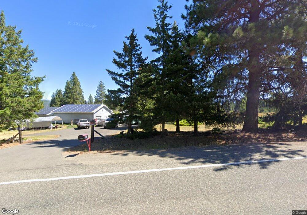
7181 Upper Peoh Point Rd Cle Elum, WA 98922
Estimated Value: $982,213 - $1,155,000
4
Beds
4
Baths
2,745
Sq Ft
$385/Sq Ft
Est. Value
About This Home
This home is located at 7181 Upper Peoh Point Rd, Cle Elum, WA 98922 and is currently estimated at $1,058,053, approximately $385 per square foot. 7181 Upper Peoh Point Rd is a home located in Kittitas County with nearby schools including Cle Elum Roslyn Elementary School, Walter Strom Middle School, and Cle Elum Roslyn High School.
Ownership History
Date
Name
Owned For
Owner Type
Purchase Details
Closed on
Jun 14, 2011
Sold by
Bale Dennis G and Bale Linda A
Bought by
Crawford Michael D and Crawford Cynthia L
Current Estimated Value
Home Financials for this Owner
Home Financials are based on the most recent Mortgage that was taken out on this home.
Original Mortgage
$375,250
Interest Rate
4.46%
Purchase Details
Closed on
Nov 20, 2007
Sold by
Hyndman George H and Hyndman Edith M
Bought by
Bale Dennis G and Bale Linda A
Home Financials for this Owner
Home Financials are based on the most recent Mortgage that was taken out on this home.
Original Mortgage
$160,000
Interest Rate
6.36%
Mortgage Type
New Conventional
Create a Home Valuation Report for This Property
The Home Valuation Report is an in-depth analysis detailing your home's value as well as a comparison with similar homes in the area
Home Values in the Area
Average Home Value in this Area
Purchase History
| Date | Buyer | Sale Price | Title Company |
|---|---|---|---|
| Crawford Michael D | $395,000 | Stwt Title | |
| Bale Dennis G | $410,000 | Amerititle |
Source: Public Records
Mortgage History
| Date | Status | Borrower | Loan Amount |
|---|---|---|---|
| Previous Owner | Crawford Michael D | $375,250 | |
| Previous Owner | Bale Dennis G | $160,000 |
Source: Public Records
Tax History Compared to Growth
Tax History
| Year | Tax Paid | Tax Assessment Tax Assessment Total Assessment is a certain percentage of the fair market value that is determined by local assessors to be the total taxable value of land and additions on the property. | Land | Improvement |
|---|---|---|---|---|
| 2025 | $4,666 | $792,640 | $192,650 | $599,990 |
| 2023 | $4,666 | $696,910 | $148,650 | $548,260 |
| 2022 | $4,139 | $570,850 | $111,150 | $459,700 |
| 2021 | $4,267 | $561,800 | $111,150 | $450,650 |
| 2019 | $3,126 | $408,760 | $73,150 | $335,610 |
| 2018 | $2,754 | $341,640 | $73,150 | $268,490 |
| 2017 | $2,754 | $341,640 | $73,150 | $268,490 |
| 2016 | $2,761 | $341,640 | $73,150 | $268,490 |
| 2015 | $2,859 | $341,640 | $73,150 | $268,490 |
| 2013 | -- | $349,240 | $88,650 | $260,590 |
Source: Public Records
Map
Nearby Homes
- 61 - 341 Tetons Ln
- 6280 Lower Peoh Point Rd
- 500 Colfax Rd
- 1810 Casassa Rd
- 181 Elk Rd
- 31 Forest Ridge Dr
- 451 Aspen Springs Rd
- 61 Tom and Nita Rd
- 1 Black Hawk Dr
- 4081 Washington 970 Unit A6
- 4081 Washington 970 Unit D1
- 4081 Washington 970 Unit D9
- 4081 Washington 970 Unit D10
- 4081 Washington 970 Unit D7
- 4081 Washington 970 Unit B5
- 4081 Washington 970 Unit B3
- 4081 Washington 970 Unit D6
- 4081 Washington 970 Unit A3
- 4081 Washington 970 Unit B6
- 4081 Washington 970 Unit B4
- 0 Anders Rd Unit 1183521
- 0 Anders Rd Unit 29052167
- 0 Anders Rd Unit 29060824
- 7310 Upper Peoh Point Rd
- 100 Anderson Ln
- 0 Casassa Rd Unit 1021177
- 0 Casassa Rd Unit 1123179
- 2 Casassa Rd
- 0 Casassa Rd Unit 1184604
- 270 Anderson Ln
- 7301 Upper Peoh Point Rd
- 6823 Upper Peoh Point Rd
- 311 Anderson Ln
- 211 Anderson Ln
- 131 Casassa Rd
- 170 Casassa Rd
- 6821 Upper Peoh Point Rd
- 511 Anderson Ln
- 7303 Upper Peoh Point Rd