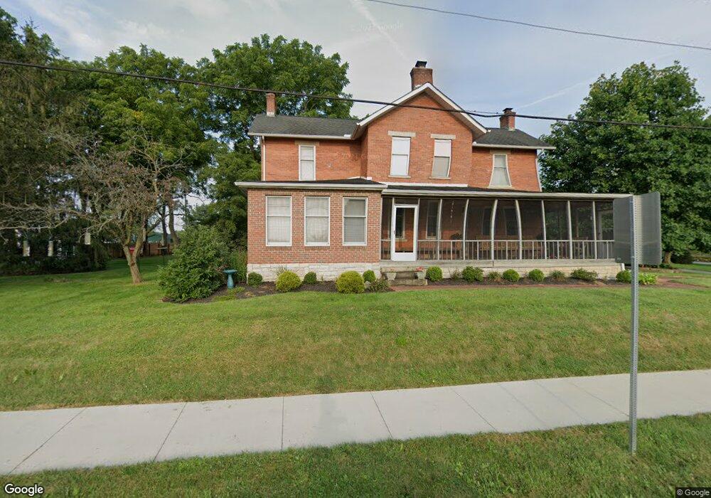
7184 Sunbury Rd Westerville, OH 43082
Genoa NeighborhoodEstimated Value: $497,164 - $573,000
3
Beds
2
Baths
2,416
Sq Ft
$221/Sq Ft
Est. Value
About This Home
This home is located at 7184 Sunbury Rd, Westerville, OH 43082 and is currently estimated at $534,791, approximately $221 per square foot. 7184 Sunbury Rd is a home located in Delaware County with nearby schools including Robert Frost Elementary School, Heritage Middle School, and Westerville-North High School.
Ownership History
Date
Name
Owned For
Owner Type
Purchase Details
Closed on
Sep 1, 2005
Sold by
Barton Kay A and Kay A Barton Revocable Living
Bought by
Lamb Beth A and Smith Sydney A
Current Estimated Value
Home Financials for this Owner
Home Financials are based on the most recent Mortgage that was taken out on this home.
Original Mortgage
$234,050
Outstanding Balance
$125,846
Interest Rate
5.93%
Mortgage Type
Fannie Mae Freddie Mac
Estimated Equity
$408,945
Create a Home Valuation Report for This Property
The Home Valuation Report is an in-depth analysis detailing your home's value as well as a comparison with similar homes in the area
Home Values in the Area
Average Home Value in this Area
Purchase History
| Date | Buyer | Sale Price | Title Company |
|---|---|---|---|
| Lamb Beth A | $260,100 | -- |
Source: Public Records
Mortgage History
| Date | Status | Borrower | Loan Amount |
|---|---|---|---|
| Open | Lamb Beth A | $234,050 |
Source: Public Records
Tax History Compared to Growth
Tax History
| Year | Tax Paid | Tax Assessment Tax Assessment Total Assessment is a certain percentage of the fair market value that is determined by local assessors to be the total taxable value of land and additions on the property. | Land | Improvement |
|---|---|---|---|---|
| 2024 | $7,170 | $138,460 | $27,720 | $110,740 |
| 2023 | $7,028 | $138,460 | $27,720 | $110,740 |
| 2022 | $7,908 | $119,880 | $31,890 | $87,990 |
| 2021 | $7,987 | $119,880 | $31,890 | $87,990 |
| 2020 | $8,035 | $119,880 | $31,890 | $87,990 |
| 2019 | $6,930 | $99,260 | $27,720 | $71,540 |
| 2018 | $6,719 | $99,260 | $27,720 | $71,540 |
| 2017 | $6,502 | $88,940 | $27,720 | $61,220 |
| 2016 | $6,474 | $88,940 | $27,720 | $61,220 |
| 2015 | $6,423 | $88,940 | $27,720 | $61,220 |
| 2014 | $6,345 | $88,940 | $27,720 | $61,220 |
| 2013 | $6,139 | $86,590 | $27,720 | $58,870 |
Source: Public Records
Map
Nearby Homes
- 1155 Ashford Ct
- 9119 Robinhood Cir
- 7568 Park Bend Ct
- 6611 Lake of the Woods Point
- 6618 Wild Rose Ln
- 9200 Knoll Dr
- 8369 Manitou Dr
- 974 Lakeland Dr
- 6460 Bromfield Dr
- 6685 Tussic Street Rd
- 73 Keethler Dr S
- 7663 Rolling Ridge Way
- 912 Lakeway Ct E
- 656 Olde Mill Dr
- 4485 Smothers Rd
- 718 Sugar Ct
- 6999 Red Bank Rd
- 754 Kingsmead Rd Unit 18754
- 5840 Heron Ct
- 5547 Red Bank Rd Unit Tract B
- 7200 Sunbury Rd
- 7185 Sunbury Rd
- 1259 Sea Shell Dr
- 7135 Sunbury Rd
- 7250 Sunbury Rd
- 7124 Sunbury Rd
- 1266 Sea Shell Dr
- 1231 Buoy Ct
- 1228 Buoy Ct
- 1252 Sea Shell Dr
- 1237 Sea Shell Dr
- 7286 Sunbury Rd
- 7111 Sunbury Rd
- 1227 Buoy Ct
- 1244 Sea Shell Dr
- 1227 Sea Shell Dr
- 7094 Sunbury Rd
- 1225 Sea Shell Dr
- 664 Sea Shell Ct
- 7320 Sunbury Rd