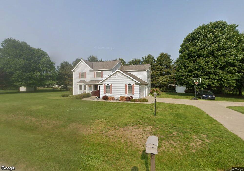
7185 Fieldstone Ave Conneaut, OH 44030
Kingsville NeighborhoodEstimated Value: $327,000 - $379,000
4
Beds
3
Baths
2,396
Sq Ft
$144/Sq Ft
Est. Value
About This Home
This home is located at 7185 Fieldstone Ave, Conneaut, OH 44030 and is currently estimated at $344,406, approximately $143 per square foot. 7185 Fieldstone Ave is a home located in Ashtabula County with nearby schools including Kingsville Elementary School, Ridgeview Elementary School, and Wallace H. Braden Junior High School.
Ownership History
Date
Name
Owned For
Owner Type
Purchase Details
Closed on
Dec 19, 2006
Sold by
Trotto Michael H and Trotto Florence J
Bought by
Skwera David P and Skwera Gretchen M
Current Estimated Value
Home Financials for this Owner
Home Financials are based on the most recent Mortgage that was taken out on this home.
Original Mortgage
$17,000
Interest Rate
5.96%
Mortgage Type
Stand Alone Second
Purchase Details
Closed on
Feb 16, 1995
Sold by
Wing Peter J
Bought by
Trotto Michael H
Create a Home Valuation Report for This Property
The Home Valuation Report is an in-depth analysis detailing your home's value as well as a comparison with similar homes in the area
Home Values in the Area
Average Home Value in this Area
Purchase History
| Date | Buyer | Sale Price | Title Company |
|---|---|---|---|
| Skwera David P | $205,000 | City Title Co | |
| Trotto Michael H | $140,000 | -- |
Source: Public Records
Mortgage History
| Date | Status | Borrower | Loan Amount |
|---|---|---|---|
| Closed | Skwera David P | $17,000 | |
| Open | Skwera David P | $164,000 | |
| Closed | Trotto Michael H | -- |
Source: Public Records
Tax History
| Year | Tax Paid | Tax Assessment Tax Assessment Total Assessment is a certain percentage of the fair market value that is determined by local assessors to be the total taxable value of land and additions on the property. | Land | Improvement |
|---|---|---|---|---|
| 2024 | $6,163 | $86,660 | $13,860 | $72,800 |
| 2023 | $3,061 | $86,660 | $13,860 | $72,800 |
| 2022 | $2,543 | $64,620 | $10,680 | $53,940 |
| 2021 | $2,546 | $64,620 | $10,680 | $53,940 |
| 2020 | $2,575 | $64,620 | $10,680 | $53,940 |
| 2019 | $2,847 | $68,290 | $12,390 | $55,900 |
| 2018 | $2,743 | $68,290 | $12,390 | $55,900 |
| 2017 | $2,565 | $68,290 | $12,390 | $55,900 |
| 2016 | $2,388 | $58,840 | $10,680 | $48,160 |
| 2015 | $2,385 | $58,840 | $10,680 | $48,160 |
| 2014 | $2,311 | $58,840 | $10,680 | $48,160 |
| 2013 | $2,256 | $58,000 | $8,510 | $49,490 |
Source: Public Records
Map
Nearby Homes
- 3881 E Center St
- 7296 Poore Rd
- 7032 Reed Rd
- 7002 Reed Rd
- 7435 Glenwood Rd
- 7527 Tamkrist Trail
- 7630 Darling Ave
- 3339 Lake Rd
- 3241 S Forest Dr
- 0 Creek Rd Unit 5172426
- 2940 Corries Way
- 255 N Amboy Rd
- 0 Village Green Unit 5169512
- 436 Keefus Rd
- 1381 Robb Rd
- 2572 W Center St
- 7223 Kenmore Ave
- 3583 Fox Rd
- 3545 Fox Rd
- 3561 Fox Rd
- 0 Fieldstone Ave
- 7201 Fieldstone Ave
- 7166 Fieldstone Ave
- 7161 Fieldstone Ave
- 3780 Stoneridge Cir
- 7190 Harmony Glen Dr
- 7170 Harmony Glen Dr
- 3781 Stoneridge Cir
- 7202 Harmony Glen Dr
- 7221 Fieldstone Ave
- 7139 Fieldstone Ave
- 3781 E Center St
- 3805 E Center St
- 7150 Harmony Glen Dr
- 3804 Stoneridge Cir
- 3780 Pinestone Ct
- 7205 Harmony Glen Dr
- 3804 Stoneridge Cir
- 3802 E Center St
- 3805 Stoneridge Cir
Your Personal Tour Guide
Ask me questions while you tour the home.