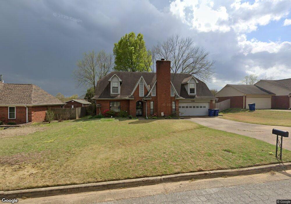
7185 Maplewood Rd Olive Branch, MS 38654
Estimated Value: $260,098 - $285,000
4
Beds
--
Bath
2,087
Sq Ft
$130/Sq Ft
Est. Value
About This Home
This home is located at 7185 Maplewood Rd, Olive Branch, MS 38654 and is currently estimated at $270,775, approximately $129 per square foot. 7185 Maplewood Rd is a home located in DeSoto County with nearby schools including Pleasant Hill Elementary School, DeSoto Central Middle School, and DeSoto Central High School.
Ownership History
Date
Name
Owned For
Owner Type
Purchase Details
Closed on
Oct 5, 2018
Sold by
Easley Michael and Waldheim Marla
Bought by
Lane Christopher and Lane Julie
Current Estimated Value
Home Financials for this Owner
Home Financials are based on the most recent Mortgage that was taken out on this home.
Original Mortgage
$132,554
Outstanding Balance
$114,878
Interest Rate
4.5%
Mortgage Type
FHA
Estimated Equity
$155,897
Purchase Details
Closed on
Jul 21, 2010
Sold by
Mcquilliams Ashley R
Bought by
Mcquilliams David D
Create a Home Valuation Report for This Property
The Home Valuation Report is an in-depth analysis detailing your home's value as well as a comparison with similar homes in the area
Home Values in the Area
Average Home Value in this Area
Purchase History
We collect this data history from publicly available records. To have your information removed, we recommend requesting removal directly through your county’s website.
| Date | Buyer | Sale Price | Title Company |
|---|---|---|---|
| Lane Christopher | -- | None Available | |
| Mcquilliams David D | -- | First National Financial Tit |
Source: Public Records
Mortgage History
We collect this data history from publicly available records. To have your information removed, we recommend requesting removal directly through your county’s website.
| Date | Status | Borrower | Loan Amount |
|---|---|---|---|
| Open | Lane Christopher | $132,554 |
Source: Public Records
Tax History
| Year | Tax Paid | Tax Assessment Tax Assessment Total Assessment is a certain percentage of the fair market value that is determined by local assessors to be the total taxable value of land and additions on the property. | Land | Improvement |
|---|---|---|---|---|
| 2025 | $1,637 | $16,726 | $2,500 | $14,226 |
| 2024 | $1,378 | $12,293 | $2,500 | $9,793 |
| 2023 | $1,378 | $12,293 | $0 | $0 |
| 2022 | $1,377 | $12,286 | $2,500 | $9,786 |
| 2021 | $1,377 | $12,286 | $2,500 | $9,786 |
| 2020 | $1,270 | $11,504 | $2,500 | $9,004 |
| 2019 | $1,270 | $11,504 | $2,500 | $9,004 |
| 2017 | $504 | $19,850 | $11,175 | $8,675 |
| 2016 | $504 | $11,175 | $2,500 | $8,675 |
| 2015 | $1,533 | $19,850 | $11,175 | $8,675 |
| 2014 | $504 | $11,175 | $0 | $0 |
| 2013 | $490 | $11,175 | $0 | $0 |
Source: Public Records
Map
Nearby Homes
- 7168 Oak Forest Dr
- 7051 Maplewood Rd
- 7340 Kingcrest Rd
- 7248 Kingcrest Rd
- 7084 Eastover Blvd
- 10190 May Flowers St
- 813 Hawkeye St
- 771 Arrow Cove
- 784 Arrow Cove
- 7063 Cedardale Rd
- 6934 Sunrise Loop W
- 6703 Jessie Hoyt Dr
- 6763 Sunrise Loop W
- 0 S Hamilton Cir
- 7128 Apache Dr
- 6559 Shenandoah Ln
- 6632 Timber Oaks Dr
- 6363 Cheyenne Dr
- 7402 Grandiflora Dr
- 6309 Cheyenne Dr
- 7199 Larkfield Rd
- 7179 Larkfield Rd
- 7085 Oak Forest Dr
- 7194 Maplewood Rd
- 7161 Larkfield Rd
- 7176 Maplewood Rd
- 7121 Oak Forest Dr
- 7162 Maplewood Rd
- 7212 Maplewood Rd
- 7145 Larkfield Rd
- 7088 Oak Forest Dr
- 7076 Oak Forest Dr
- 7146 Maplewood Rd
- 7102 Oak Forest Dr
- 7142 Larkfield Cove
- 7242 Maplewood Rd
- 7141 Oak Forest Dr
- 7131 Larkfield Rd
- 7156 Larkfield Cove
- 7209 Maplewood Rd
Your Personal Tour Guide
Ask me questions while you tour the home.