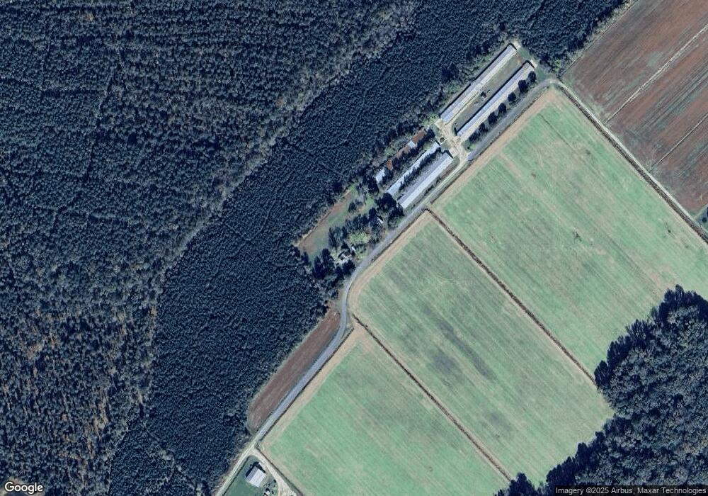
7186 Virginia Bowland Rd Westover, MD 21871
Westover NeighborhoodEstimated Value: $176,245 - $274,000
--
Bed
1
Bath
2,068
Sq Ft
$119/Sq Ft
Est. Value
About This Home
This home is located at 7186 Virginia Bowland Rd, Westover, MD 21871 and is currently estimated at $246,561, approximately $119 per square foot. 7186 Virginia Bowland Rd is a home located in Somerset County.
Ownership History
Date
Name
Owned For
Owner Type
Purchase Details
Closed on
Mar 2, 2012
Sold by
Crockett Andrew L
Bought by
Taylor Clifton G
Current Estimated Value
Purchase Details
Closed on
Jan 13, 2000
Sold by
Ann Myers John J and Ann Delores
Bought by
Crockett Andrew L and Crockett Carolyn R
Purchase Details
Closed on
Nov 21, 1984
Sold by
Crockett Andrew L And
Bought by
Crockett Andrew L
Home Financials for this Owner
Home Financials are based on the most recent Mortgage that was taken out on this home.
Original Mortgage
$22,500
Interest Rate
13.63%
Create a Home Valuation Report for This Property
The Home Valuation Report is an in-depth analysis detailing your home's value as well as a comparison with similar homes in the area
Home Values in the Area
Average Home Value in this Area
Purchase History
| Date | Buyer | Sale Price | Title Company |
|---|---|---|---|
| Taylor Clifton G | $450,000 | None Available | |
| Crockett Andrew L | $30,000 | -- | |
| Crockett Andrew L | $22,000 | -- |
Source: Public Records
Mortgage History
| Date | Status | Borrower | Loan Amount |
|---|---|---|---|
| Previous Owner | Crockett Andrew L | $22,500 |
Source: Public Records
Tax History Compared to Growth
Tax History
| Year | Tax Paid | Tax Assessment Tax Assessment Total Assessment is a certain percentage of the fair market value that is determined by local assessors to be the total taxable value of land and additions on the property. | Land | Improvement |
|---|---|---|---|---|
| 2025 | $1,499 | $126,600 | $0 | $0 |
| 2024 | $1,209 | $112,700 | $33,000 | $79,700 |
| 2023 | $1,209 | $108,700 | $0 | $0 |
| 2022 | $1,164 | $104,700 | $0 | $0 |
| 2021 | $2,480 | $100,700 | $33,000 | $67,700 |
| 2020 | $1,179 | $100,600 | $0 | $0 |
| 2019 | $1,178 | $100,500 | $0 | $0 |
| 2018 | $1,236 | $100,400 | $33,000 | $67,400 |
| 2017 | $1,176 | $100,400 | $0 | $0 |
| 2016 | $1,197 | $100,400 | $0 | $0 |
| 2015 | $1,197 | $107,600 | $0 | $0 |
| 2014 | $2,041 | $107,600 | $0 | $0 |
Source: Public Records
Map
Nearby Homes
- 6600 Old Westover Marion Rd
- 29769 Kingston Ln
- 30560 Charles Barnes Rd
- 6360 Crickett Hill Rd
- 29580 Kingston Ln
- 7293 Boggs Schoolhouse Rd
- 6028 Cornstack Rd
- 7080 Charles Cannon Rd
- 8160 Mennonite Church Rd
- 29862 Hudson Corner Rd
- 7366 River Rd
- 31355 Harvest Ct
- 6055 Village Way
- 31415 Harvest Ct
- 31420 Harvest Ct
- 31430 Harvest Ct
- 31425 Harvest Ct
- 29353 Fairmount Rd
- 8775 Lisa Ln
- 30299 Sam Barnes Rd
- 7192 Virginia Bowland Rd
- 7090 Virginia Bowland Rd
- 7209 Virginia Bowland Rd
- 30300 Charles Barnes Rd
- 30320 Charles Barnes Rd
- 30210 Charles Barnes Rd
- 7221 Old Westover Marion Rd
- 7125 Old Westover Marion Rd
- 30380 Charles Barnes Rd
- 6902 Boggs Schoolhouse Rd
- 30358 Charles Barnes Rd
- 30190 Charles Barnes Rd
- 7031 Old Westover Marion Rd
- 7148 Old Westover Marion Rd
- 7435 Old Westover Marion Rd
- 7228 Old Westover Marion Rd
- 7192 Old Westover Marion Rd
- 30365 Charles Barnes Rd
- 7248 Old Westover Marion Rd
- 7335 Old Westover Marion Rd
