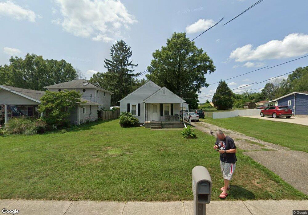
719 Barr Dr SW Lancaster, OH 43130
Estimated Value: $166,000 - $220,000
2
Beds
1
Bath
936
Sq Ft
$202/Sq Ft
Est. Value
About This Home
This home is located at 719 Barr Dr SW, Lancaster, OH 43130 and is currently estimated at $189,154, approximately $202 per square foot. 719 Barr Dr SW is a home located in Fairfield County with nearby schools including General Sherman Junior High School, Lancaster High School, and St Mary Elementary School.
Ownership History
Date
Name
Owned For
Owner Type
Purchase Details
Closed on
Oct 8, 2004
Sold by
Owen Timothy W
Bought by
Seifert Donald L
Current Estimated Value
Home Financials for this Owner
Home Financials are based on the most recent Mortgage that was taken out on this home.
Original Mortgage
$77,400
Interest Rate
5.93%
Mortgage Type
Purchase Money Mortgage
Purchase Details
Closed on
Mar 23, 1998
Sold by
Long William H
Bought by
Owen Timothy W
Home Financials for this Owner
Home Financials are based on the most recent Mortgage that was taken out on this home.
Original Mortgage
$63,800
Interest Rate
7.14%
Mortgage Type
New Conventional
Purchase Details
Closed on
May 21, 1996
Sold by
Notestone Wayne E
Bought by
Long William H and Long Tamara L
Home Financials for this Owner
Home Financials are based on the most recent Mortgage that was taken out on this home.
Original Mortgage
$65,000
Interest Rate
7.86%
Mortgage Type
New Conventional
Purchase Details
Closed on
Feb 8, 1994
Sold by
Brewer Bradley Nathan
Bought by
Notestone Wayne E
Purchase Details
Closed on
Apr 1, 1989
Create a Home Valuation Report for This Property
The Home Valuation Report is an in-depth analysis detailing your home's value as well as a comparison with similar homes in the area
Home Values in the Area
Average Home Value in this Area
Purchase History
| Date | Buyer | Sale Price | Title Company |
|---|---|---|---|
| Seifert Donald L | $86,000 | -- | |
| Owen Timothy W | $76,500 | -- | |
| Long William H | $65,000 | -- | |
| Notestone Wayne E | $55,000 | -- | |
| -- | $34,000 | -- |
Source: Public Records
Mortgage History
| Date | Status | Borrower | Loan Amount |
|---|---|---|---|
| Closed | Seifert Donald L | $77,400 | |
| Previous Owner | Owen Timothy W | $63,800 | |
| Previous Owner | Long William H | $65,000 |
Source: Public Records
Tax History Compared to Growth
Tax History
| Year | Tax Paid | Tax Assessment Tax Assessment Total Assessment is a certain percentage of the fair market value that is determined by local assessors to be the total taxable value of land and additions on the property. | Land | Improvement |
|---|---|---|---|---|
| 2024 | $3,486 | $38,780 | $11,660 | $27,120 |
| 2023 | $1,077 | $38,780 | $11,660 | $27,120 |
| 2022 | $1,097 | $38,780 | $11,660 | $27,120 |
| 2021 | $805 | $29,410 | $8,890 | $20,520 |
| 2020 | $810 | $29,410 | $8,890 | $20,520 |
| 2019 | $734 | $29,410 | $8,890 | $20,520 |
| 2018 | $507 | $22,320 | $8,890 | $13,430 |
| 2017 | $508 | $22,320 | $8,890 | $13,430 |
| 2016 | $494 | $22,320 | $8,890 | $13,430 |
| 2015 | $488 | $21,740 | $8,890 | $12,850 |
| 2014 | $464 | $21,740 | $8,890 | $12,850 |
| 2013 | $464 | $21,740 | $8,890 | $12,850 |
Source: Public Records
Map
Nearby Homes
- 0 W Fair Ave
- 2576 Brook Run Dr
- 958 Thorn Hill Place
- 957 Governor's Cir
- 2610 Misty Meadows Ave
- 204 Western St
- 185 9th St
- 255 9th St
- 3 1st St
- 282 14th St
- 599 Front St
- 71 3rd St
- 371 12th St
- 367 12th St
- 331 16th St
- 635 Brannon Dr
- 5701 Lancaster-Circleville Rd SW
- 1829 Shoshone Dr
- 1821 Shoshone Dr
- 147 Shawnee Dr
- 713 Barr Dr SW
- 725 Barr Dr SW
- 707 Barr Dr SW
- 733 Barr Dr SW
- 706 Barr Dr SW
- 730 Barr Dr SW
- 645 Barr Dr SW
- 739 Barr Dr SW
- 743 Barr Dr SW
- 738 Barr Dr SW
- 633 Barr Dr SW
- 748 Barr Dr SW
- 722 Barr Dr SW
- 632 Barr Dr SW
- 809 Barr Dr SW
- 627 Barr Dr SW
- 808 Barr Dr SW
- 817 Barr Dr SW
- 716 Becks Knob Rd
- 730 Becks Knob Rd