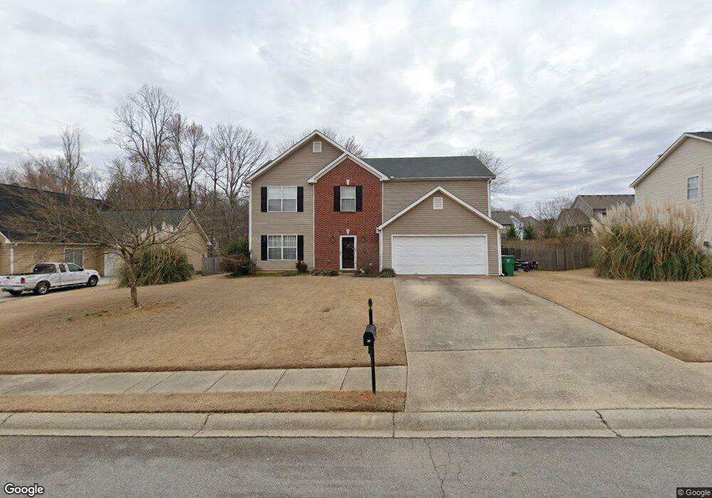
719 Baskins Cir Winder, GA 30680
Estimated Value: $353,318 - $387,000
3
Beds
3
Baths
2,368
Sq Ft
$157/Sq Ft
Est. Value
About This Home
This home is located at 719 Baskins Cir, Winder, GA 30680 and is currently estimated at $371,580, approximately $156 per square foot. 719 Baskins Cir is a home located in Barrow County with nearby schools including County Line Elementary School, Russell Middle School, and Winder-Barrow High School.
Ownership History
Date
Name
Owned For
Owner Type
Purchase Details
Closed on
Sep 10, 1999
Sold by
Dcm Bldrs Inc
Bought by
Fields Donald E and Fields Robin M
Current Estimated Value
Home Financials for this Owner
Home Financials are based on the most recent Mortgage that was taken out on this home.
Original Mortgage
$109,900
Outstanding Balance
$32,657
Interest Rate
7.85%
Mortgage Type
New Conventional
Estimated Equity
$338,923
Create a Home Valuation Report for This Property
The Home Valuation Report is an in-depth analysis detailing your home's value as well as a comparison with similar homes in the area
Home Values in the Area
Average Home Value in this Area
Purchase History
| Date | Buyer | Sale Price | Title Company |
|---|---|---|---|
| Fields Donald E | $129,900 | -- |
Source: Public Records
Mortgage History
| Date | Status | Borrower | Loan Amount |
|---|---|---|---|
| Open | Fields Donald E | $109,900 |
Source: Public Records
Tax History Compared to Growth
Tax History
| Year | Tax Paid | Tax Assessment Tax Assessment Total Assessment is a certain percentage of the fair market value that is determined by local assessors to be the total taxable value of land and additions on the property. | Land | Improvement |
|---|---|---|---|---|
| 2024 | $3,122 | $113,693 | $27,200 | $86,493 |
| 2023 | $2,637 | $113,693 | $27,200 | $86,493 |
| 2022 | $2,859 | $87,235 | $22,800 | $64,435 |
| 2021 | $2,733 | $80,435 | $16,000 | $64,435 |
| 2020 | $2,254 | $68,583 | $14,000 | $54,583 |
| 2019 | $2,203 | $66,120 | $14,000 | $52,120 |
| 2018 | $2,115 | $63,720 | $11,600 | $52,120 |
| 2017 | $1,489 | $49,914 | $11,600 | $38,314 |
| 2016 | $1,452 | $47,042 | $11,600 | $35,442 |
| 2015 | $1,467 | $47,454 | $11,600 | $35,854 |
| 2014 | $1,364 | $45,014 | $6,860 | $38,154 |
| 2013 | -- | $42,232 | $6,860 | $35,372 |
Source: Public Records
Map
Nearby Homes
- 980 Lake Rockwell Way
- 412 Regan Dr
- 746 Baskins Cir
- 615 Wellington Dr
- The Paisley Plan at Rockwell Farms
- The Rockwell Plan at Rockwell Farms
- The Barnes Plan at Rockwell Farms
- The Reynolds Plan at Rockwell Farms
- The Austin Plan at Rockwell Farms
- The Logan Plan at Rockwell Farms
- The Rose II Plan at Rockwell Farms
- 318 Ryan Rd
- 926 Live Oak Ct Unit 2
- 27 Creekside Dr
- 563 Rockwell Church Rd NW
- 0 Gainesville Hwy Unit 10549985
- 0 E Northcrest Dr Unit 10648147
- 401 N 5th Ave
- 469 Plantation Dr
- 0 Mulberry Cir Unit 10647438
- 717 Baskins Cir
- 717 Baskins Cir Unit 1
- 721 Baskins Cir
- 988 Lake Rockwell Way
- 986 Lake Rockwell Way
- 718 Baskins Cir
- 720 Baskins Cir
- 715 Baskins Cir
- 723 Baskins Cir Unit 1
- 984 Lake Rockwell Way
- 722 Baskins Cir Unit 1
- 990 Lake Rockwell Way
- 403 Regan Dr
- 982 Lake Rockwell Way
- 713 Baskins Cir Unit 1
- 725 Baskins Cir
- 724 Baskins Cir
- 714 Baskins Cir
- 991 Lake Rockwell Way Unit 28
- 991 Lake Rockwell Way