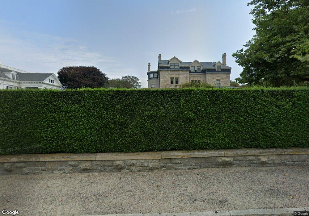
719 Bellevue Ave Unit 1 Newport, RI 02840
Bellevue Avenue and Estates NeighborhoodEstimated Value: $2,394,901 - $4,211,000
5
Beds
7
Baths
6,052
Sq Ft
$571/Sq Ft
Est. Value
About This Home
This home is located at 719 Bellevue Ave Unit 1, Newport, RI 02840 and is currently estimated at $3,455,975, approximately $571 per square foot. 719 Bellevue Ave Unit 1 is a home located in Newport County with nearby schools including Rogers High School and St Michael's Country Day School.
Ownership History
Date
Name
Owned For
Owner Type
Purchase Details
Closed on
Mar 10, 2015
Sold by
Moyal David
Bought by
Brousard Bruce D and Broussard Janine
Current Estimated Value
Home Financials for this Owner
Home Financials are based on the most recent Mortgage that was taken out on this home.
Original Mortgage
$1,800,000
Outstanding Balance
$1,309,520
Interest Rate
2.38%
Mortgage Type
Adjustable Rate Mortgage/ARM
Estimated Equity
$2,146,455
Purchase Details
Closed on
Nov 12, 2004
Sold by
Inchiquin Family Lp
Bought by
Moyal David
Home Financials for this Owner
Home Financials are based on the most recent Mortgage that was taken out on this home.
Original Mortgage
$1,520,000
Interest Rate
5.75%
Mortgage Type
Purchase Money Mortgage
Create a Home Valuation Report for This Property
The Home Valuation Report is an in-depth analysis detailing your home's value as well as a comparison with similar homes in the area
Home Values in the Area
Average Home Value in this Area
Purchase History
| Date | Buyer | Sale Price | Title Company |
|---|---|---|---|
| Brousard Bruce D | $3,350,000 | -- | |
| Moyal David | $1,900,000 | -- |
Source: Public Records
Mortgage History
| Date | Status | Borrower | Loan Amount |
|---|---|---|---|
| Open | Moyal David | $1,800,000 | |
| Previous Owner | Moyal David | $1,520,000 |
Source: Public Records
Tax History Compared to Growth
Tax History
| Year | Tax Paid | Tax Assessment Tax Assessment Total Assessment is a certain percentage of the fair market value that is determined by local assessors to be the total taxable value of land and additions on the property. | Land | Improvement |
|---|---|---|---|---|
| 2025 | $22,683 | $2,610,500 | $0 | $2,610,500 |
| 2024 | $21,458 | $2,610,500 | $0 | $2,610,500 |
| 2023 | $25,579 | $2,578,500 | $0 | $2,578,500 |
| 2022 | $24,779 | $2,578,500 | $0 | $2,578,500 |
| 2021 | $24,057 | $2,578,500 | $0 | $2,578,500 |
| 2020 | $24,605 | $2,393,500 | $0 | $2,393,500 |
| 2019 | $24,605 | $2,393,500 | $0 | $2,393,500 |
| 2018 | $23,697 | $2,372,100 | $0 | $2,372,100 |
| 2017 | $20,084 | $1,791,600 | $0 | $1,791,600 |
| 2016 | $19,582 | $1,791,600 | $0 | $1,791,600 |
| 2015 | $19,116 | $1,791,600 | $0 | $1,791,600 |
| 2014 | $20,667 | $1,713,700 | $0 | $1,713,700 |
Source: Public Records
Map
Nearby Homes
- 601 Bellevue Ave
- 553 Bellevue Ave Unit 14
- 129 Ruggles Ave
- 519 Bellevue Ave Unit 1W
- 63 Coggeshall Ave
- 207 Ruggles Ave
- 11 Ocean Heights Rd
- 70 Carroll Ave Unit 905
- 70 Carroll Ave Unit 510
- 0 Meikle Ave
- 2 Harrison Ave
- 17 Meikle Ave Unit 19
- 13 Vaughan Ave
- 14 Leroy Ave
- 99 Roseneath Ave
- 39 Connection St
- 91 Houston Ave
- 57 Clinton St Unit 57C
- 46 Chastellux Ave Unit M6
- 45 Hammond St Unit 2
- 719 Bellevue Ave Unit F
- 719 Bellevue Ave Unit 7
- 719 Bellevue Ave Unit 6
- 719 Bellevue Ave Unit 5
- 719 Bellevue Ave Unit 4
- 719 Bellevue Ave Unit 3
- 719 Bellevue Ave Unit 2
- 719 Bellevue Ave
- 719 Bellevue Ave Unit 1, 6, D
- 729 Bellevue Ave Unit Cottage
- 729 Bellevue Ave Unit 5
- 11 Ledge Rd
- 18 Ledge Rd
- 9 Ledge Rd
- 236 Coggeshall Ave
- 707 Bellevue Ave
- 718 Bellevue Ave Unit 3
- 718 Bellevue Ave Unit 5
- 718 Bellevue Ave Unit 4
- 718 Bellevue Ave Unit 2