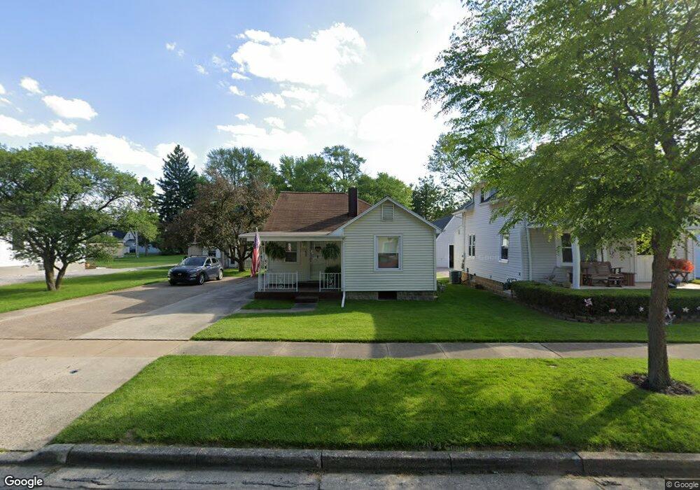
719 Chestnut St Fremont, OH 43420
Estimated Value: $86,000 - $134,000
2
Beds
1
Bath
944
Sq Ft
$114/Sq Ft
Est. Value
About This Home
This home is located at 719 Chestnut St, Fremont, OH 43420 and is currently estimated at $107,512, approximately $113 per square foot. 719 Chestnut St is a home located in Sandusky County with nearby schools including Fremont Ross High School, Sacred Heart School, and Bishop Hoffman Catholic School - This is St Joe's School now.
Ownership History
Date
Name
Owned For
Owner Type
Purchase Details
Closed on
Nov 18, 2021
Sold by
Moneghan John A and Moneghan Jennifer A
Bought by
Moneghan John A
Current Estimated Value
Purchase Details
Closed on
Sep 1, 1991
Sold by
Moneghan John A
Bought by
Moneghan John A
Purchase Details
Closed on
Sep 1, 1990
Sold by
Moneghan John A
Bought by
Moneghan John A
Purchase Details
Closed on
Nov 1, 1986
Bought by
Moneghan John A
Create a Home Valuation Report for This Property
The Home Valuation Report is an in-depth analysis detailing your home's value as well as a comparison with similar homes in the area
Home Values in the Area
Average Home Value in this Area
Purchase History
| Date | Buyer | Sale Price | Title Company |
|---|---|---|---|
| Moneghan John A | -- | None Available | |
| Moneghan John A | $21,000 | -- | |
| Moneghan John A | -- | -- | |
| Moneghan John A | -- | -- |
Source: Public Records
Tax History Compared to Growth
Tax History
| Year | Tax Paid | Tax Assessment Tax Assessment Total Assessment is a certain percentage of the fair market value that is determined by local assessors to be the total taxable value of land and additions on the property. | Land | Improvement |
|---|---|---|---|---|
| 2024 | $937 | $25,450 | $5,990 | $19,460 |
| 2023 | $937 | $21,740 | $5,110 | $16,630 |
| 2022 | $841 | $21,740 | $5,110 | $16,630 |
| 2021 | $889 | $21,740 | $5,110 | $16,630 |
| 2020 | $802 | $19,320 | $5,110 | $14,210 |
| 2019 | $801 | $19,320 | $5,110 | $14,210 |
| 2018 | $764 | $19,320 | $5,110 | $14,210 |
| 2017 | $726 | $17,430 | $5,110 | $12,320 |
| 2016 | $639 | $17,430 | $5,110 | $12,320 |
| 2015 | $629 | $17,430 | $5,110 | $12,320 |
| 2014 | $693 | $18,310 | $5,010 | $13,300 |
| 2013 | $678 | $18,310 | $5,010 | $13,300 |
Source: Public Records
Map
Nearby Homes
- 322 4th St
- 230 N Pennsylvania Ave
- 714 E State St
- 433 Sandusky Ave
- 612 2nd St
- 533 Sandusky Ave Unit 535
- 340 340 Sandusky Ave
- 924 Birdseye Blvd
- 224 Sandusky Ave Unit 226
- 208 E State St
- 314 S Collinwood Blvd
- 906 Amsden Blvd
- 0 S Buchanan St
- 600 S Buchanan St
- 516 N Front St
- 1526 Sunrise Blvd
- 546 Oaklawn Ave
- 318 Ethan Dr
- 711 Bloom Rd
- 427 N Clover St