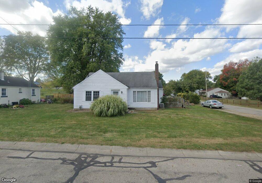
719 Dwight Rd Springfield, OH 45503
Estimated Value: $146,000 - $184,000
2
Beds
1
Bath
1,270
Sq Ft
$129/Sq Ft
Est. Value
About This Home
This home is located at 719 Dwight Rd, Springfield, OH 45503 and is currently estimated at $163,353, approximately $128 per square foot. 719 Dwight Rd is a home located in Clark County with nearby schools including Warder Park-Wayne Elementary School, Schaefer Middle School, and Springfield High School.
Ownership History
Date
Name
Owned For
Owner Type
Purchase Details
Closed on
Aug 16, 2005
Sold by
Hud
Bought by
Rbmg Inc
Current Estimated Value
Purchase Details
Closed on
Mar 23, 2004
Sold by
Nicodemus Patricia and Rbmg Inc
Bought by
Hud
Purchase Details
Closed on
Sep 3, 1999
Sold by
Mcenaney Timothy J and Estate Of Hattie Fern Mcenaney
Bought by
Nicodemus Curtis B and Nicodemus Patricia L
Home Financials for this Owner
Home Financials are based on the most recent Mortgage that was taken out on this home.
Original Mortgage
$70,963
Interest Rate
8.21%
Mortgage Type
FHA
Create a Home Valuation Report for This Property
The Home Valuation Report is an in-depth analysis detailing your home's value as well as a comparison with similar homes in the area
Home Values in the Area
Average Home Value in this Area
Purchase History
| Date | Buyer | Sale Price | Title Company |
|---|---|---|---|
| Rbmg Inc | -- | -- | |
| Hud | $64,000 | -- | |
| Nicodemus Curtis B | $71,000 | Ohio Real Estate Title |
Source: Public Records
Mortgage History
| Date | Status | Borrower | Loan Amount |
|---|---|---|---|
| Previous Owner | Nicodemus Curtis B | $70,963 |
Source: Public Records
Tax History
| Year | Tax Paid | Tax Assessment Tax Assessment Total Assessment is a certain percentage of the fair market value that is determined by local assessors to be the total taxable value of land and additions on the property. | Land | Improvement |
|---|---|---|---|---|
| 2025 | $4,101 | $47,640 | $10,550 | $37,090 |
| 2024 | $2,874 | $37,080 | $7,580 | $29,500 |
| 2023 | $7,755 | $37,080 | $7,580 | $29,500 |
| 2022 | $10,121 | $37,080 | $7,580 | $29,500 |
| 2021 | $3,118 | $29,320 | $5,920 | $23,400 |
| 2020 | $2,077 | $29,320 | $5,920 | $23,400 |
| 2019 | $2,504 | $29,320 | $5,920 | $23,400 |
| 2018 | $2,095 | $25,010 | $4,310 | $20,700 |
| 2017 | $2,080 | $25,012 | $4,309 | $20,703 |
| 2016 | $1,998 | $25,012 | $4,309 | $20,703 |
| 2015 | $4,350 | $24,273 | $4,309 | $19,964 |
| 2014 | $1,464 | $24,273 | $4,309 | $19,964 |
| 2013 | $1,449 | $24,273 | $4,309 | $19,964 |
Source: Public Records
Map
Nearby Homes
- 2845 Columbus Ave Unit 5
- 207 Roseland Ave W
- 907 Bellevue Ave
- 515 Bellevue Ave
- 129 N Burnett Rd
- 419 Bellevue Ave
- 2201 Woodside Ave
- 2702 Maplewood Ave
- 2226 Columbus Ave
- 2224-2226 Columbus Ave
- 121 Willis Ave
- 2124 Woodside Ave
- 2210 Larch St
- 2111 Beatrice St
- 2691 Tecumseh Ave
- 115 S Burnett Rd
- 1519 Edgewood Ave
- 3114 Columbus Ave
- 2020 Woodside Ave
- 2023 Cleveland Ave
- 715 Dwight Rd
- 725 Dwight Rd
- 2817 Marshall Rd
- 2967 Hillside Ave
- 729 Dwight Rd
- 2820 Marshall Rd
- 2813 Marshall Rd
- 2816 Marshall Rd
- 3010 Hillside Ave
- 728 Dwight Rd
- 728 Dwight Rd
- 735 Dwight Rd
- 2809 Marshall Rd
- 2970 Hillside Ave
- 2810 Marshall Rd
- 732 Dwight Rd
- 3027 Hillside Ave
- 2821 Dwight Rd
- 741 Dwight Rd
- 722 Patrick Rd
Your Personal Tour Guide
Ask me questions while you tour the home.