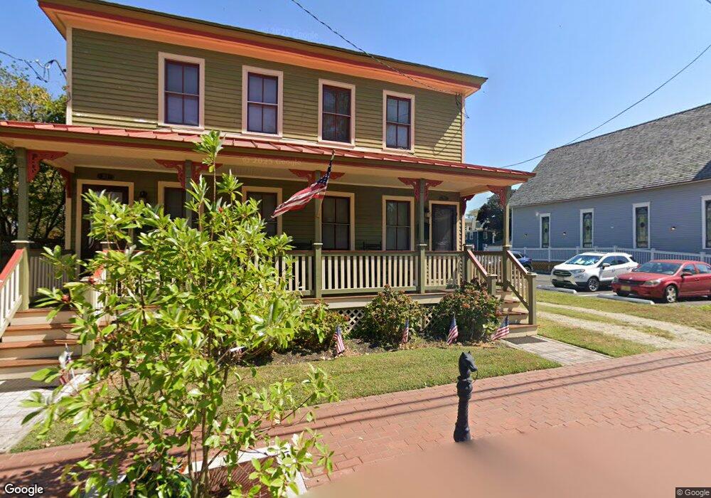
719 Franklin St Unit 721 Cape May, NJ 08204
Estimated Value: $674,000 - $1,163,708
--
Bed
--
Bath
2,984
Sq Ft
$328/Sq Ft
Est. Value
About This Home
This home is located at 719 Franklin St Unit 721, Cape May, NJ 08204 and is currently estimated at $979,177, approximately $328 per square foot. 719 Franklin St Unit 721 is a home located in Cape May County with nearby schools including Cape May City Elementary School, Richard M. Teitelman School, and Lower Cape May Regional High School.
Ownership History
Date
Name
Owned For
Owner Type
Purchase Details
Closed on
Apr 13, 2011
Sold by
Nix Robert N C and Nix Michael L
Bought by
Ternove Patricia
Current Estimated Value
Purchase Details
Closed on
Apr 11, 2005
Sold by
Nix Renate
Bought by
Nix Robert N C and Nix Michael L
Home Financials for this Owner
Home Financials are based on the most recent Mortgage that was taken out on this home.
Original Mortgage
$137,750
Interest Rate
5.81%
Mortgage Type
Fannie Mae Freddie Mac
Purchase Details
Closed on
Apr 8, 2005
Sold by
Lane David J and The Estate Of Robert N C Nix J
Bought by
Nix Renate
Home Financials for this Owner
Home Financials are based on the most recent Mortgage that was taken out on this home.
Original Mortgage
$137,750
Interest Rate
5.81%
Mortgage Type
Fannie Mae Freddie Mac
Purchase Details
Closed on
Apr 28, 1989
Sold by
Wimberly Edgar and Wimberly Evelyn
Bought by
Nix Robert
Create a Home Valuation Report for This Property
The Home Valuation Report is an in-depth analysis detailing your home's value as well as a comparison with similar homes in the area
Home Values in the Area
Average Home Value in this Area
Purchase History
| Date | Buyer | Sale Price | Title Company |
|---|---|---|---|
| Ternove Patricia | $315,000 | None Available | |
| Nix Robert N C | $145,000 | Congress Title | |
| Nix Renate | -- | Congress Title | |
| Nix Robert | $38,300 | -- |
Source: Public Records
Mortgage History
| Date | Status | Borrower | Loan Amount |
|---|---|---|---|
| Previous Owner | Nix Robert N C | $137,750 |
Source: Public Records
Tax History Compared to Growth
Tax History
| Year | Tax Paid | Tax Assessment Tax Assessment Total Assessment is a certain percentage of the fair market value that is determined by local assessors to be the total taxable value of land and additions on the property. | Land | Improvement |
|---|---|---|---|---|
| 2025 | $4,714 | $446,000 | $356,200 | $89,800 |
| 2024 | $4,714 | $446,000 | $356,200 | $89,800 |
| 2023 | $4,790 | $446,000 | $356,200 | $89,800 |
| 2022 | $4,603 | $446,000 | $356,200 | $89,800 |
| 2021 | $4,540 | $446,000 | $356,200 | $89,800 |
| 2020 | $4,326 | $446,000 | $356,200 | $89,800 |
| 2019 | $4,402 | $446,000 | $356,200 | $89,800 |
| 2018 | $4,152 | $446,000 | $356,200 | $89,800 |
| 2017 | $3,943 | $446,000 | $356,200 | $89,800 |
| 2016 | $3,711 | $446,000 | $356,200 | $89,800 |
| 2015 | $3,848 | $444,800 | $356,200 | $88,600 |
| 2014 | $3,848 | $444,800 | $356,200 | $88,600 |
Source: Public Records
Map
Nearby Homes
- 519 Franklin St
- 614 Jefferson St
- 645 Hughes St
- 627 Hughes St
- 523 Lafayette St Unit 2
- 626 Hughes St
- 210 Ocean St Unit 1
- 202 Ocean St
- 933 Washington St
- 936 Lafayette St Unit 5
- 24 Ocean St
- 106 A Howard St
- 106 Howard St Unit A
- 1015 Washington St
- 1011 Lafayette St Unit 302
- 202 Perry St
- 819 Beach Ave Unit B1
- 918 Stockton Ave
- 1045-1047 Lafayette St Unit 3
- 610 Beach Ave
- 729 Franklin St
- 729 Franklin St
- 729 Franklin St
- 729 Franklin St Unit C-1
- 729 Franklin St Unit 2 or B
- 712 Lafayette St
- 714 Osborne St
- 717 Washington St
- 659 Lafayette St
- 645 Lafayette St
- 721 Washington St
- 729 Washington St
- 804 Saint Johns St
- 801 Saint Johns St
- 735 Washington St Unit 1
- 735 Washington St
- 735 Washington St
- 735 Washington St Unit 3
- 735 Washington St Unit 5
- 735 Washington St Unit 2