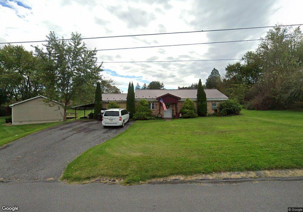
719 Hower St Selinsgrove, PA 17870
Estimated Value: $79,218 - $230,000
--
Bed
--
Bath
--
Sq Ft
0.47
Acres
About This Home
This home is located at 719 Hower St, Selinsgrove, PA 17870 and is currently estimated at $186,555. 719 Hower St is a home located in Snyder County with nearby schools including Selinsgrove Intermediate School, Selinsgrove Area Elementary School, and Selinsgrove Area Middle School.
Ownership History
Date
Name
Owned For
Owner Type
Purchase Details
Closed on
Jan 11, 2011
Sold by
Us Bank National Assoc Iation
Bought by
Drzewiecki Ryan M
Current Estimated Value
Home Financials for this Owner
Home Financials are based on the most recent Mortgage that was taken out on this home.
Original Mortgage
$34,000
Outstanding Balance
$23,235
Interest Rate
4.83%
Mortgage Type
Unknown
Estimated Equity
$163,320
Purchase Details
Closed on
Sep 22, 2010
Sold by
Sheriff Of Snyder County
Bought by
Us Bank National Association As Trust
Purchase Details
Closed on
Sep 15, 2006
Sold by
Iedeal Associates
Bought by
Troxell Fawn I
Home Financials for this Owner
Home Financials are based on the most recent Mortgage that was taken out on this home.
Original Mortgage
$69,642
Interest Rate
1.64%
Purchase Details
Closed on
May 31, 2006
Sold by
Miller Glenn Wayne and Mull Marilyn L
Bought by
Ideal Associates
Create a Home Valuation Report for This Property
The Home Valuation Report is an in-depth analysis detailing your home's value as well as a comparison with similar homes in the area
Home Values in the Area
Average Home Value in this Area
Purchase History
| Date | Buyer | Sale Price | Title Company |
|---|---|---|---|
| Drzewiecki Ryan M | $42,900 | -- | |
| Us Bank National Association As Trust | $32,000 | -- | |
| Troxell Fawn I | $77,380 | -- | |
| Ideal Associates | $61,000 | -- |
Source: Public Records
Mortgage History
| Date | Status | Borrower | Loan Amount |
|---|---|---|---|
| Open | Drzewiecki Ryan M | $34,000 | |
| Previous Owner | Troxell Fawn I | $69,642 | |
| Closed | Us Bank National Association As Trust | $0 |
Source: Public Records
Tax History Compared to Growth
Tax History
| Year | Tax Paid | Tax Assessment Tax Assessment Total Assessment is a certain percentage of the fair market value that is determined by local assessors to be the total taxable value of land and additions on the property. | Land | Improvement |
|---|---|---|---|---|
| 2025 | $1,464 | $15,390 | $3,380 | $12,010 |
| 2024 | $1,421 | $15,390 | $3,380 | $12,010 |
| 2023 | $374 | $15,390 | $3,380 | $12,010 |
| 2022 | $1,351 | $15,390 | $3,380 | $12,010 |
| 2021 | $1,351 | $15,390 | $3,380 | $12,010 |
| 2020 | $1,351 | $15,390 | $3,380 | $12,010 |
| 2019 | $1,351 | $15,390 | $3,380 | $12,010 |
| 2018 | $1,351 | $15,390 | $3,380 | $12,010 |
| 2017 | $1,336 | $15,390 | $3,380 | $12,010 |
| 2016 | $351 | $15,390 | $3,380 | $12,010 |
| 2015 | $32,030 | $15,390 | $3,380 | $12,010 |
| 2014 | $32,030 | $15,390 | $3,380 | $12,010 |
Source: Public Records
Map
Nearby Homes
- 104 18th St
- 321 Pleasant Dr
- 21 Calvett Place
- Lot 1 522 Route S
- 207 Orange St Unit 209
- 501 N 9th St
- 500 N Orange St
- 610 N 10th St
- 722 N 8th St
- 456 State School Rd
- 223 E Pine St
- 301 E Walnut St
- 20 Quarry Rd
- 301 E Pine St
- 0 Wedgewood Dr
- 732 Salem Rd
- 85 Old Colony Rd
- 1667&1679 Route 204
- 34 Oakmont Ct
- 2 Victory Ln