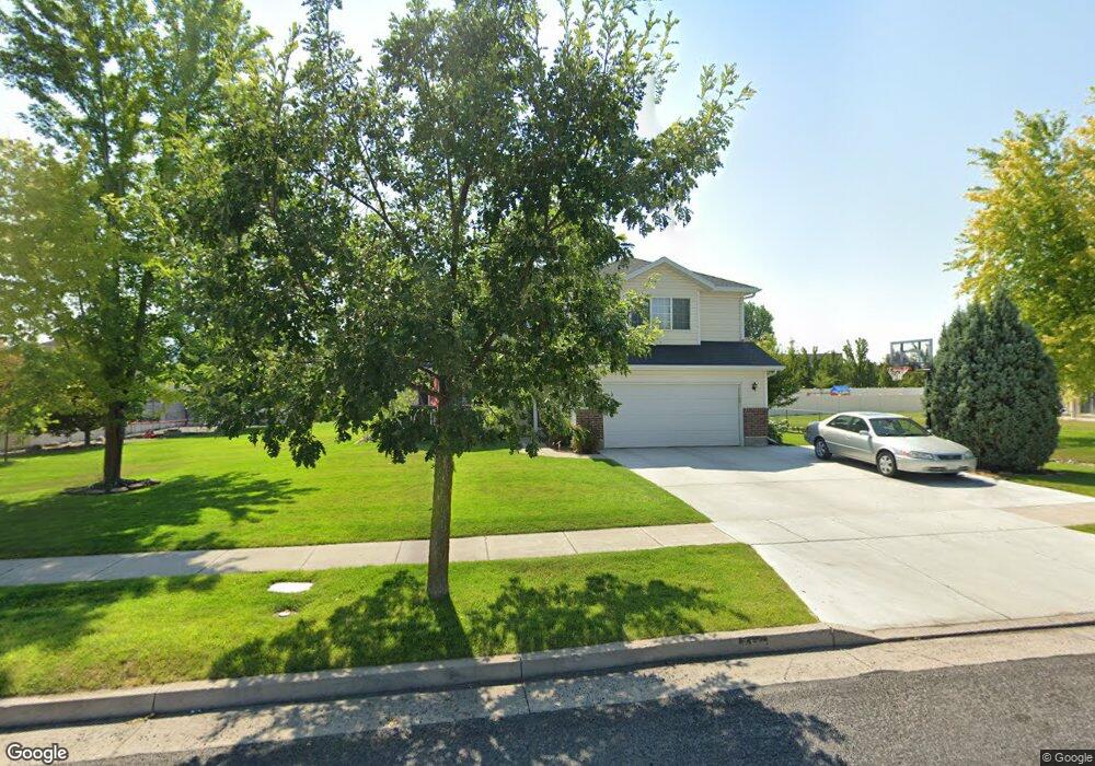
719 S 1360 W Logan, UT 84321
Woodruff NeighborhoodEstimated Value: $474,338 - $523,000
4
Beds
3
Baths
2,522
Sq Ft
$198/Sq Ft
Est. Value
About This Home
This home is located at 719 S 1360 W, Logan, UT 84321 and is currently estimated at $500,085, approximately $198 per square foot. 719 S 1360 W is a home located in Cache County with nearby schools including Woodruff School, Mount Logan Middle School, and Logan High School.
Ownership History
Date
Name
Owned For
Owner Type
Purchase Details
Closed on
May 20, 2020
Sold by
Mumford Bradley and Mumford Cassi
Bought by
Mumford Cassi L and Mumford Bradley N
Current Estimated Value
Purchase Details
Closed on
Dec 21, 2016
Sold by
Mumford Bradley
Bought by
Mumford Bradley and Mumford Cassi
Home Financials for this Owner
Home Financials are based on the most recent Mortgage that was taken out on this home.
Original Mortgage
$249,246
Outstanding Balance
$203,857
Interest Rate
4.03%
Mortgage Type
VA
Estimated Equity
$296,228
Purchase Details
Closed on
Nov 28, 2016
Sold by
Brooks Kenneth W and Brooks Gilda R
Bought by
Mumford Bradley
Home Financials for this Owner
Home Financials are based on the most recent Mortgage that was taken out on this home.
Original Mortgage
$249,246
Outstanding Balance
$203,857
Interest Rate
4.03%
Mortgage Type
VA
Estimated Equity
$296,228
Purchase Details
Closed on
Jul 15, 2005
Sold by
Brooks Kenneth Wayne and Brooks Gilda R
Bought by
Brooks Kenneth W and Brooks Gilda R
Home Financials for this Owner
Home Financials are based on the most recent Mortgage that was taken out on this home.
Original Mortgage
$190,000
Interest Rate
5.51%
Mortgage Type
VA
Create a Home Valuation Report for This Property
The Home Valuation Report is an in-depth analysis detailing your home's value as well as a comparison with similar homes in the area
Home Values in the Area
Average Home Value in this Area
Purchase History
| Date | Buyer | Sale Price | Title Company |
|---|---|---|---|
| Mumford Cassi L | -- | None Available | |
| Mumford Bradley | -- | Advanced Title | |
| Mumford Bradley | -- | Pinnacle Title | |
| Brooks Kenneth W | -- | Cache Title Company |
Source: Public Records
Mortgage History
| Date | Status | Borrower | Loan Amount |
|---|---|---|---|
| Open | Mumford Bradley | $249,246 | |
| Closed | Mumford Bradley | $249,246 | |
| Previous Owner | Brooks Kenneth W | $190,000 |
Source: Public Records
Tax History Compared to Growth
Tax History
| Year | Tax Paid | Tax Assessment Tax Assessment Total Assessment is a certain percentage of the fair market value that is determined by local assessors to be the total taxable value of land and additions on the property. | Land | Improvement |
|---|---|---|---|---|
| 2025 | $1,902 | $246,035 | $0 | $0 |
| 2024 | $197 | $246,825 | $0 | $0 |
| 2023 | $2,038 | $243,370 | $0 | $0 |
| 2022 | $1,867 | $208,170 | $0 | $0 |
| 2021 | $1,814 | $312,390 | $48,000 | $264,390 |
| 2020 | $1,924 | $298,240 | $48,000 | $250,240 |
| 2019 | $2,011 | $298,240 | $48,000 | $250,240 |
| 2018 | $1,961 | $265,600 | $48,000 | $217,600 |
| 2017 | $1,656 | $118,580 | $0 | $0 |
| 2016 | $1,717 | $118,580 | $0 | $0 |
| 2015 | $1,579 | $108,925 | $0 | $0 |
| 2014 | $1,427 | $108,925 | $0 | $0 |
| 2013 | -- | $108,925 | $0 | $0 |
Source: Public Records
Map
Nearby Homes
- 763 S 1500 W
- 1506 Silver Canoe Loop
- 1506 Silver Canoe Loop Unit 102
- 1239 W 575 S Unit 152
- Hemlock Plan at Sugar Creek - Logan
- Eucalyptus Plan at Sugar Creek - Logan
- Blackberry Plan at Sugar Creek - Logan
- Magnolia Plan at Sugar Creek - Logan
- 548 S 1225 W Unit 115
- 1220 W 575 S
- 542 S 1225 W Unit 116
- 552 Rivergate Dr
- 420 S 1400 W
- 518 S 1225 W
- 2157 S 1580 W
- 506 S 1225 W
- 524 Rivergate Dr
- 1227 W 500 S Unit 151
- 1585 W Silver Canoe Way
- 1615 Silver Canoe Way
- 716 Legend Dr
- 1362 W Henrys Pt Dr
- 735 S 1360 W
- 679 Legend Dr
- 1366 W Henrys Pt Dr
- 1380 Henrys Point Dr
- 1380 Henrys Point Dr Unit 54
- 750 Legend Dr
- 724 S 1360 W
- 707 Legend Dr
- 1386 W Henrys Pt Dr
- 1386 Henrys Point Dr
- 702 S 1360 W
- 734 S 1360 W
- 694 Legend Dr
- 755 S 1360 W
- 748 S 1360 W
- 1390 W Henrys Pt Dr
- 1379 W Henrys Pt Dr
- 699 S 1360 W